 Old Cumbria Gazetteer
 |
 |
|
| Holy Well, Waterhead | ||
| Holy Well | ||
| Palmer Hill Holy Well | ||
| locality:- | Palmer Hill | |
| civil parish:- | Kingwater (formerly Cumberland) | |
| county:- | Cumbria | |
| locality type:- | well | |
| locality type:- | spring | |
| locality type:- | holy well | |
| coordinates:- | NY59446834 | |
| 1Km square:- | NY5968 | |
| 10Km square:- | NY56 | |
|
|
||
| evidence:- | old map:- OS County Series (Cmd 12 3) placename:- Holy Well item:- sulphurous spring |
|
| source data:- | Maps, County Series maps of Great Britain, scales 6 and 25
inches to 1 mile, published by the Ordnance Survey, Southampton,
Hampshire, from about 1863 to 1948. "Holy Well (Sulphurous)" |
|
|
|
||
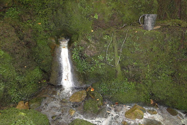 BVJ95.jpg Palmer Hill Holy Well courtesy of Ed Henderson 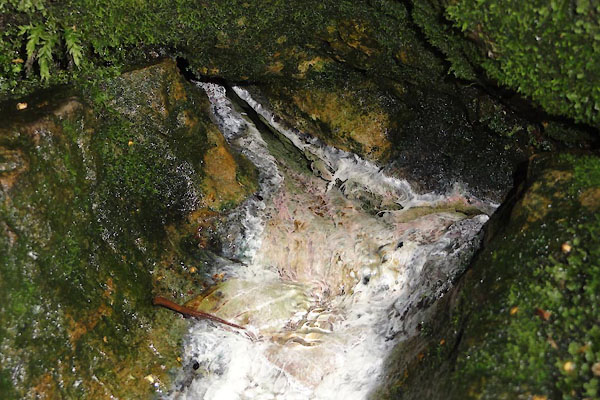 BVJ96.jpg Palmer Hill Holy Well courtesy of Ed Henderson |
||
| Located next to the footbridge over King Water, east of Palmer Hill farm house. The
metal cup attached to the rock by a wire has been there for a while. Most people would
not drink the sulphureous water but clearly someone thinks it is potable. The farmer
at High House farm says that her mum used to go there to get water if her father was
ill. |
||
|
|
||
 Lakes Guides menu.