 Old Cumbria Gazetteer
 |
 |
|
| Holme Dub | ||
| runs into:- |  Crummock Beck Crummock Beck |
|
|
|
||
| civil parish:- | Bromfield (formerly Cumberland) | |
| civil parish:- | Holme Abbey (formerly Cumberland) | |
| civil parish:- | Westnewton (formerly Cumberland) | |
| county:- | Cumbria | |
| locality type:- | river | |
| locality type:- | boundary | |
| locality type:- | parish boundary | |
| 1Km square:- | NY1346 (etc) | |
| 10Km square:- | NY14 | |
|
|
||
| evidence:- | old map:- OS County Series (Cmd 28 9) placename:- Holme Dub |
|
| source data:- | Maps, County Series maps of Great Britain, scales 6 and 25
inches to 1 mile, published by the Ordnance Survey, Southampton,
Hampshire, from about 1863 to 1948. |
|
|
|
||
| evidence:- | old map:- Garnett 1850s-60s H placename:- Crummock Beck |
|
| source data:- | Map of the English Lakes, in Cumberland, Westmorland and
Lancashire, scale about 3.5 miles to 1 inch, published by John
Garnett, Windermere, Westmorland, 1850s-60s.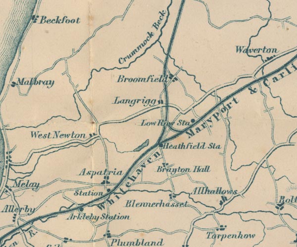 GAR2NY14.jpg "Crummock Beck" wiggly line, river; Cruumock Beck is now understood to flow from Brocklebank Fell item:- JandMN : 82.1 Image © see bottom of page |
|
|
|
||
Lakes Guides menu.