 Old Cumbria Gazetteer
 |
 |
|
| Holesfoot, Crosby Ravensworth | ||
| Holesfoot | ||
| Street:- | Brackenslack Lane | |
| civil parish:- | Crosby Ravensworth (formerly Westmorland) | |
| county:- | Cumbria | |
| locality type:- | buildings | |
| coordinates:- | NY64131735 | |
| 1Km square:- | NY6417 | |
| 10Km square:- | NY61 | |
|
|
||
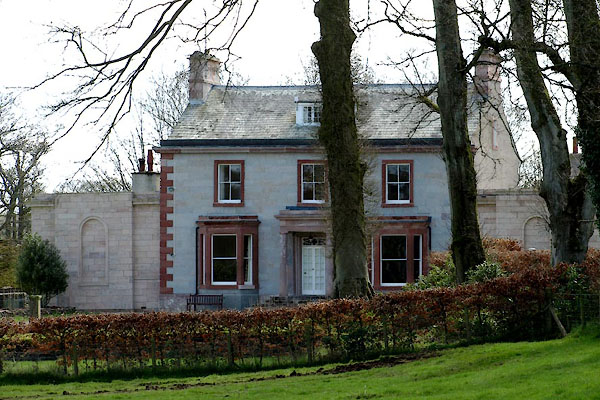 BWF63.jpg (taken 13.4.2012) |
||
|
|
||
| evidence:- | old map:- Jefferys 1770 (Wmd) placename:- Hall Foot |
|
| source data:- | Map, 4 sheets, The County of Westmoreland, scale 1 inch to 1
mile, surveyed 1768, and engraved and published by Thomas
Jefferys, London, 1770.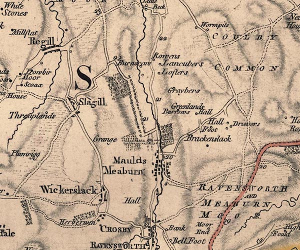 J5NY61NW.jpg "Hall Foot" circle, labelled in italic lowercase text; settlement, farm, house, or hamlet? item:- National Library of Scotland : EME.s.47 Image © National Library of Scotland |
|
|
|
||
| evidence:- | old map:- Cary 1789 (edn 1805) placename:- Hall Foot |
|
| source data:- | Map, uncoloured engraving, Westmoreland, scale about 2.5 miles
to 1 inch, by John Cary, London, 1789; edition 1805.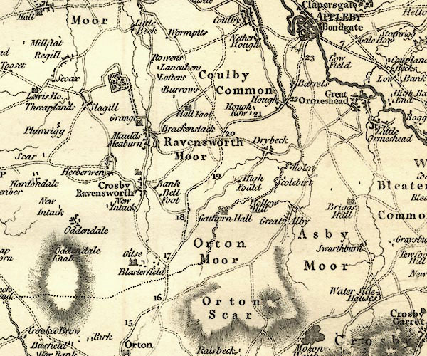 CY24NY61.jpg "Hall Foot" house symbol; large house item:- JandMN : 129 Image © see bottom of page |
|
|
|
||
| evidence:- | database:- Listed Buildings 2010 placename:- Holesfoot House |
|
| source data:- | courtesy of English Heritage "HOLESFOOT HOUSE / / BRACKENSLACK LANE / CROSBY RAVENSWORTH / EDEN / CUMBRIA / II[star] / 74027 / NY6413217351" |
|
|
|
||
 Lakes Guides menu.