 Old Cumbria Gazetteer
 |
 |
|
| Hill House, Salta | ||
| Hill House | ||
| locality:- | Salta | |
| civil parish:- | Holme St Cuthbert (formerly Cumberland) | |
| county:- | Cumbria | |
| locality type:- | buildings | |
| coordinates:- | NY08254548 | |
| 1Km square:- | NY0845 | |
| 10Km square:- | NY04 | |
|
|
||
| evidence:- | old map:- OS County Series (Cmd 27 14) placename:- Hill House |
|
| source data:- | Maps, County Series maps of Great Britain, scales 6 and 25
inches to 1 mile, published by the Ordnance Survey, Southampton,
Hampshire, from about 1863 to 1948. |
|
|
|
||
| evidence:- | old text:- Gents Mag item:- sea mark |
|
| source data:- | Magazine, The Gentleman's Magazine or Monthly Intelligencer or
Historical Chronicle, published by Edward Cave under the
pseudonym Sylvanus Urban, and by other publishers, London,
monthly from 1731 to 1922. goto source goto sourceGentleman's Magazine 1748 p.291 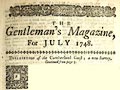 click to enlarge click to enlargeG748E04.jpg "... Hill-house is a sea-mark, because it stands pretty high, and is made use of in the same manner almost as Dubmill-house, to avoid dangerous sand, which stretches almost from Workington-bar to the Scotch coast." |
|
|
|
||
| evidence:- | old map:- Donald 1774 (Cmd) placename:- Hill House |
|
| source data:- | Map, hand coloured engraving, 3x2 sheets, The County of Cumberland, scale about 1
inch to 1 mile, by Thomas Donald, engraved and published by Joseph Hodskinson, 29
Arundel Street, Strand, London, 1774.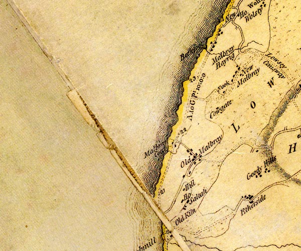 D4NY04NE.jpg "Hill / House" block or blocks, labelled in lowercase; a hamlet or just a house item:- Carlisle Library : Map 2 Image © Carlisle Library |
|
|
|
||
| evidence:- | old map:- Ford 1839 map placename:- Hill House |
|
| source data:- | Map, uncoloured engraving, Map of the Lake District of
Cumberland, Westmoreland and Lancashire, scale about 3.5 miles
to 1 inch, published by Charles Thurnam, Carlisle, and by R
Groombridge, 5 Paternoster Row, London, 3rd edn 1843.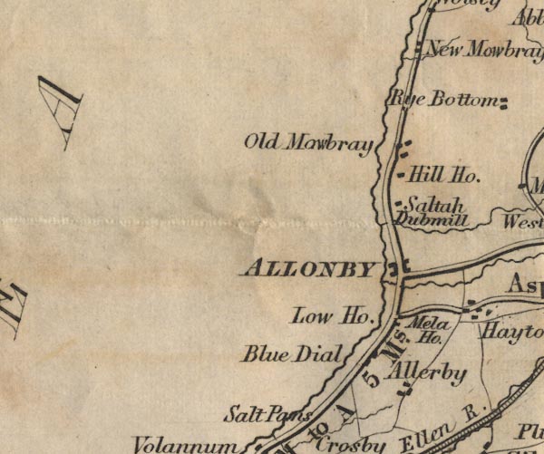 FD02NY04.jpg "Hill Ho." item:- JandMN : 100.1 Image © see bottom of page |
|
|
|
||
Lakes Guides menu.