 |
 |
|
|
|
|
Highlaws |
| civil parish:- |
Holme Abbey (formerly Cumberland) |
| county:- |
Cumbria |
| locality type:- |
locality |
| locality type:- |
buildings |
| coordinates:- |
NY14144976 (etc) |
| 1Km square:- |
NY1449 |
| 10Km square:- |
NY14 |
|
|
| evidence:- |
old map:- OS County Series (Cmd 28 1)
placename:- Highlaws
|
| source data:- |
Maps, County Series maps of Great Britain, scales 6 and 25
inches to 1 mile, published by the Ordnance Survey, Southampton,
Hampshire, from about 1863 to 1948.
|
|
|
| evidence:- |
old map:- Donald 1774 (Cmd)
placename:- High Laws
|
| source data:- |
Map, hand coloured engraving, 3x2 sheets, The County of Cumberland, scale about 1
inch to 1 mile, by Thomas Donald, engraved and published by Joseph Hodskinson, 29
Arundel Street, Strand, London, 1774.
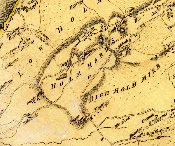
D4NY14NW.jpg
"High Laws"
block or blocks, labelled in lowercase; a hamlet or just a house
item:- Carlisle Library : Map 2
Image © Carlisle Library |
|
|
| places:- |
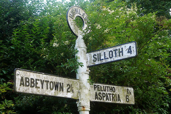 |
NY14014971 fingerpost, Highlaws (Holme Abbey) |
|
|
 |
NY14524993 Gale, The (Holme Abbey) |
|
|
|
NY13994954 Highlaws Brow (Holme Abbey) |
|
|
|
NY13934974 Highlaws Farm (Holme Abbey) |
|
|
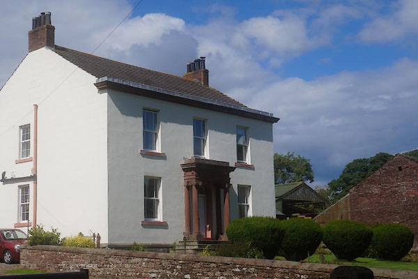 |
NY14154979 Highlaws House (Holme Abbey) |
|
|
|
NY14664995 Hole House (Holme Abbey) gone |
|
|
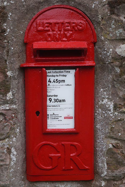 |
NY13984970 post box, Highlaws (Holme Abbey) |
|
