 Old Cumbria Gazetteer
 |
 |
|
| High Stott Park, Colton | ||
| Stott Park House | ||
| Stott Park Cottage | ||
| High Stott Park | ||
| Stott Park Farm | ||
| locality:- | High Stott Park | |
| civil parish:- | Colton (formerly Lancashire) | |
| county:- | Cumbria | |
| locality type:- | buildings | |
| locality type:- | park | |
| locality type:- | wood | |
| coordinates:- | SD37268858 | |
| 1Km square:- | SD3788 | |
| 10Km square:- | SD38 | |
|
|
||
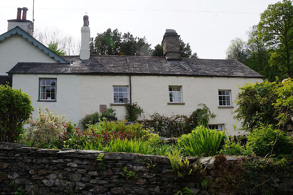 CAS11.jpg Stott Park Cottage (taken 16.5.2014) 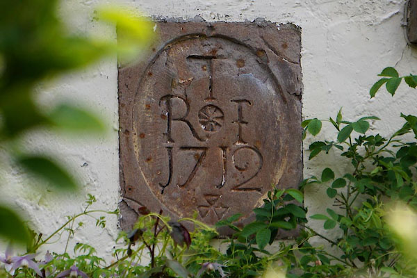 CAS13.jpg Stott Park Cottage, date stone:- "T / R I / 1712" (taken 16.5.2014) |
||
|
|
||
| evidence:- | old map:- OS County Series (Lan 8 11) placename:- High Stott Park placename:- Stott Park, High |
|
| source data:- | Maps, County Series maps of Great Britain, scales 6 and 25
inches to 1 mile, published by the Ordnance Survey, Southampton,
Hampshire, from about 1863 to 1948. |
|
|
|
||
| evidence:- | old text:- Clarke 1787 placename:- Stott Park placename:- Oxen Park item:- placename, High Stott Park |
|
| source data:- | Guide book, A Survey of the Lakes of Cumberland, Westmorland,
and Lancashire, written and published by James Clarke, Penrith,
Cumberland, and in London etc, 1787; published 1787-93. goto source goto sourcePage 152:- "..." "We next pass Stott-Park, by some called Oxen-Park; (Stott in the North country dialect signifies an Ox, but is by the farmers so called till four years of age, after which age he is called an Ox.) This estate is the property of a Mr Brathwaite; here are two good houses, with pretty gardens; their situation is low, without any extensive prospect or view of the Lake; but there are some flat meadows before them, with beautiful copses of wood interspersed, which afford a pleasing variety; many of them jut into the Lake, and indent the shore, making several bays and peninsulas, which at high-water become, some of them, islands." |
|
|
|
||
| evidence:- | probably old map:- Clarke 1787 map (Windermere S) placename:- Brathwaite's estate |
|
| source data:- | Maps, series issued in a guide book, A Survey of the Lakes of
Cumberland, Westmorland, and Lancashire, by James Clarke,
Penrith, Cumberland, engraved by S J Neele, 352 Strand, London,
published 1787-89; and in Plans of the Lakes ... 1793. "BRATHWAITE Esqr." |
|
|
|
||
| evidence:- | old map:- Clarke 1787 map (Windermere S) placename:- Stott Park |
|
| source data:- | Map, A Map of the Southern Part of the Lake Winandermere and its
Environs, scale about 6.5 ins to 1 mile, by James Clarke,
engraved by Samuel John Neele, 352 Strand, published by James
Clarke, Penrith, Cumberland and in London etc, 1787.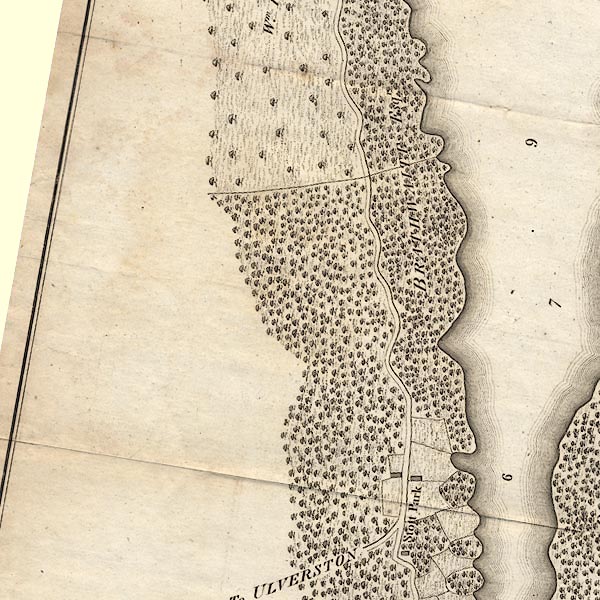 CLBSD38U.jpg "Stott Park" item:- private collection : 10.11 Image © see bottom of page |
|
|
|
||
| evidence:- | possibly old map:- Otley 1818 placename:- Stot Park |
|
| source data:- | Map, uncoloured engraving, The District of the Lakes,
Cumberland, Westmorland, and Lancashire, scale about 4 miles to
1 inch, by Jonathan Otley, 1818, engraved by J and G Menzies,
Edinburgh, Scotland, published by Jonathan Otley, Keswick,
Cumberland, et al, 1833.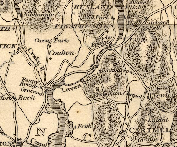 OT02SD38.jpg item:- JandMN : 48.1 Image © see bottom of page |
|
|
|
||
| evidence:- | old map:- Ford 1839 map placename:- Stott Park |
|
| source data:- | Map, uncoloured engraving, Map of the Lake District of
Cumberland, Westmoreland and Lancashire, scale about 3.5 miles
to 1 inch, published by Charles Thurnam, Carlisle, and by R
Groombridge, 5 Paternoster Row, London, 3rd edn 1843.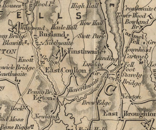 FD02SD38.jpg "Stott Park" item:- JandMN : 100.1 Image © see bottom of page |
|
|
|
||
| evidence:- | old map:- Garnett 1850s-60s H placename:- High Stock Park |
|
| source data:- | Map of the English Lakes, in Cumberland, Westmorland and
Lancashire, scale about 3.5 miles to 1 inch, published by John
Garnett, Windermere, Westmorland, 1850s-60s.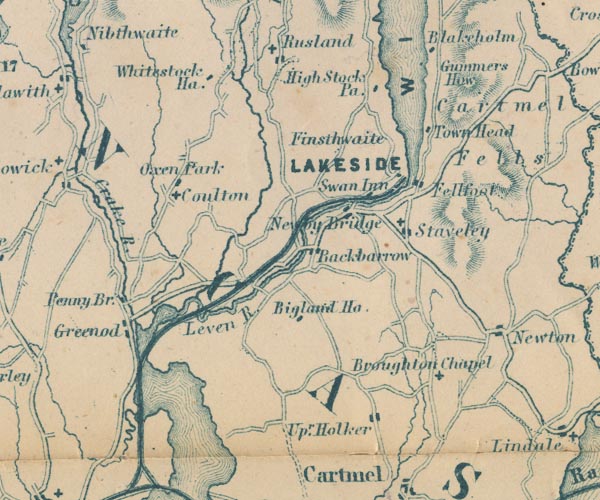 GAR2SD38.jpg "High Stock Pa." block, building item:- JandMN : 82.1 Image © see bottom of page |
|
|
|
||
| evidence:- | old map:- Prior 1874 map 1 placename:- High Stott Park |
|
| source data:- | Map, uncoloured engraving or lithograph? Winander Mere, scale
about 2.5 miles to 1 inch, published by John Garnett,
Windermere, Westmorland, 1874. click to enlarge click to enlargePI03M1.jpg "High Stott Park" block/s; building/s item:- private collection : 133.1 Image © see bottom of page |
|
|
|
||
| evidence:- | database:- Listed Buildings 2010 placename:- High Stott Park item:- date stone (1712) |
|
| source data:- | courtesy of English Heritage "HIGH STOTT PARK HOUSE AND COTTAGE / / / COLTON / SOUTH LAKELAND / CUMBRIA / II / 421451 / SD3726088580" |
|
|
|
||
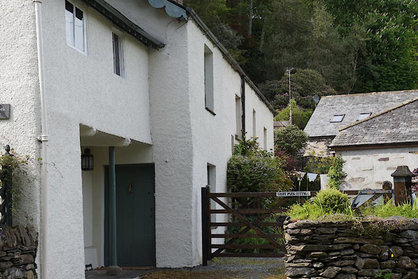 CAS12.jpg Stott Park Cottage, enclosed gallery. (taken 16.5.2014) 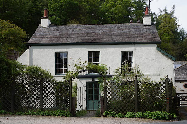 CAS10.jpg Stott Park House (taken 16.5.2014) |
||
|
|
||
| hearsay:- |
At the south end there are two windows over a 'porch', these are in a wall that now
encloses an open gallery. |
|
|
|
||
Lakes Guides menu.