 Old Cumbria Gazetteer
 |
 |
|
| High Rigg, St John's Castlerigg etc | ||
| High Rigg | ||
| Naddle Fell | ||
| civil parish:- | St John's Castlerigg and Wythburn (formerly Cumberland) | |
| county:- | Cumbria | |
| locality type:- | hill | |
| coordinates:- | NY30782139 (etc) | |
| 1Km square:- | NY3021 | |
| 10Km square:- | NY32 | |
|
|
||
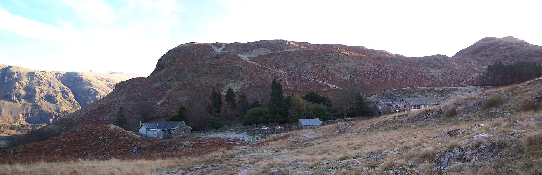
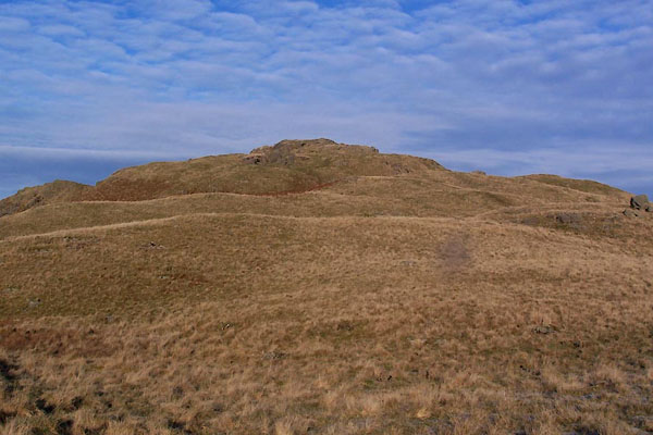 BXT49.jpg The highest bit. (taken 13.12.2012) 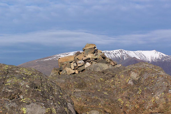 BXT48.jpg Cairn, summit, (taken 13.12.2012) |
||
|
|
||
| evidence:- | old map:- OS County Series (Cmd 64 12) placename:- High Rigg placename:- Rigg, High |
|
| source data:- | Maps, County Series maps of Great Britain, scales 6 and 25
inches to 1 mile, published by the Ordnance Survey, Southampton,
Hampshire, from about 1863 to 1948. |
|
|
|
||
| evidence:- | descriptive text:- West 1778 (11th edn 1821) |
|
| source data:- | Guide book, A Guide to the Lakes, by Thomas West, published by
William Pennington, Kendal, Cumbria once Westmorland, and in
London, 1778 to 1821. goto source goto sourceMrs Radcliffe's Ride over Skiddaw, 1794 Page 305:- "..." "At length, as we ascended, ... An opening to the south, at length, showed the whole plan of the narrow vales of St. John and of Nadale, separated by the dark ridge of rocks called St. John's Rigg, ... A white speck on the top of St. John's Rigg, was pointed out by the guide to be a chapel of ease to Keswick, ..." |
|
|
|
||
| evidence:- | descriptive text:- West 1778 (11th edn 1821) placename:- Naddle Fells |
|
| source data:- | Guide book, A Guide to the Lakes, by Thomas West, published by
William Pennington, Kendal, Cumbria once Westmorland, and in
London, 1778 to 1821. goto source Addendum; Mr Gray's Journal, 1769 Page 210:- "..." "Oct. 8. I left Keswick, and took the Ambleside road, ... good country road, through sound but narrow and stony ones, very safe in broad day light. This is the case about Causeway foot and among Naddle-fells, to Langthwaite." |
|
|
|
||
| evidence:- | descriptive text:- Wainwright, A: 1955: Book 3 Central Fells: Westmorland Gazette (Kendal, Westmorland) placename:- Naddle Fell |
|
| source data:- | "known locally as Naddle Fell" |
|
|
|
||
| evidence:- | perhaps outline view:- Tattersall 1836 (version 1869) placename:- Naddle Fell |
|
| source data:- | Print, hand coloured, Vale of St John, from the South, Cumberland, drawn by George
Tattersall, 1836, engraved by W F Topham, published by T J Allman, 463 Oxford Street,
London, 1869.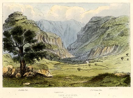 click to enlarge click to enlargeTAT208.jpg Included in The Lakes of England, by W F Topham. printed at bottom:- "VALE OF ST. JOHN, / from the South." printed at bottom:- "Naddle Fell. / Saddleback. / Pt. of White Pike. / Castle Rock." item:- Armitt Library : A1067.8 Image © see bottom of page |
|
|
|
||
| evidence:- | perhaps outline view:- Tattersall 1836 placename:- Naddle Fell |
|
| source data:- | Print, engraving, Vale of St John, from the South, Cumberland, drawn by George Tattersall,
engraved by W F Topham, published by Sherwood and Co, Paternoster Row, London, about
1836.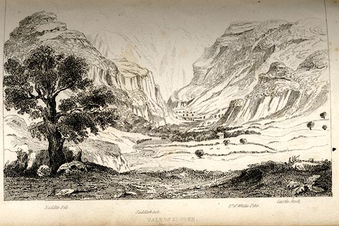 click to enlarge click to enlargeTAT119.jpg The print is captioned with mountain names and acts as an outline view. Tipped in opposite p.56 of The Lakes of England, by George Tattersall. printed at bottom:- "VALE OF ST. JOHN. / from the South." printed at bottom left to right:- "Naddle Fell. / Saddleback. / Pt.of White Pike. / Castle Rock." item:- Armitt Library : A1204.20 Image © see bottom of page |
|
|
|
||
| evidence:- | outline view:- placename:- Naddle Fell |
|
| source data:- | Print, hand coloured engraving, Vale of St John from the South, Cumberland, published
by Sherwood and Co, London, 1836?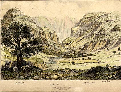 click to enlarge click to enlargePR0372.jpg Objects in the view are identified by a caption at the bottom - Naddle Fell, Saddleback, Pt. of White Pike, Castle Rock. printed at bottom:- "VALE of ST. JOHN, / from the South. / London, Pubd. April 15th 1836 by Sherwood &Co." item:- Dove Cottage : 2008.107.372 Image © see bottom of page |
|
|
|
||
 Click to enlarge BXT50.jpg (taken 13.12.2012) |
||
|
|
||
Lakes Guides menu.