 Old Cumbria Gazetteer
 |
 |
|
| High Bridge, Dacre | ||
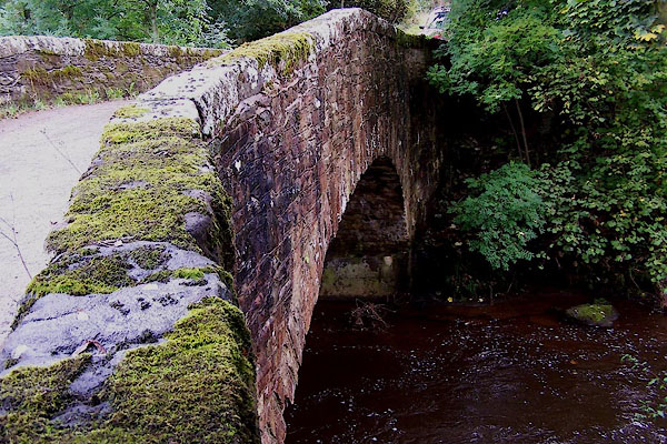
| High Bridge | ||
| site name:- | Dacre Beck | |
| civil parish:- | Dacre (formerly Cumberland) | |
| county:- | Cumbria | |
| locality type:- | bridge | |
| coordinates:- | NY45222609 | |
| 1Km square:- | NY4526 | |
| 10Km square:- | NY42 | |
|
|
||
 BJW84.jpg (taken 30.9.2005) |
||
|
|
||
| evidence:- | old map:- Donald 1774 (Cmd) |
|
| source data:- | Map, hand coloured engraving, 3x2 sheets, The County of Cumberland, scale about 1
inch to 1 mile, by Thomas Donald, engraved and published by Joseph Hodskinson, 29
Arundel Street, Strand, London, 1774.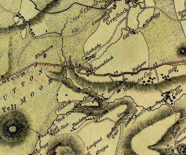 D4NY42NW.jpg double line across a river; a bridge near Southwaite item:- Carlisle Library : Map 2 Image © Carlisle Library |
|
|
|
||
| evidence:- | old map:- Bell 1892 placename:- Dacre High Bridge |
|
| source data:- | Map, colour lithograph, Road Map of Cumberland, by George Joseph
Bell, scale about 2.5 miles to 1 inch, printed by Charles
Thurnam and Sons, Carlisle, Cumberland, 1892.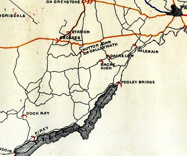 BEL9NY42.jpg "DACRE HIGH" bridge symbol Road map of Cumberland showing County Bridges item:- Carlisle Library : Map 38 Image © Carlisle Library |
|
|
|
||
| evidence:- | database:- Listed Buildings 2010 placename:- High Bridge |
|
| source data:- | courtesy of English Heritage "HIGH BRIDGE / / / DACRE / EDEN / CUMBRIA / II / 73758 / NY4522426096" |
|
| source data:- | courtesy of English Heritage "Road bridge. Early C19 with C20 repairs. Sandstone rubble. Narrow bridge of single segmental arch, under solid parapet with flat coping stones." |
|
|
|
||
| hearsay:- |
The deep pool by the bridge was the wash dub, used for dipping sheep - and, of course,
was the local swimming hole. |
|
|
|
||
 Lakes Guides menu.