 Old Cumbria Gazetteer
 |
 |
|
| High Borrow Bridge, Fawcett Forest | ||
| High Borrow Bridge | ||
| site name:- | Borrow Beck | |
| locality:- | Hucks Bridge | |
| locality:- | Borrowdale | |
| civil parish:- | Fawcett Forest (formerly Westmorland) | |
| county:- | Cumbria | |
| locality type:- | bridge | |
| coordinates:- | NY55010404 | |
| 1Km square:- | NY5504 | |
| 10Km square:- | NY50 | |
|
|
||
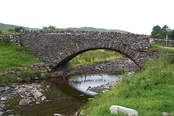 BJQ37.jpg (taken 22.7.2005) |
||
|
|
||
| evidence:- | old map:- OS County Series (Wmd 28 9) placename:- High Borrow Old Bridge placename:- Borrow Old Bridge, High |
|
| source data:- | Maps, County Series maps of Great Britain, scales 6 and 25
inches to 1 mile, published by the Ordnance Survey, Southampton,
Hampshire, from about 1863 to 1948. |
|
|
|
||
| evidence:- | old map:- Jefferys 1770 (Wmd) placename:- High Borrow Bridge placename:- Borrow Bridge, High |
|
| source data:- | Map, 4 sheets, The County of Westmoreland, scale 1 inch to 1
mile, surveyed 1768, and engraved and published by Thomas
Jefferys, London, 1770.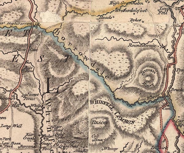 J5NY50SE.jpg "High Borrow B." double line, road, across a stream; bridge item:- National Library of Scotland : EME.s.47 Image © National Library of Scotland |
|
|
|
||
| evidence:- | probably old map:- Cary 1789 (edn 1805) placename:- High Borron placename:- Borron, High |
|
| source data:- | Map, uncoloured engraving, Westmoreland, scale about 2.5 miles
to 1 inch, by John Cary, London, 1789; edition 1805.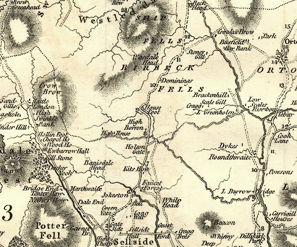 CY24NY50.jpg "High Borron" block/s, labelled in italic lowercase; house, or hamlet; there is also a road across a stream; bridge over the Borrow Beck item:- JandMN : 129 Image © see bottom of page |
|
|
|
||
| evidence:- | database:- Listed Buildings 2010 placename:- High Borrow Bridge |
|
| source data:- | courtesy of English Heritage "HIGH BORROW BRIDGE / / / FAWCETT FOREST / SOUTH LAKELAND / CUMBRIA / II / 75634 / NY5500504043" |
|
| source data:- | courtesy of English Heritage "Bridge over Borrow Beck. Probably C18 with late c18 widening. Stone rubble. Segmental arch with thin voussoirs, some of those to east face are long. Plain straight parapet with upright stones to coping. Roadway approx. 3.5m wide. On route of Heron Syke to Eamont Bridge turnpike road, 1856, replaced by new route over Shap Fell, crossing Borrow Beck over Huck's Bridge, (q.v.), c1826." |
|
|
|
||
| hearsay:- |
Used by the Heron Syke to Eamont Bridge turnpike, 1756. |
|
|
|
||
 Lakes Guides menu.