 Old Cumbria Gazetteer
 |
 |
|
| Hell Gill Bridge, Mallerstang | ||
| Hell Gill Bridge | ||
| site name:- | Hell Gill Beck | |
| locality:- | Mallerstang | |
| civil parish:- | Mallerstang (formerly Westmorland) | |
| county:- | Cumbria | |
| locality type:- | bridge | |
| locality type:- | county boundary mark | |
| coordinates:- | SD78649687 | |
| 1Km square:- | SD7896 | |
| 10Km square:- | SD79 | |
| county:- | North Yorkshire | |
| current boundary | ||
| locality:- | Cumbria boundary | |
|
|
||
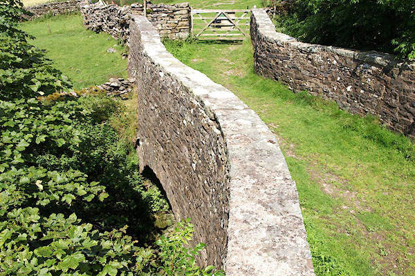 BRG04.jpg (taken 3.8.2009) 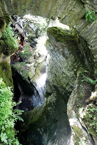 BRG02.jpg (taken 3.8.2009) |
||
|
|
||
| evidence:- | old map:- OS County Series (Wmd 36) placename:- Hellgill Bridge |
|
| source data:- | Maps, County Series maps of Great Britain, scales 6 and 25
inches to 1 mile, published by the Ordnance Survey, Southampton,
Hampshire, from about 1863 to 1948. |
|
|
|
||
| evidence:- | old map:- Jefferys 1770 (Wmd) placename:- Hell Gill Bridge |
|
| source data:- | Map, 4 sheets, The County of Westmoreland, scale 1 inch to 1
mile, surveyed 1768, and engraved and published by Thomas
Jefferys, London, 1770.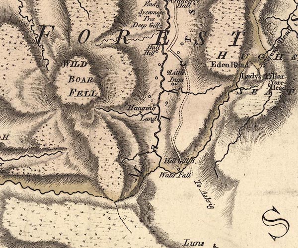 J5SD79NE.jpg "Hell Gill B." double line, road, across a stream; bridge item:- National Library of Scotland : EME.s.47 Image © National Library of Scotland |
|
|
|
||
| evidence:- | old map:- Laurie and Whittle 1806 placename:- Hell Gill Bridge |
|
| source data:- | Road map, Continuation of the Roads to Glasgow and Edinburgh,
scale about 10 miles to 1 inch, by Nathaniel Coltman? 1806,
published by Robert H Laurie, 53 Fleet Street, London, 1834. click to enlarge click to enlargeLw21.jpg "Hell Gill Br." bridge; on county boundary item:- private collection : 18.21 Image © see bottom of page |
|
|
|
||
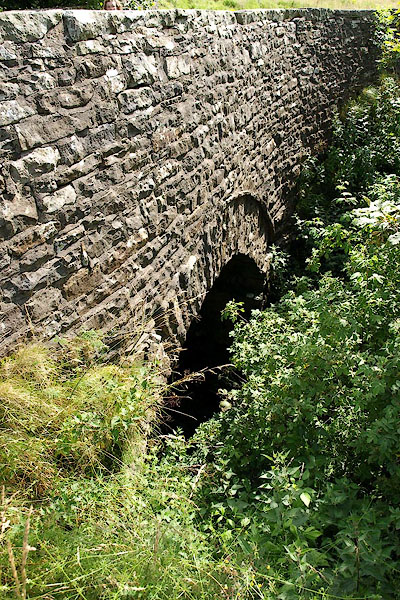 BRG01.jpg (taken 3.8.2009) 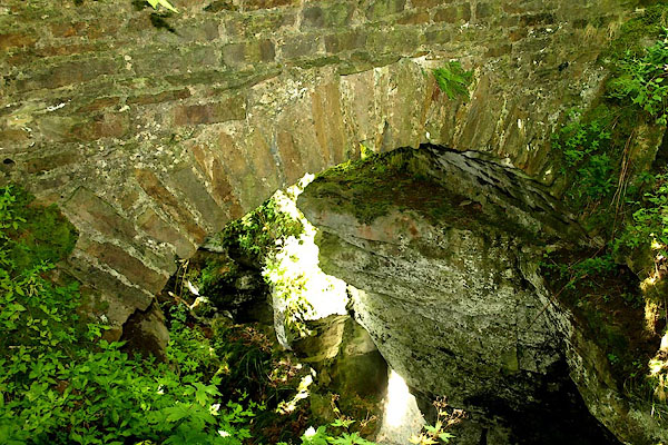 BRG03.jpg (taken 3.8.2009) |
||
|
|
||
 Lakes Guides menu.