 Old Cumbria Gazetteer
 |
 |
|
| Hause Farm, Martindale | ||
| Hause Farm | ||
| locality:- | Martindale | |
| civil parish:- | Martindale (formerly Westmorland) | |
| county:- | Cumbria | |
| locality type:- | buildings | |
| coordinates:- | NY43401912 | |
| 1Km square:- | NY4319 | |
| 10Km square:- | NY41 | |
|
|
||
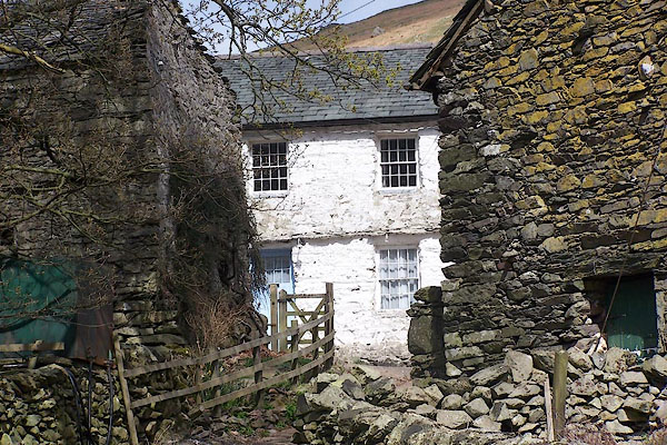 BNP18.jpg (taken 18.4.2007) 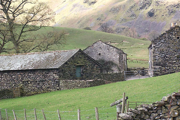 BNP19.jpg (taken 18.4.2007) |
||
|
|
||
| evidence:- | old map:- OS County Series (Wmd 12 4) placename:- Horse |
|
| source data:- | Maps, County Series maps of Great Britain, scales 6 and 25
inches to 1 mile, published by the Ordnance Survey, Southampton,
Hampshire, from about 1863 to 1948. |
|
|
|
||
| evidence:- | hearth tax returns:- Hearth Tax 1675 placename:- Hawse, The |
|
| source data:- | Records, hearth tax survey returns, Westmorland, 1674/75. "The Hawse" in "Martindale" |
|
|
|
||
| evidence:- | old map:- Jefferys 1770 (Wmd) placename:- Hause |
|
| source data:- | Map, 4 sheets, The County of Westmoreland, scale 1 inch to 1
mile, surveyed 1768, and engraved and published by Thomas
Jefferys, London, 1770.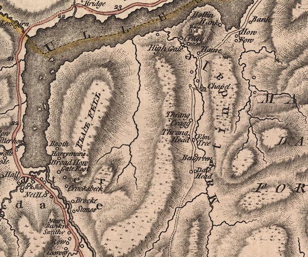 J5NY41NW.jpg "Hause" circle, labelled in italic lowercase text; settlement, farm, house, or hamlet? item:- National Library of Scotland : EME.s.47 Image © National Library of Scotland |
|
|
|
||
| evidence:- | database:- Listed Buildings 2010 placename:- Hause Farm |
|
| source data:- | courtesy of English Heritage "HAUSE FARMHOUSE AND ATTACHED BARN / / / MARTINDALE / EDEN / CUMBRIA / II / 74536 / NY4340319118" |
|
|
|
||
| hearsay:- |
A letter from W P Hasket Smith, West Cumberland Times, 5 January 1888, complains about
the Ordanance Survey calling places '... Horse', eg:- Horse Point, Burnt Horse, Dale
Horse, Horsey Gill. He said:- |
|
| "At the foot [of Howtown Hause] stands a farmhouse which appears in the map dignified
with the absurd name 'Horse'! We have the authority of Mr. Squeers for the fact that
'an Englishman may call his house an island if he likes', but when did any sane man
ever call his dwelling a sheep or a horse?" |
||
|
|
||
 Lakes Guides menu.