 Old Cumbria Gazetteer
 |
 |
|
| Orton Hall, Orton | ||
| Orton Hall | ||
| locality:- | Orton | |
| civil parish:- | Orton S (formerly Westmorland) | |
| county:- | Cumbria | |
| locality type:- | buildings | |
| coordinates:- | NY62530780 | |
| 1Km square:- | NY6207 | |
| 10Km square:- | NY60 | |
|
|
||
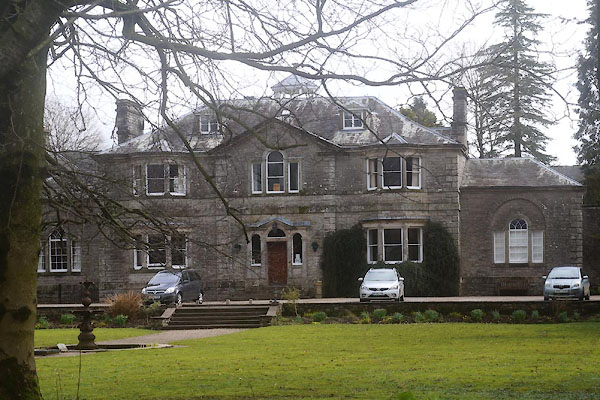 CFY60.jpg (taken 31.3.2017) |
||
|
|
||
| evidence:- | old map:- OS County Series (Wmd 21 16) placename:- Orton Hall |
|
| source data:- | Maps, County Series maps of Great Britain, scales 6 and 25
inches to 1 mile, published by the Ordnance Survey, Southampton,
Hampshire, from about 1863 to 1948. |
|
|
|
||
| evidence:- | old map:- Ford 1839 map placename:- Orton Hall |
|
| source data:- | Map, uncoloured engraving, Map of the Lake District of
Cumberland, Westmoreland and Lancashire, scale about 3.5 miles
to 1 inch, published by Charles Thurnam, Carlisle, and by R
Groombridge, 5 Paternoster Row, London, 3rd edn 1843.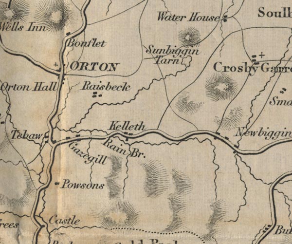 FD02NY60.jpg "Orton Hall" item:- JandMN : 100.1 Image © see bottom of page |
|
|
|
||
| evidence:- | database:- Listed Buildings 2010 placename:- Orton Hall |
|
| source data:- | courtesy of English Heritage "ORTON HALL / / B6260 / ORTON / EDEN / CUMBRIA / II / 74088 / NY6253007808" |
|
|
|
||
| notes:- |
Built 1662, for the Burn Family. |
|
|
|
||
 Lakes Guides menu.