 Old Cumbria Gazetteer
 |
 |
|
| Gurnal Bridge, Skelsmergh | ||
| Gurnal Bridge | ||
| site name:- | Sprint, River | |
| site name:- | Gurnal Bridge Lane | |
| civil parish:- | Skelsmergh (formerly Westmorland) | |
| civil parish:- | Strickland Roger (formerly Westmorland) | |
| county:- | Cumbria | |
| locality type:- | bridge | |
| coordinates:- | SD52099752 | |
| 1Km square:- | SD5297 | |
| 10Km square:- | SD59 | |
|
|
||
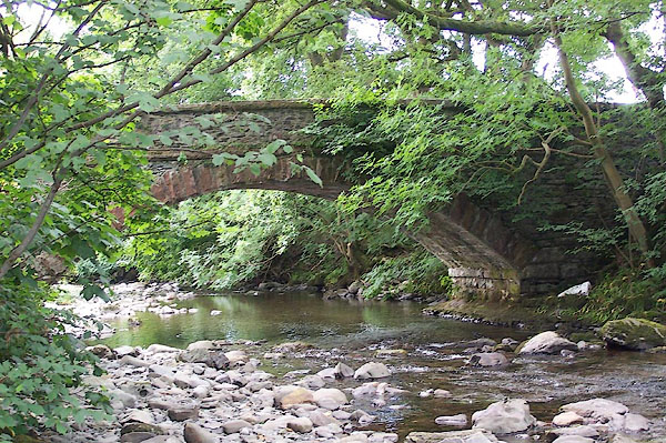 BJQ34.jpg (taken 16.7.2005) |
||
|
|
||
| evidence:- | old map:- OS County Series (Wmd 33 12) placename:- Gurnal Bridge |
|
| source data:- | Maps, County Series maps of Great Britain, scales 6 and 25
inches to 1 mile, published by the Ordnance Survey, Southampton,
Hampshire, from about 1863 to 1948. |
|
|
|
||
| evidence:- | old map:- Jefferys 1770 (Wmd) |
|
| source data:- | Map, 4 sheets, The County of Westmoreland, scale 1 inch to 1
mile, surveyed 1768, and engraved and published by Thomas
Jefferys, London, 1770.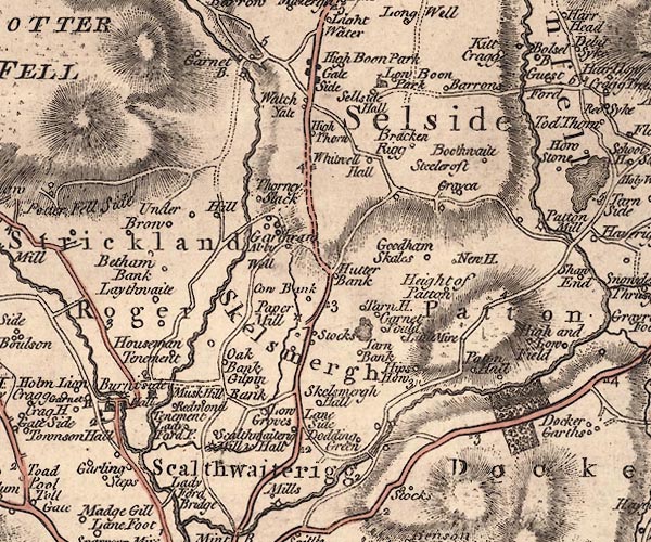 J5SD59NW.jpg double line, road, across a stream; bridge item:- National Library of Scotland : EME.s.47 Image © National Library of Scotland |
|
|
|
||
| hearsay:- |
Mentioned in 1560. A wooden bridge here fell down in 1724. The inhabitants of Skelsmergh
and Strickland Roger parishes had to replace it with a good stone bridge. |
|
|
|
||
 Lakes Guides menu.