 Old Cumbria Gazetteer
 |
 |
|
| Greycrag Tarn, Longsleddale | ||
| Greycrag Tarn | ||
| locality:- | Sleddale Fell | |
| civil parish:- | Longsleddale (formerly Westmorland) | |
| county:- | Cumbria | |
| locality type:- | tarn | |
| locality type:- | moss | |
| coordinates:- | NY49230767 | |
| 1Km square:- | NY4907 | |
| 10Km square:- | NY40 | |
| altitude:- | 1953 feet | |
| altitude:- | 595m | |
|
|
||
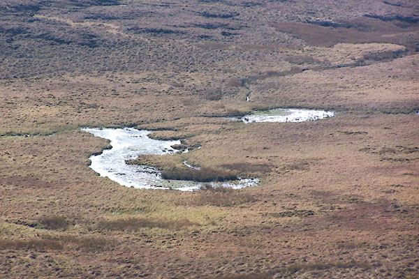 BNO66.jpg (taken 12.4.2007) |
||
|
|
||
| evidence:- | old map:- OS County Series (Wmd 27 3) placename:- Greycrag Tarn |
|
| source data:- | Maps, County Series maps of Great Britain, scales 6 and 25
inches to 1 mile, published by the Ordnance Survey, Southampton,
Hampshire, from about 1863 to 1948. Shown as a marsh rather than open water. |
|
|
|
||
| evidence:- | old map:- Hodgson 1828 placename:- Grey Crag Tarn |
|
| source data:- | Map, hand coloured engraving, 4 sheets mounted together on linen and rolled, Plan
of the County of Westmorland, scale about 1.25 inches to 1 mile, by Thomas Hodgson,
engraved by W R Gardner, Harpur Street, London, published by Thomas Hodgson, Lancaster,
and perhaps by C Smith, 172 Strand, London,1828.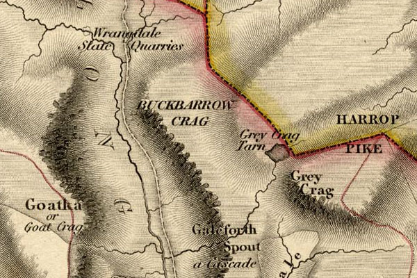 HDG6lsl4.jpg map courtesy of Mark Cropper "Grey Crag Tarn" Drawn as open water. item:- private collection : 371 Image © see bottom of page |
|
|
|
||
| evidence:- | old text:- Prior 1865 placename:- Grey Crag Tarn |
|
| source data:- | Guide book, Ascents and Passes in the Lake District of England,
by Herman Prior, published by John Garnett, Windermere,
Westmorland, and by Simpkin, Marshall and Co, London, 1865. Page 109:- "... Grey Crag Tarn, a dismal sheet of water, almost entirely overgrown, and backed by a stretch of most horrible bog." "... Grey Crag Tarn is so overgrown, that it is almost as much like land as water; and the whole of the wide ridge beyond is one mass of slush, with, here and there, some of the worst bog ever seen. ..." |
|
|
|
||
| evidence:- | old map:- OS 1881-82 New Series (outline edition) placename:- Greycrag Tarn |
|
| source data:- | Map, engraving, area north of Kendal, Westmorland, New Series
one inch map, outline edition, sheet 39, scale 1 inch to 1 mile,
published by the Ordnance Survey, Southampton, Hampshire,
1881-82.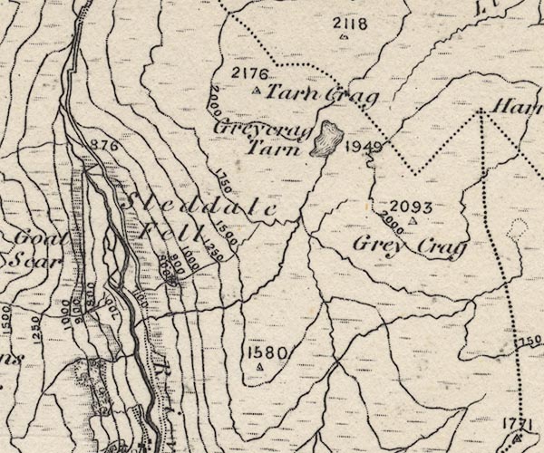 O21NY40Y.jpg "Greycrag Tarn" Drawn as open water. item:- JandMN : 61 Image © see bottom of page |
|
|
|
||
| evidence:- | textbook:- EPNS Westmorland 1967 placename:- Braban tarne |
|
| source data:- | Book, The Place Names of Westmorland, two volumes, by A H Smith,
published for the English Place Name Society by Cambridge
University Press, Cambridgeshire, 1967 |
|
|
|
||
| evidence:- | map:- OS Six Inch (1956) placename:- Greycrag Tarn |
|
| source data:- | Map series, various editions with the national grid, scale about
6 inches to 1 mile, published by the Ordnance Survey,
Southampton, Hampshire, scale 1 to 10560 from 1950s to 1960s,
then 1 to 10000 from 1960s to 2000s, superseded by print on
demand from digital data.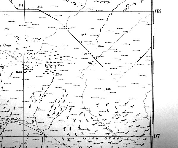 SINY4907.jpg "Greycrag Tarn" drawn as an area of marsh. |
|
|
|
||
 Lakes Guides menu.