 Old Cumbria Gazetteer
 |
 |
|
||
| Greta, River (2) | ||||
| county:- | Lancashire | |||
| locality type:- | river | |||
| coordinates:- | SD599728 | |||
| 1Km square:- | SD5972 | |||
| 10Km square:- | SD57 | |||
|
|
||||
| evidence:- | old map:- Saxton 1579 |
|||
| source data:- | Map, hand coloured engraving, Westmorlandiae et Cumberlandiae Comitatus ie Westmorland
and Cumberland, scale about 5 miles to 1 inch, by Christopher Saxton, London, engraved
by Augustinus Ryther, 1576, published 1579-1645.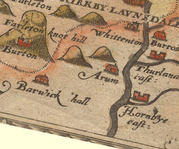 Sax9SD57.jpg item:- private collection : 2 Image © see bottom of page |
|||
|
|
||||
| evidence:- | old map:- Speed 1611 (Wmd) |
|||
| source data:- | Map, hand coloured engraving, The Countie Westmorland and
Kendale the Cheif Towne, scale about 2.5 miles to 1 inch, by
John Speed, 1610, published by George Humble, Popes Head Alley,
London, 1611-12.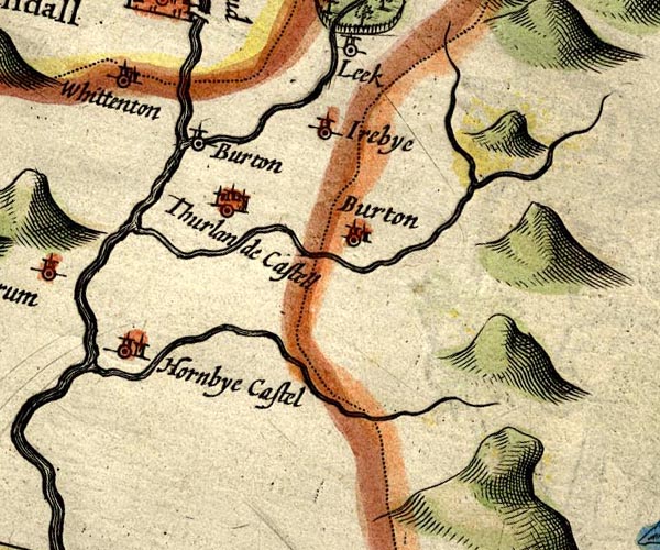 SP14SD67.jpg double line, into the Lune item:- Armitt Library : 2008.14.5 Image © see bottom of page |
|||
|
|
||||
| evidence:- | old map:- Jansson 1646 |
|||
| source data:- | Map, hand coloured engraving, Cumbria and Westmoria, ie
Cumberland and Westmorland, scale about 3.5 miles to 1 inch, by
John Jansson, Amsterdam, Netherlands, 1646.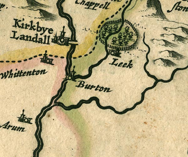 JAN3SD67.jpg Double wiggly line tapering to single. item:- JandMN : 88 Image © see bottom of page |
|||
|
|
||||
| evidence:- | old map:- Seller 1694 (Wmd) |
|||
| source data:- | Map, hand coloured engraving, Westmorland, scale about 8 miles
to 1 inch, by John Seller, 1694. click to enlarge click to enlargeSEL7.jpg tapering wiggly line; river item:- Dove Cottage : 2007.38.87 Image © see bottom of page |
|||
|
|
||||
| evidence:- | old map:- Morden 1695 (Wmd) |
|||
| source data:- | Map, hand coloured engraving, Westmorland, scale about 2.5 miles to 1 inch, by Robert
Morden, published by Abel Swale, the Unicorn, St Paul's Churchyard, Awnsham, and John
Churchill, the Black Swan, Paternoster Row, London, 1695.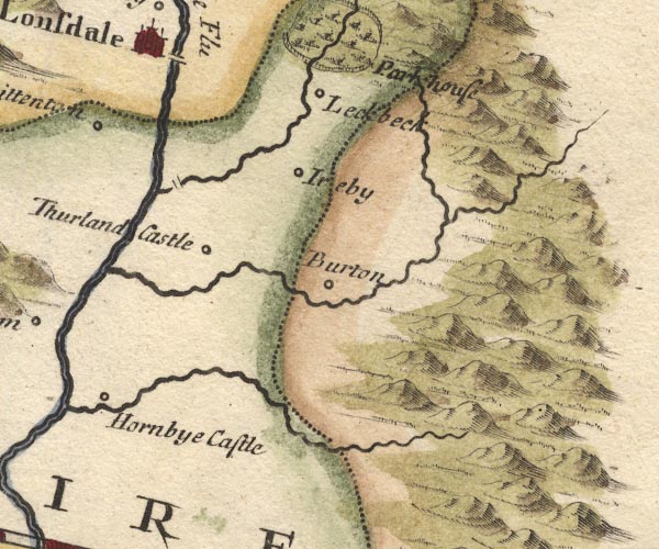 MD10SD67.jpg Running into the Lune. item:- JandMN : 24 Image © see bottom of page |
|||
|
|
||||
| evidence:- | old map:- Garnett 1850s-60s H placename:- Winning, River |
|||
| source data:- | Map of the English Lakes, in Cumberland, Westmorland and
Lancashire, scale about 3.5 miles to 1 inch, published by John
Garnett, Windermere, Westmorland, 1850s-60s.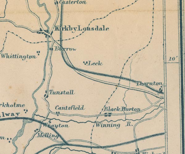 GAR2SD67.jpg "Winning R." wiggly line, river item:- JandMN : 82.1 Image © see bottom of page |
|||
|
|
||||
| places:- |
|
|||
 Lakes Guides menu.