 Old Cumbria Gazetteer
 |
 |
|
| Greenodd Station, Greenodd | ||
| Greenodd Station | ||
| site name:- | Lakeside branch railway | |
| locality:- | Greenodd | |
| civil parish:- | Egton with Newland (formerly Lancashire) | |
| county:- | Cumbria | |
| locality type:- | railway station | |
| coordinates:- | SD314824 (guess) | |
| 1Km square:- | SD3182 | |
| 10Km square:- | SD38 | |
| SummaryText:- | Opened 1869; closed 1946. | |
|
|
||
| evidence:- | old map:- OS County Series (Lan 11 12) placename:- Greenodd Station item:- railway signal; weighing machine |
|
| source data:- | Maps, County Series maps of Great Britain, scales 6 and 25
inches to 1 mile, published by the Ordnance Survey, Southampton,
Hampshire, from about 1863 to 1948.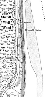 click to enlarge click to enlargeCSRY0154.jpg "Greenodd Station / Signal Box / W.M. / S.P." |
|
|
|
||
| evidence:- | old map:- Postlethwaite 1877 (3rd edn 1913) |
|
| source data:- | Map, uncoloured engraving, Map of the Lake District Mining Field, Westmorland, Cumberland,
Lancashire, scale about 5 miles to 1 inch, by John Postlethwaite, published by W H
Moss and Sons, 13 Lowther Street, Whitehaven, Cumberland, 1877 edn 1913.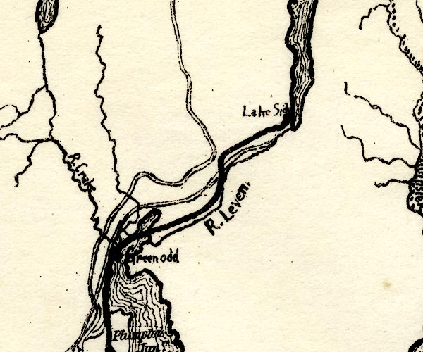 PST2SD38.jpg "Greenodd" station on railway item:- JandMN : 162.2 Image © see bottom of page |
|
|
|
||
| Paley and Austin series | ||
| person:- | architect : Paley, Edward G |
|
| date:- | 1869 |
|
| New building. |
||
|
|
||
 Lakes Guides menu.