 Old Cumbria Gazetteer
 |
 |
|
| Great Coum, Dent | ||
| Great Coum | ||
| civil parish:- | Dent (formerly Yorkshire) | |
| civil parish:- | Casterton (formerly Westmorland) | |
| county:- | Cumbria | |
| locality type:- | hill | |
| locality type:- | boundary feature | |
| locality type:- | parish boundary feature | |
| locality type:- | county boundary feature (old) | |
| coordinates:- | SD70138352 (etc) | |
| 1Km square:- | SD7083 | |
| 10Km square:- | SD78 | |
|
|
||
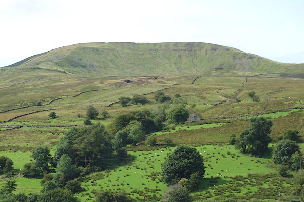 CDT99.jpg (taken 25.8.2015) |
||
|
|
||
| evidence:- | old map:- OS County Series (Wmd 44 12) placename:- Great Coum placename:- Coum, Great |
|
| source data:- | Maps, County Series maps of Great Britain, scales 6 and 25
inches to 1 mile, published by the Ordnance Survey, Southampton,
Hampshire, from about 1863 to 1948. |
|
|
|
||
| evidence:- | possibly old map:- Jefferys 1770 (Wmd) placename:- Crage |
|
| source data:- | Map, 4 sheets, The County of Westmoreland, scale 1 inch to 1
mile, surveyed 1768, and engraved and published by Thomas
Jefferys, London, 1770.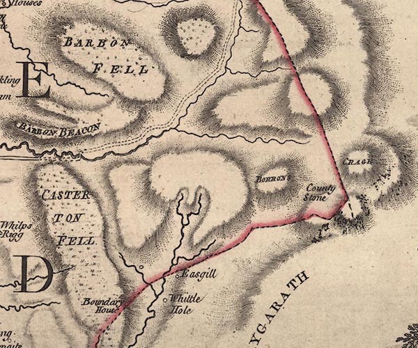 J5SD68SE.jpg "CRAGE" hill hachuring; hill or mountain item:- National Library of Scotland : EME.s.47 Image © National Library of Scotland |
|
|
|
||
| evidence:- | probably descriptive text:- West 1778 (11th edn 1821) |
|
| source data:- | Guide book, A Guide to the Lakes, by Thomas West, published by
William Pennington, Kendal, Cumbria once Westmorland, and in
London, 1778 to 1821. goto source goto sourceTour to the Caves in the West Riding of Yorkshire, late 18th century Page 270:- "... There was a very thin bed of coal almost on the top of this mountain [Whernside], and we were told another corresponded with it on the top of great Colm, a lofty mountain on the other side of that branch of the vale of Dent called Dibdale.- ..." |
|
|
|
||
Lakes Guides menu.