 Old Cumbria Gazetteer
 |
 |
|
| Goldrill Bridge, Patterdale | ||
| Goldrill Bridge | ||
| site name:- | Goldrill Beck | |
| locality:- | Patterdale | |
| civil parish:- | Patterdale (formerly Westmorland) | |
| county:- | Cumbria | |
| locality type:- | bridge | |
| coordinates:- | NY39811582 | |
| 1Km square:- | NY3915 | |
| 10Km square:- | NY31 | |
|
|
||
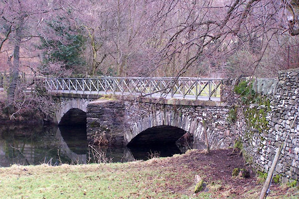 BLN61.jpg (taken 7.1.2006) |
||
|
|
||
| evidence:- | old map:- Donald 1774 (Cmd) |
|
| source data:- | Map, hand coloured engraving, 3x2 sheets, The County of Cumberland, scale about 1
inch to 1 mile, by Thomas Donald, engraved and published by Joseph Hodskinson, 29
Arundel Street, Strand, London, 1774.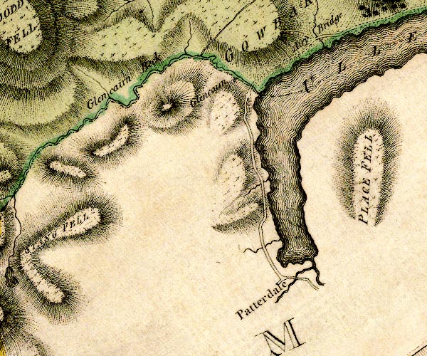 D4NY31NE.jpg double line across a river; a bridge item:- Carlisle Library : Map 2 Image © Carlisle Library |
|
|
|
||
| evidence:- | probably old map:- Clarke 1787 map (Ullswater) |
|
| source data:- | Map, A Map of the Lake Ullswater and its Environs, scale about
6.5 ins to 1 mile, by James Clarke, engraved by S J Neele, 352
Strand, published by James Clarke, Penrith, Cumberland and in
London etc, 1787.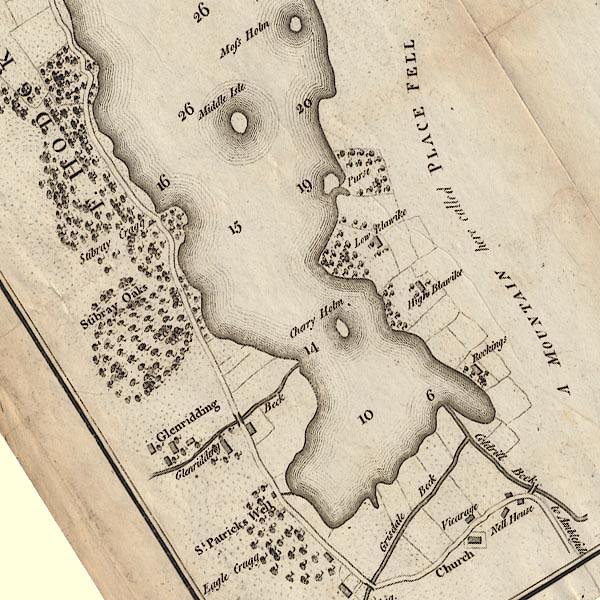 CL4NY31Y.jpg Drawn by a bridge symbol, over the Goldrill Beck. item:- private collection : 10.4 Image © see bottom of page |
|
|
|
||
| evidence:- | old print:- Rose 1832-35 (vol.3 no.66) |
|
| source data:- | Print, uncoloured engraving, Goldril Beck and Ullswater, Cumberland, drawn by G Pickering,
engraved by D Buckle, published by Fisher, Son and Co, London, 1832-35.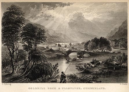 click to enlarge click to enlargePR0055.jpg vol.3 pl.66 in the set of prints, Westmorland, Cumberland, Durham and Northumberland Illustrated. This is in Westmorland. printed at bottom left, right, centre:- "G. Pickering. / D. Buckle. / GOLDRILL BECK &ULLSWATER, CUMBERLAND." item:- Dove Cottage : 2008.107.55 Image © see bottom of page |
|
|
|
||
| evidence:- | possibly old print:- Rose 1832-35 placename:- Patterdale Bridge |
|
| source data:- | Print, engraving, Patterdale Bridge, Westmorland, by Thomas
Allom, engraved by R Sands, 1834.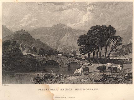 click to enlarge click to enlargeR234.jpg item:- JandMN : 66.54 Image © see bottom of page |
|
|
|
||
 Lakes Guides menu.