 Old Cumbria Gazetteer
 |
 |
|
| Godmond Hall, Strickland Roger | ||
| Godmond Hall | ||
| Street:- | Potter Fell Road | |
| civil parish:- | Strickland Roger (formerly Westmorland) | |
| county:- | Cumbria | |
| locality type:- | buildings | |
| coordinates:- | SD49959785 | |
| 1Km square:- | SD4997 | |
| 10Km square:- | SD49 | |
|
|
||
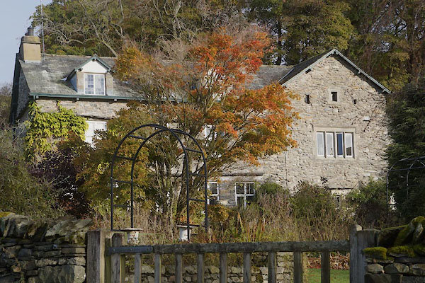 CFR65.jpg (taken 11.11.2016) |
||
|
|
||
| evidence:- | old map:- OS County Series (Wmd 33 11) placename:- Godmond Hall |
|
| source data:- | Maps, County Series maps of Great Britain, scales 6 and 25
inches to 1 mile, published by the Ordnance Survey, Southampton,
Hampshire, from about 1863 to 1948. |
|
|
|
||
| evidence:- | possibly old map:- Jefferys 1770 (Wmd) placename:- Potter Fell Side |
|
| source data:- | Map, 4 sheets, The County of Westmoreland, scale 1 inch to 1
mile, surveyed 1768, and engraved and published by Thomas
Jefferys, London, 1770.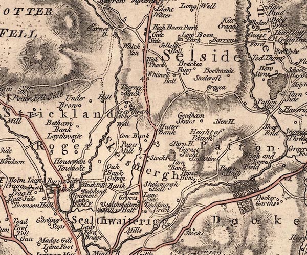 J5SD59NW.jpg "Potter Fell Side" circle; hamlet or houses item:- National Library of Scotland : EME.s.47 Image © National Library of Scotland |
|
|
|
||
| evidence:- | old text:- Camden 1789 (Gough Additions) placename:- Godmond Hall |
|
| source data:- | Book, Britannia, or A Chorographical Description of the Flourishing Kingdoms of England,
Scotland, and Ireland, by William Camden, 1586, translated from the 1607 Latin edition
by Richard Gough, published London, 1789. goto source goto sourcePage 153:- "In Strickland Roger another chapelry of Kendal remains at Godmond hall the tower in its original state. The walls are upwards of two yards thick and strongly cemented; the windows small and crossed with strong iron bars: the lowest floor is arched over; and the next above laid with massy boards or planks groined into each other to prevent assaults from above: for the predatory parties did not proceed by way of sap, but by compendious method strove to unroof the building and let themselves down by ropes and ladders." |
|
|
|
||
| evidence:- | possibly old map:- Cary 1789 (edn 1805) placename:- Potter Fell |
|
| source data:- | Map, uncoloured engraving, Westmoreland, scale about 2.5 miles
to 1 inch, by John Cary, London, 1789; edition 1805.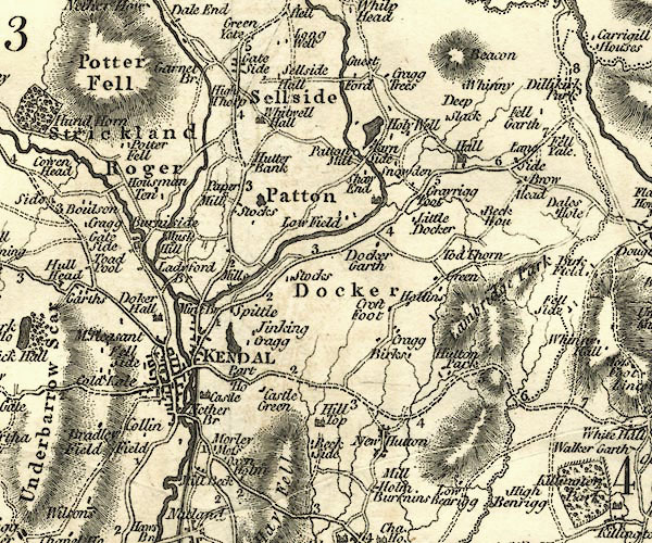 CY24SD59.jpg "Potter Fell" block/s, labelled in italic lowercase; house, or hamlet item:- JandMN : 129 Image © see bottom of page |
|
|
|
||
| evidence:- | old photograph:- Bell 1880s-1940s placename:- Godmond Hall |
|
| source data:- | Photograph, Godmond Hall, Strickland Roger, Westmorland, by Herbert Bell, photographer,
Ambleside, Westmorland, 1897.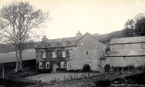 click to enlarge click to enlargeHB0154.jpg Vol.2 no.154 in an album, Examples of Early Domestic and Military Architecture in Westmorland, assembled 1910. ms at bottom:- "154. Godmond Hall. Kendal. K." item:- Armitt Library : 1958.3166.48 Image © see bottom of page |
|
|
|
||
| evidence:- | database:- Listed Buildings 2010 placename:- Godmond Hall |
|
| source data:- | courtesy of English Heritage "GODMOND HALL / / POTTER FELL ROAD / STRICKLAND ROGER / SOUTH LAKELAND / CUMBRIA / II / 76434 / SD4995697851" |
|
|
|
||
| notes:- |
possible 15th century tower and hall |
|
| Perriam, D R &Robinson, J: 1998: Medieval Fortified Buildings of Cumbria: CWAAS::
ISBN 1 873124 23 6; plan and illustration |
||
|
|
||
Lakes Guides menu.