

Brook, D & Davies, G & Long, M H &Sutcliffe, J R: 1975: Northern Caves, vol.4 Whernside and Gragareth: Dalesman Books:: ISBN 0 85206 259 1
placename:- Gavel Pot
placename:- Navel Pot
 goto source
page 73:- "..."
"Gavel, or Navel Pot."
"At length Fenwick's Allotment has to be left at the lower end, where the hollow passes into the next field. Walk along the upper edge of the slope on the left hand side and many yards will not have been traversed before a wooden fence surrounding a large opening will be seen, that might have been unobserved by a person walking in the bottom of the depression; this is Navel Pot, a great vacuity in the rocks, quite different from those already examined in the adjacent field. The general configuration of the gulf is elliptical, but at the upper end it has a prolongation, which is very narrow and bends slightly to the south; in fact, the chasm presents a contour not unlike that of the human navel. The rocks are very precipitous on all side, except upon the north eastern boundary, where there are found instead, to some extent at least, steep slopes, down which it is possible to make one's way so as to descend into one part of the pot, which is not so deep as the rest, thereby enabling the explorer to examine a cave or rift wherein an unseen waterfall may be heard in a rent leading to a deeper abyss. In this way the plummet may be conveyed to a point which could not have been reached above, and by means of a somewhat curved line, caused to indicate a total depth of"
 goto source
page 74:- "one hundred and fourteen feet, whilst that denoted in the great pot hole from the edge of the western rock is only one hundred and three feet when measured to the foot of the rail. The girth of Gavel Pot is about one hundred and forty-eight yards, and shrubs are plentiful."
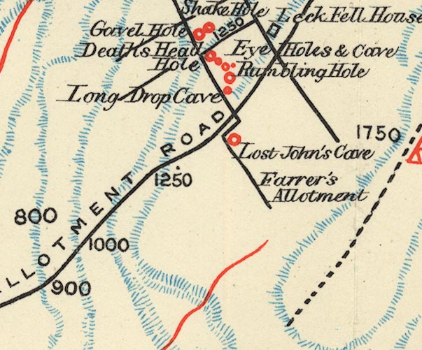
placename:- Gavel Hole

BS1SD67U.jpg
"Gavel Hole"
item:- private collection : 27.1
Image © see bottom of page
