 Old Cumbria Gazetteer
 |
 |
|
| included in:- |
 track, Wasdale Head to Gatesgarth track, Wasdale Head to Gatesgarth |
|
| Gatesgarth, Buttermere | ||
| Gatesgarth | ||
| civil parish:- | Buttermere (formerly Cumberland) | |
| county:- | Cumbria | |
| locality type:- | buildings | |
| locality type:- | locality | |
| coordinates:- | NY19351503 | |
| 1Km square:- | NY1915 | |
| 10Km square:- | NY11 | |
|
|
||
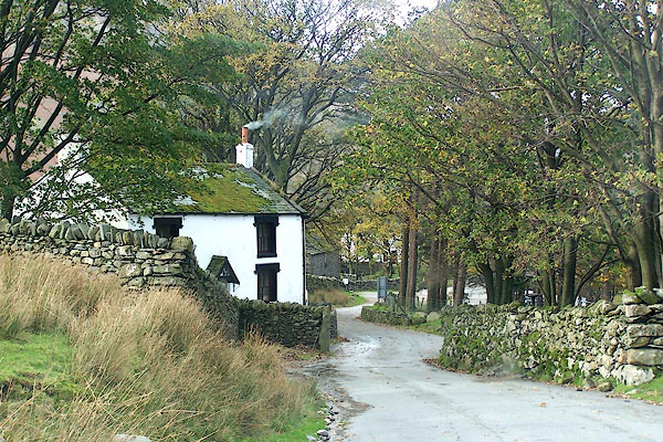 BJZ25.jpg (taken 7.11.2005) |
||
|
|
||
| evidence:- | old map:- OS County Series (Cmd 69 11) placename:- Gatesgarth |
|
| source data:- | Maps, County Series maps of Great Britain, scales 6 and 25
inches to 1 mile, published by the Ordnance Survey, Southampton,
Hampshire, from about 1863 to 1948. |
|
|
|
||
| evidence:- | old map:- Donald 1774 (Cmd) placename:- Gatesgarth |
|
| source data:- | Map, hand coloured engraving, 3x2 sheets, The County of Cumberland, scale about 1
inch to 1 mile, by Thomas Donald, engraved and published by Joseph Hodskinson, 29
Arundel Street, Strand, London, 1774.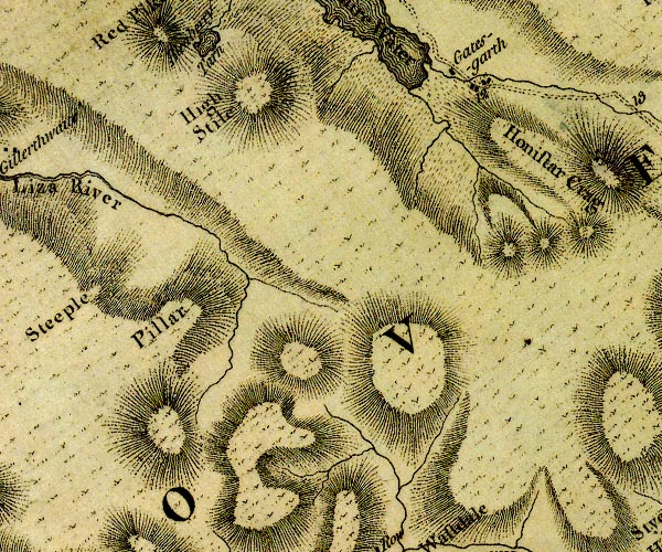 D4NY11SE.jpg "Gatesgarth" block or blocks, labelled in lowercase; a hamlet or just a house item:- Carlisle Library : Map 2 Image © Carlisle Library |
|
|
|
||
| evidence:- | descriptive text:- West 1778 (11th edn 1821) |
|
| source data:- | Guide book, A Guide to the Lakes, by Thomas West, published by
William Pennington, Kendal, Cumbria once Westmorland, and in
London, 1778 to 1821. goto source Page 136:- "... A group of houses, called Gatesgarth, is seated on the southern extremity [of Buttermere], under the most extraordinary amphitheatre of mountainous rocks that ever eye beheld. ..." |
|
|
|
||
| evidence:- | old map:- Crosthwaite 1783-94 (But/Cru/Low) placename:- Gatesgarth |
|
| source data:- | Map, uncoloured engraving, An Accurate Map of Buttermere,
Crummock and Loweswater Lakes, scale about 3 inches to 1 mile,
by Peter Crosthwaite, Keswick, Cumberland, 1794, version
published 1800.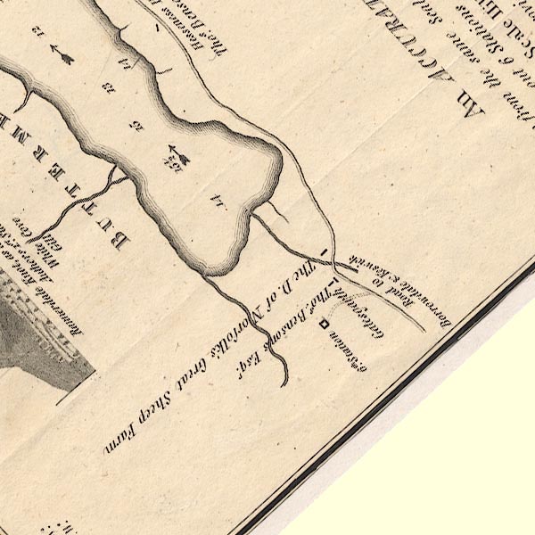 CT8NY11X.jpg "Gatesgarth / Thos. Benson's Esqr." item:- Armitt Library : 1959.191.2 Image © see bottom of page |
|
|
|
||
| evidence:- | old map:- West 1784 map placename:- Gatesgarth |
|
| source data:- | Map, hand coloured engraving, A Map of the Lakes in Cumberland,
Westmorland and Lancashire, scale about 3.5 miles to 1 inch,
engraved by Paas, 53 Holborn, London, about 1784.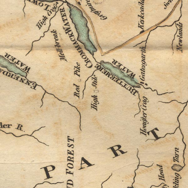 Ws02NY11.jpg item:- Armitt Library : A1221.1 Image © see bottom of page |
|
|
|
||
| evidence:- | old map:- Otley 1818 placename:- Gatesgarth |
|
| source data:- | Map, uncoloured engraving, The District of the Lakes,
Cumberland, Westmorland, and Lancashire, scale about 4 miles to
1 inch, by Jonathan Otley, 1818, engraved by J and G Menzies,
Edinburgh, Scotland, published by Jonathan Otley, Keswick,
Cumberland, et al, 1833.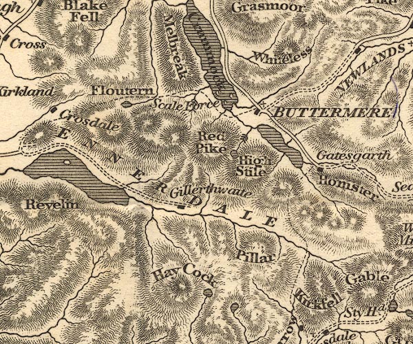 OT02NY11.jpg item:- JandMN : 48.1 Image © see bottom of page |
|
|
|
||
| evidence:- | descriptive text:- Ford 1839 (3rd edn 1843) placename:- Gatesgarth |
|
| source data:- | Guide book, A Description of Scenery in the Lake District, by
Rev William Ford, published by Charles Thurnam, Carlisle, by W
Edwards, 12 Ave Maria Lane, Charles Tilt, Fleet Street, William
Smith, 113 Fleet Street, London, by Currie and Bowman,
Newcastle, by Bancks and Co, Manchester, by Oliver and Boyd,
Edinburgh, and by Sinclair, Dumfries, 1839. goto source Page 88:- "... The sheep farm-house and others called Gatesgarth, stand at the end of Honistar Crag, half a mile from the head of the lake, ..." |
|
|
|
||
| evidence:- | old map:- Ford 1839 map placename:- Gatesgarth |
|
| source data:- | Map, uncoloured engraving, Map of the Lake District of
Cumberland, Westmoreland and Lancashire, scale about 3.5 miles
to 1 inch, published by Charles Thurnam, Carlisle, and by R
Groombridge, 5 Paternoster Row, London, 3rd edn 1843.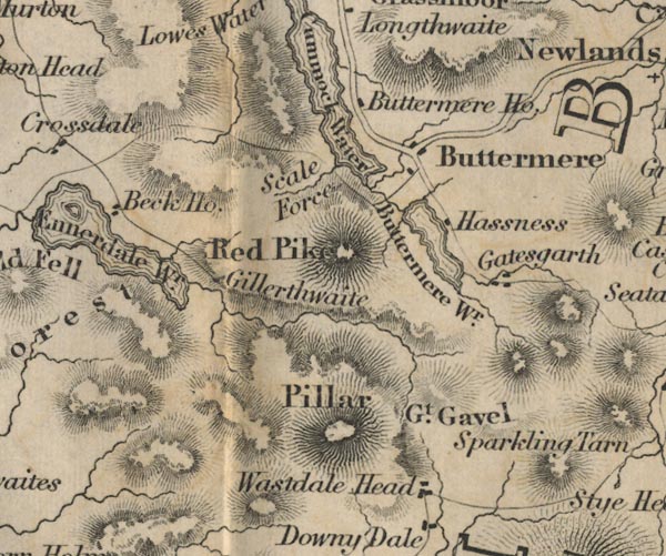 FD02NY11.jpg "Gatesgarth" item:- JandMN : 100.1 Image © see bottom of page |
|
|
|
||
| evidence:- | old map:- Garnett 1850s-60s H placename:- Gatescarth |
|
| source data:- | Map of the English Lakes, in Cumberland, Westmorland and
Lancashire, scale about 3.5 miles to 1 inch, published by John
Garnett, Windermere, Westmorland, 1850s-60s.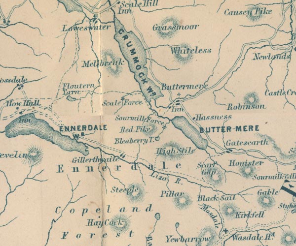 GAR2NY11.jpg "Gatescarth" blocks, settlement item:- JandMN : 82.1 Image © see bottom of page |
|
|
|
||
| evidence:- | old text:- Martineau 1855 |
|
| source data:- | Guide book, A Complete Guide to the English Lakes, by Harriet
Martineau, published by John Garnett, Windermere, Westmorland,
and by Whittaker and Co, London, 1855; published 1855-76. goto source Page 133:- "... Then comes Gatesgarth,- the farmstead whence the road to Scarf Gap is taken, by which, as we have told, London gentlemen and Kendal ladies have run into such extreme danger. ..." |
|
|
|
||
Lakes Guides menu.