 Old Cumbria Gazetteer
 |
 |
|
| Garriestown, Rockcliffe | ||
| Garriestown | ||
| civil parish:- | Rockcliffe (formerly Cumberland) | |
| county:- | Cumbria | |
| locality type:- | buildings | |
| coordinates:- | NY35156439 | |
| 1Km square:- | NY3564 | |
| 10Km square:- | NY36 | |
|
|
||
 BWT77.jpg (taken 15.6.2012) 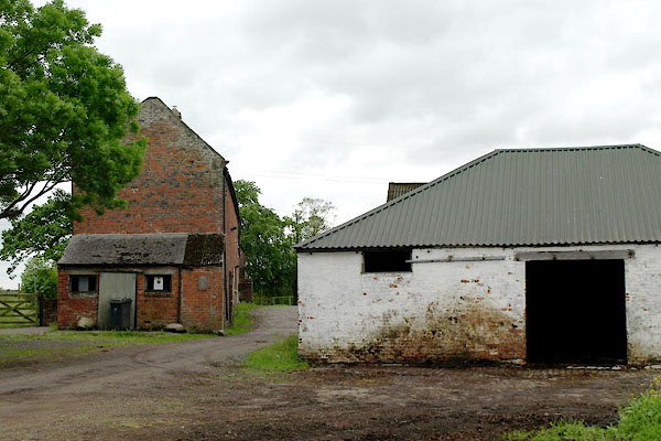 BWT76.jpg (taken 15.6.2012) |
||
|
|
||
| evidence:- | old map:- OS County Series (Cmd 10 13) placename:- Garriestown |
|
| source data:- | Maps, County Series maps of Great Britain, scales 6 and 25
inches to 1 mile, published by the Ordnance Survey, Southampton,
Hampshire, from about 1863 to 1948. |
|
|
|
||
| evidence:- | old map:- Bowen and Kitchin 1760 placename:- Garriston |
|
| source data:- | Map, hand coloured engraving, A New Map of the Counties of
Cumberland and Westmoreland Divided into their Respective Wards,
scale about 4 miles to 1 inch, by Emanuel Bowen and Thomas
Kitchin et al, published by T Bowles, Robert Sayer, and John
Bowles, London, 1760.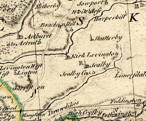 BO18NY46.jpg "Garriston" blocks on road item:- Armitt Library : 2008.14.10 Image © see bottom of page |
|
|
|
||
| evidence:- | old map:- Donald 1774 (Cmd) placename:- Garries Town |
|
| source data:- | Map, hand coloured engraving, 3x2 sheets, The County of Cumberland, scale about 1
inch to 1 mile, by Thomas Donald, engraved and published by Joseph Hodskinson, 29
Arundel Street, Strand, London, 1774.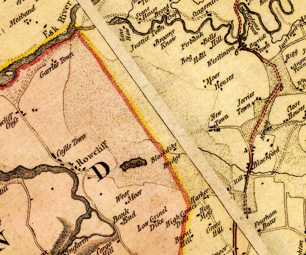 D4NY36SE.jpg "Garries Town" block or blocks, labelled in lowercase; a hamlet or just a house item:- Carlisle Library : Map 2 Image © Carlisle Library |
|
|
|
||
| evidence:- | database:- Listed Buildings 2010 placename:- Garristown |
|
| source data:- | courtesy of English Heritage "GARRISTOWN AND ADJOINING OUTBUILDINGS / / / ROCKCLIFFE / CARLISLE / CUMBRIA / II / 77950 / NY3515764391" |
|
|
|
||
 Lakes Guides menu.