 Old Cumbria Gazetteer
 |
 |
|
| Gair Burn | ||
| runs into:- |  Irthing, River Irthing, River |
|
|
|
||
| civil parish:- | Bewcastle (formerly Cumberland) | |
| county:- | Cumbria | |
| locality type:- | river | |
| locality type:- | boundary | |
| locality type:- | county boundary | |
| 1Km square:- | NY6278 (etc) | |
| 10Km square:- | NY67 | |
| current boundary | ||
| locality:- | Cumbria boundary | |
|
|
||
| evidence:- | old map:- OS County Series (Cmd 4 8) placename:- Gair Burn |
|
| source data:- | Maps, County Series maps of Great Britain, scales 6 and 25
inches to 1 mile, published by the Ordnance Survey, Southampton,
Hampshire, from about 1863 to 1948. |
|
|
|
||
| evidence:- | probably old map:- Saxton 1579 placename:- Trout Bek |
|
| source data:- | Map, hand coloured engraving, Westmorlandiae et Cumberlandiae Comitatus ie Westmorland
and Cumberland, scale about 5 miles to 1 inch, by Christopher Saxton, London, engraved
by Augustinus Ryther, 1576, published 1579-1645.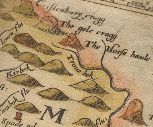 Sax9NY67.jpg "Trout bek" County boundary. item:- private collection : 2 Image © see bottom of page |
|
|
|
||
| evidence:- | old map:- Burghley 1590 (facsimile) placename:- Troute Beck |
|
| source data:- | Facsimile map, A Platt of the Opposete Border of Scotland to ye West Marches of England,
parts of Cumberland and Scotland including the Debateable Land, from a manuscript
drawn for William Cecil, Lord Burghley, about 1590, published by R B Armstrong, 1897. courtesy of the National Library of Scotland 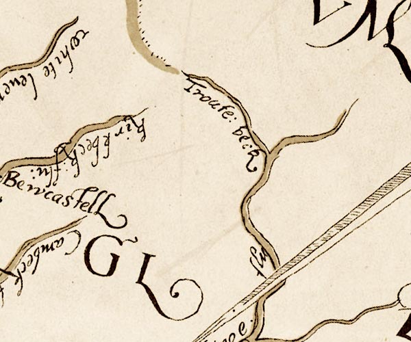 M048NY67.jpg "Troute beck" river item:- National Library of Scotland : MS6113 f.267 Image © National Library of Scotland |
|
|
|
||
| evidence:- | possibly old map:- Mercator 1595 (edn?) placename:- Trout Bek |
|
| source data:- | Map, hand coloured engraving, Northumbria, Cumberlandia, et
Dunelmensis Episcopatus, ie Northumberland, Cumberland and
Durham etc, scale about 6.5 miles to 1 inch, by Gerard Mercator,
Duisberg, Germany, about 1595. MER8CumA.jpg "Trout bek" double line with stream lines; rivet item:- JandMN : 169 Image © see bottom of page |
|
|
|
||
| evidence:- | old map:- Speed 1611 (Cmd) placename:- Trout Beck |
|
| source data:- | Map, hand coloured engraving, Cumberland and the Ancient Citie
Carlile Described, scale about 4 miles to 1 inch, by John Speed,
1610, published by J Sudbury and George Humble, Popes Head
Alley, London, 1611-12.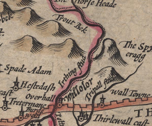 SP11NY67.jpg "Trout Beck" double line with stream lines; county boundary item:- private collection : 16 Image © see bottom of page |
|
|
|
||
| evidence:- | probably old map:- Jansson 1646 placename:- Trout Bek |
|
| source data:- | Map, hand coloured engraving, Cumbria and Westmoria, ie
Cumberland and Westmorland, scale about 3.5 miles to 1 inch, by
John Jansson, Amsterdam, Netherlands, 1646.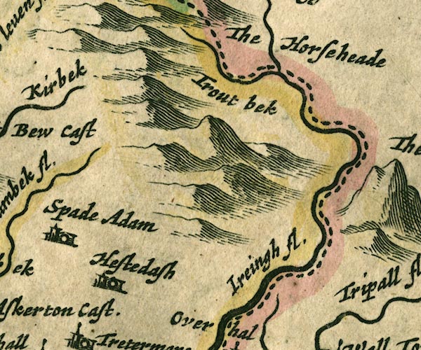 JAN3NY67.jpg "Trout bek" Single wiggly line; county boundary. item:- JandMN : 88 Image © see bottom of page |
|
|
|
||
| evidence:- | old map:- Morden 1695 (Cmd) placename:- Trout Beck River |
|
| source data:- | Map, uncoloured engraving, Cumberland, scale about 4 miles to 1
inch, by Robert Morden, 1695, published by Abel Swale, the
Unicorn, St Paul's Churchyard, Awnsham, and John Churchill, the
Black Swan, Paternoster Row, London, 1695-1715.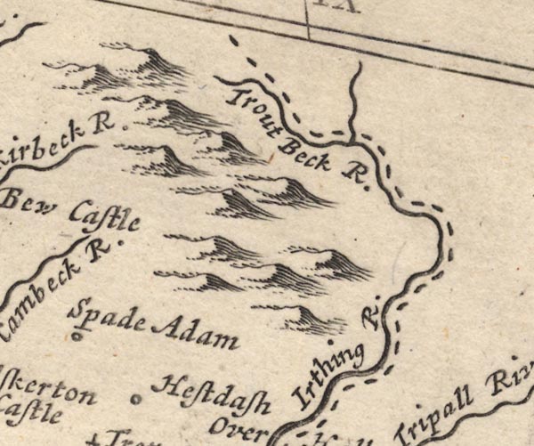 MD12NY67.jpg "Trout Beck R." With the county boundary drawn alongside. item:- JandMN : 90 Image © see bottom of page |
|
|
|
||
| evidence:- | old map:- Bowen and Kitchin 1760 placename:- Tornbeck River |
|
| source data:- | Map, hand coloured engraving, A New Map of the Counties of
Cumberland and Westmoreland Divided into their Respective Wards,
scale about 4 miles to 1 inch, by Emanuel Bowen and Thomas
Kitchin et al, published by T Bowles, Robert Sayer, and John
Bowles, London, 1760.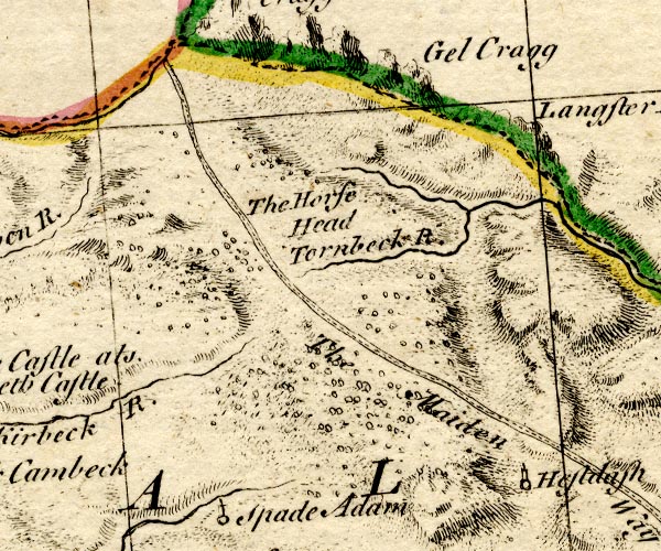 BO18NY67.jpg "Tornbeck R." wiggly line item:- Armitt Library : 2008.14.10 Image © see bottom of page |
|
|
|
||
Lakes Guides menu.