 Old Cumbria Gazetteer
 |
 |
|
| Fort Putnam, Dacre | ||
| Fort Putnam | ||
| civil parish:- | Dacre (formerly Cumberland) | |
| county:- | Cumbria | |
| locality type:- | buildings | |
| locality type:- | folly | |
| coordinates:- | NY45193094 | |
| 1Km square:- | NY4530 | |
| 10Km square:- | NY43 | |
|
|
||
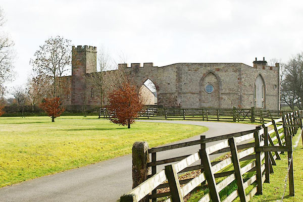 BQG02.jpg (taken 14.3.2009) 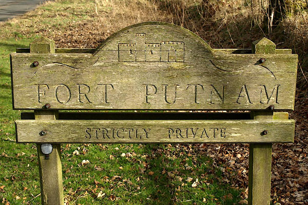 BQG03.jpg (taken 14.3.2009) |
||
|
|
||
| evidence:- | old map:- OS County Series (Cmd 58 2) placename:- Fort Putnam |
|
| source data:- | Maps, County Series maps of Great Britain, scales 6 and 25
inches to 1 mile, published by the Ordnance Survey, Southampton,
Hampshire, from about 1863 to 1948. |
|
|
|
||
| evidence:- | database:- Listed Buildings 2010 placename:- Fort Putnam item:- date stone (1892) |
|
| source data:- | courtesy of English Heritage "FORT PUTNAM FARMHOUSE, BARNS, BYRES, COW HOUSE, WALL AND GATEWAY / / / DACRE / EDEN / CUMBRIA / II[star] / 73778 / NY4519730940" |
|
|
|
||
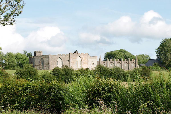 BRC74.jpg (taken 20.7.2009) |
||
|
|
||
| hearsay:- |
Named after General Israel 'Puffing' Putnam. |
|
|
|
||
 Lakes Guides menu.