 Old Cumbria Gazetteer
 |
 |
|
| Forest Hall, Fawcett Forest | ||
| Forest Hall | ||
| civil parish:- | Fawcett Forest (formerly Westmorland) | |
| county:- | Cumbria | |
| locality type:- | buildings | |
| coordinates:- | NY54810126 | |
| 1Km square:- | NY5401 | |
| 10Km square:- | NY50 | |
|
|
||
| evidence:- | old map:- OS County Series (Wmd 28 13) placename:- Forest Hall |
|
| source data:- | Maps, County Series maps of Great Britain, scales 6 and 25
inches to 1 mile, published by the Ordnance Survey, Southampton,
Hampshire, from about 1863 to 1948. |
|
|
|
||
| evidence:- | probably old map:- Saxton 1579 placename:- Fawsetwood |
|
| source data:- | Map, hand coloured engraving, Westmorlandiae et Cumberlandiae Comitatus ie Westmorland
and Cumberland, scale about 5 miles to 1 inch, by Christopher Saxton, London, engraved
by Augustinus Ryther, 1576, published 1579-1645.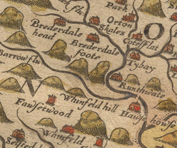 Sax9NY50.jpg Tower, symbol for a house, hall, tower, etc. "Fawsetwood" item:- private collection : 2 Image © see bottom of page |
|
|
|
||
| evidence:- | old map:- Jenner 1643 placename:- Fawsetwood |
|
| source data:- | Table of distances, with map, hand coloured engraving,
Westmerland ie Westmorland, scale about 16 miles to 1 inch,
engraved by Jacob van Langeren, published by Thomas Jenner,
Cornhill, London, 1643.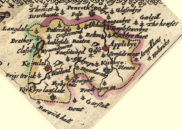 JEN3Sq.jpg "Fawsetwood" dot, circle, tower item:- private collection : 52.Wmd Image © see bottom of page |
|
|
|
||
| evidence:- | old map:- Jansson 1646 placename:- Fawsetwood |
|
| source data:- | Map, hand coloured engraving, Cumbria and Westmoria, ie
Cumberland and Westmorland, scale about 3.5 miles to 1 inch, by
John Jansson, Amsterdam, Netherlands, 1646.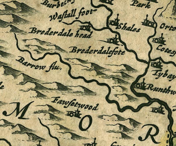 JAN3NY50.jpg "Fawsetwood" Buildings and tower. item:- JandMN : 88 Image © see bottom of page |
|
|
|
||
| evidence:- | old map:- Morden 1695 (Wmd) placename:- Fawsetwood |
|
| source data:- | Map, hand coloured engraving, Westmorland, scale about 2.5 miles to 1 inch, by Robert
Morden, published by Abel Swale, the Unicorn, St Paul's Churchyard, Awnsham, and John
Churchill, the Black Swan, Paternoster Row, London, 1695.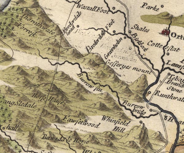 MD10NY50.jpg "Fawsetwood" Circle. item:- JandMN : 24 Image © see bottom of page |
|
|
|
||
| evidence:- | old map:- Garnett 1850s-60s H placename:- Forest Hall |
|
| source data:- | Map of the English Lakes, in Cumberland, Westmorland and
Lancashire, scale about 3.5 miles to 1 inch, published by John
Garnett, Windermere, Westmorland, 1850s-60s.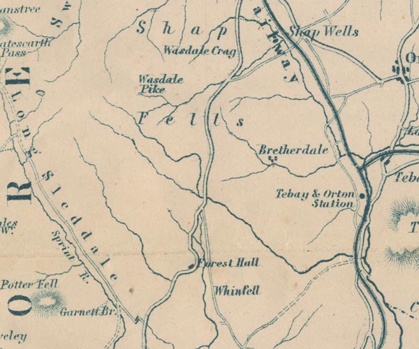 GAR2NY50.jpg "Forest Hall" block, building item:- JandMN : 82.1 Image © see bottom of page |
|
|
|
||
 Lakes Guides menu.