 Old Cumbria Gazetteer
 |
 |
|
| Farleton Fell, Beetham | ||
| Farleton Fell | ||
| civil parish:- | Beetham (formerly Westmorland) | |
| county:- | Cumbria | |
| locality type:- | hill | |
| locality type:- | fell | |
| coordinates:- | SD54308065 (etc) | |
| 1Km square:- | SD5480 | |
| 10Km square:- | SD58 | |
|
|
||
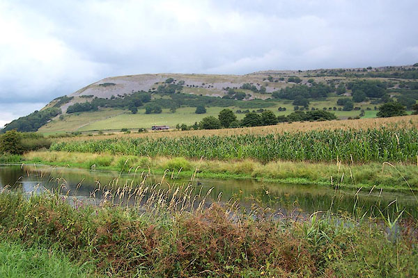 BJS24.jpg From the west. (taken 12.8.2005) |
||
|
|
||
| evidence:- | old map:- OS County Series (Wmd 47 1) placename:- Farleton Fell |
|
| source data:- | Maps, County Series maps of Great Britain, scales 6 and 25
inches to 1 mile, published by the Ordnance Survey, Southampton,
Hampshire, from about 1863 to 1948. OS County Series (Wmd 47 5) |
|
|
|
||
| evidence:- | old map:- Jefferys 1770 (Wmd) |
|
| source data:- | Map, 4 sheets, The County of Westmoreland, scale 1 inch to 1
mile, surveyed 1768, and engraved and published by Thomas
Jefferys, London, 1770.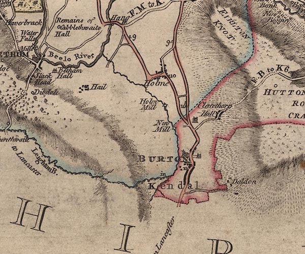 J5SD57NW.jpg hill hachuring; hill or mountain, the knott labelled at the N item:- National Library of Scotland : EME.s.47 Image © National Library of Scotland |
|
|
|
||
| evidence:- | probably descriptive text:- Baker 1802 |
|
| source data:- | Perspective road map with sections in Lancashire, Westmorland,
and Cumberland, by J Baker, London 1802. pp.25-26:- "... On leaving it [Burton], to the right of the road, may be observed a tremendous barren rock near 600 feet above the common level of the road. ..." |
|
|
|
||
| evidence:- | old map:- Otley 1818 placename:- Faralton |
|
| source data:- | Map, uncoloured engraving, The District of the Lakes,
Cumberland, Westmorland, and Lancashire, scale about 4 miles to
1 inch, by Jonathan Otley, 1818, engraved by J and G Menzies,
Edinburgh, Scotland, published by Jonathan Otley, Keswick,
Cumberland, et al, 1833.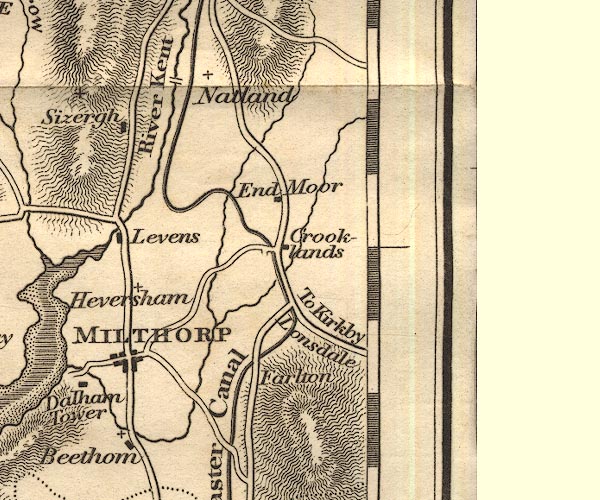 OT02SD58.jpg item:- JandMN : 48.1 Image © see bottom of page |
|
|
|
||
 Lakes Guides menu.