 Old Cumbria Gazetteer
 |
 |
|
| Far Douk Cave, North Yorkshire | ||
| Far Douk Cave | ||
| county:- | North Yorkshire | |
| locality type:- | cave | |
| locality type:- | pothole (?) | |
| coordinates:- | SD746768 | |
| 1Km square:- | SD7476 | |
| 10Km square:- | SD77 | |
| references:- | Balderston c1890 |
|
|
|
||
| evidence:- | descriptive text:- Balderston c1890 placename:- Far Douk Cave |
|
| source data:- | Book, Ingleton, Bygone and Present, by Robert R and Margaret
Balderston, published by Simpkin, Marshall and Co, London, and
by Edmndson and Co, 24 High Street, Skipton, Yorkshire, about
1890. goto source goto sourcepage 43:- "..." "Far Douk Cave." "A short distance to the south-west of Douk Hole Dell is a kind of narrow pot-hole, into which a small stream runs at its eastern, or shallower end. The western extremity is considerably deeper, and ends in a small cave of engulfment, for the stream disappears by this passage, the descent to which is somewhat difficult." |
|
|
|
||
| evidence:- | old map:- Balderston c1890 map placename:- Far Douk |
|
| source data:- | Map, the hills in the Ingleton area, probably by Robert R
Balderston, engraved by Goodall and Suddick, Leeds, West
Yorkshire, about 1890.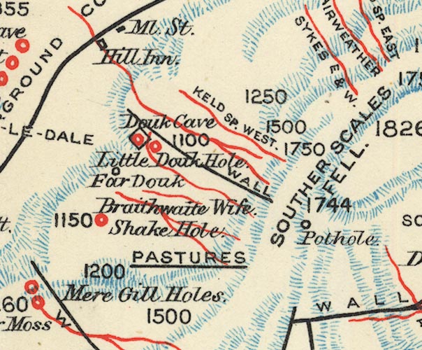 BS1SD77N.jpg "Far Douk" item:- private collection : 27.1 Image © see bottom of page |
|
|
|
||
Lakes Guides menu.