 Old Cumbria Gazetteer
 |
 |
|
| Elmhow, Grisedale | ||
| Elmhow | ||
| locality:- | Grisedale | |
| civil parish:- | Patterdale (formerly Westmorland) | |
| county:- | Cumbria | |
| locality type:- | buildings | |
| coordinates:- | NY37251506 | |
| 1Km square:- | NY3715 | |
| 10Km square:- | NY31 | |
|
|
||
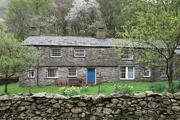 CAO83.jpg (taken 29.4.2014) |
||
|
|
||
| evidence:- | old map:- OS County Series (Wmd 12 14) placename:- Elmhow |
|
| source data:- | Maps, County Series maps of Great Britain, scales 6 and 25
inches to 1 mile, published by the Ordnance Survey, Southampton,
Hampshire, from about 1863 to 1948. |
|
|
|
||
| evidence:- | database:- Listed Buildings 2010 placename:- Elmhow |
|
| source data:- | courtesy of English Heritage "ELMHOW WITH ATTACHED CART SHEDS / / / PATTERDALE / EDEN / CUMBRIA / II / 452388 / NY3727415060" |
|
|
|
||
 Lakes Guides menu.