 Old Cumbria Gazetteer
 |
 |
|
| Eagle Crag Mine, Grisedale | ||
| Eagle Crag Mine | ||
| site name:- | Eagle Crag | |
| site name:- | Grisedale | |
| civil parish:- | Patterdale (formerly Westmorland) | |
| county:- | Cumbria | |
| locality type:- | lead mine | |
| locality type:- | mine | |
| coordinates:- | NY358142 | |
| 1Km square:- | NY3514 | |
| 10Km square:- | NY31 | |
| references:- | Adams, John: 1988: Mines of the Lake District Fells: Dalesman Books (Lancaster, Lancashire)::
ISBN 0 85206 931 6 |
|
|
|
||
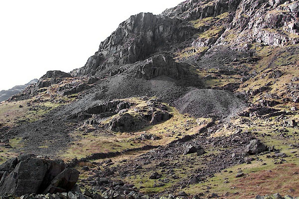 BQH02.jpg (taken 17.3.2009) 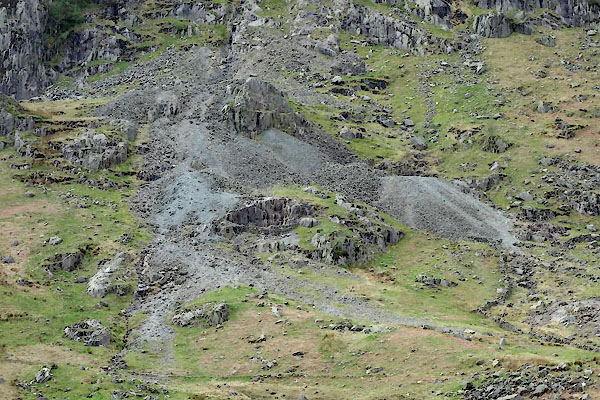 CAO34.jpg (taken 29.4.2014) 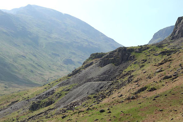 CAO35.jpg (taken 29.4.2014) |
||
|
|
||
| evidence:- | old text:- Postlethwaite 1877 (3rd edn 1913) placename:- Eagle Crag Mine item:- lead ore |
|
| source data:- | Book, Mines and Mining in the English Lake District, by John Postlethwaite, Keswick,
published by W H Moss and Sons, Whitehaven, Cumberland now Cumbria, 1877; published
1877-1913. goto source goto sourcepage 127:- "MYER HEAD, HARTSOP HALL, AND EAGLE CRAG MINES." "These mines are situated in glens, which branch off from the Patterdale Valley. ... Eagle Crag, on the north-western side, and at the upper end of Grisdale Glen. They have been wrought chiefly by means of adit levels, which pierce the sides of the mountains at various elevations. Extensive excavations have been made above and between these levels and considerable quantities of lead ore raised." |
|
|
|
||
| evidence:- | old map:- Postlethwaite 1877 (3rd edn 1913) placename:- Eagle Crag Mine |
|
| source data:- | Map, uncoloured engraving, Map of the Lake District Mining Field, Westmorland, Cumberland,
Lancashire, scale about 5 miles to 1 inch, by John Postlethwaite, published by W H
Moss and Sons, 13 Lowther Street, Whitehaven, Cumberland, 1877 edn 1913.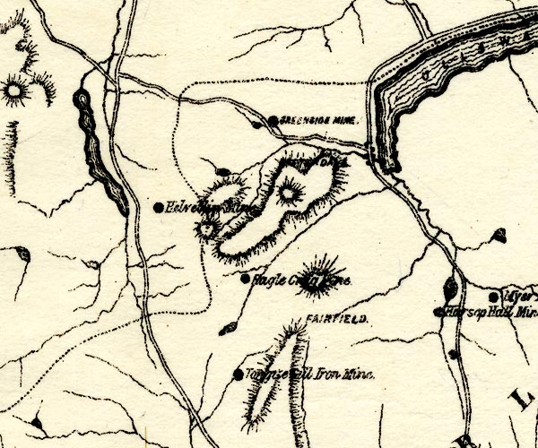 PST2NY31.jpg "Eagle Crag Mine" mine symbol item:- JandMN : 162.2 Image © see bottom of page |
|
|
|
||
| evidence:- | visit log:- KDMRS 1979-82 placename:- Eagle Crag Mines item:- galena; copper pyrites; cerrusite; pyromorphite; azurite |
|
| source data:- | Notes, log book of Geological Outings, mine plans, etc, Kendal
and District Mine Research Society, Kendal area, Cumbria, etc,
visits made 1979-82. Geological Outing of the Kendal and District Mine Research Society Log book page 91:- "DATE - 7/6/81. / MAP REF - (NY31) 3540/1365. / LOCATION - EAGLE CRAG / NAME - EAGLE CRAG MINES. / TYPE OF SITE - MINES / WORKING OR DISUSED - DISUSED / PEOPLE IN PARTY [ ] / NOS. OF PHOTOS - 52 / SPECIMENS FOUND - GALENA, COPPER PYRITES CERRUSITE, AND SMALL AMOUNTS OF PYROMORPHITE &AZURITE / COMMENTS - WARM SHOWERY DAY. QUITE A FEW LEVELS LEFT OPEN , BUT, ARE EITHER BLOCKED AFTER A FEW YARDS OR ARE ONLY VERY SHORT TRIALS. ONE LEVEL IS APPROX 50YDS LONG, AND ENDS IN A ROCK WALL." item:- private collection : 82 Image © see bottom of page |
|
|
|
||
| :- |
Eagle Crag Vein and a branch called Clay Vein. |
|
| Probably dates from elizabethan times; lasted to 1880. |
||
| Adams, John: 1988: Mines of the Lake District Fells: Dalesman Books (Lancaster, Lancashire)::
ISBN 0 85206 931 6 |
||
|
|
||
Lakes Guides menu.