 Old Cumbria Gazetteer
 |
 |
|
| Dillicar, Grayrigg | ||
| Dillicar | ||
| locality:- | Dillicar | |
| civil parish:- | Grayrigg (formerly Westmorland) | |
| county:- | Cumbria | |
| locality type:- | locality | |
| locality type:- | building/s (mostly gone) | |
| coordinates:- | SD61759820 (etc) | |
| 1Km square:- | SD6198 | |
| 10Km square:- | SD69 | |
| SummaryText:- | once a civil parish | |
|
|
||
| evidence:- | old map:- Saxton 1579 placename:- Delaken |
|
| source data:- | Map, hand coloured engraving, Westmorlandiae et Cumberlandiae Comitatus ie Westmorland
and Cumberland, scale about 5 miles to 1 inch, by Christopher Saxton, London, engraved
by Augustinus Ryther, 1576, published 1579-1645.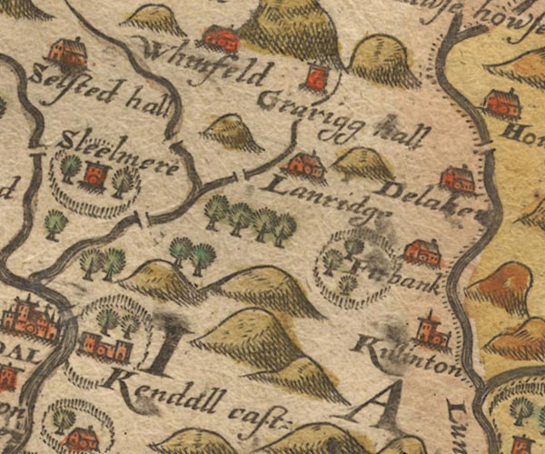 Sax9SD59.jpg Building, symbol for a hamlet, which may or may not have a nucleus. "Delake[n]" item:- private collection : 2 Image © see bottom of page |
|
|
|
||
| evidence:- | old map:- Speed 1611 (Wmd) placename:- Delake |
|
| source data:- | Map, hand coloured engraving, The Countie Westmorland and
Kendale the Cheif Towne, scale about 2.5 miles to 1 inch, by
John Speed, 1610, published by George Humble, Popes Head Alley,
London, 1611-12.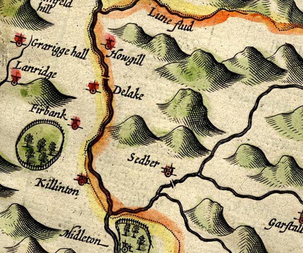 SP14SD69.jpg "Delake" circle, tower item:- Armitt Library : 2008.14.5 Image © see bottom of page |
|
|
|
||
| evidence:- | old map:- Jansson 1646 |
|
| source data:- | Map, hand coloured engraving, Cumbria and Westmoria, ie
Cumberland and Westmorland, scale about 3.5 miles to 1 inch, by
John Jansson, Amsterdam, Netherlands, 1646.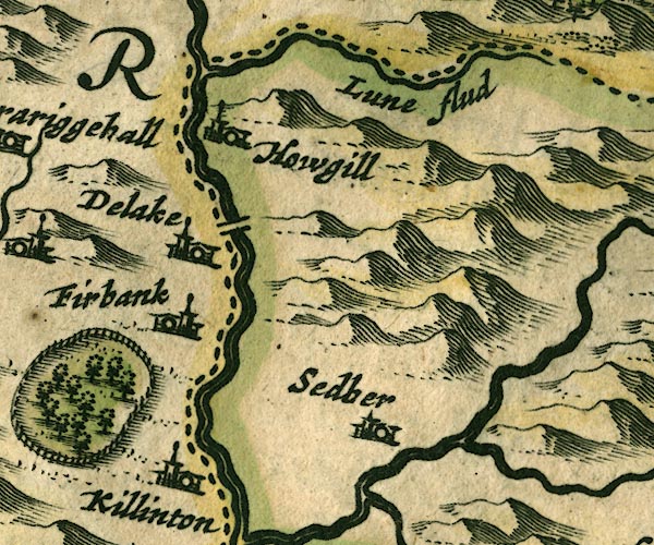 JAN3SD69.jpg Approximate 10Km square, plus overlaps. item:- JandMN : 88 Image © see bottom of page |
|
|
|
||
| evidence:- | hearth tax returns:- Hearth Tax 1675 placename:- Dillikar Constablewicke |
|
| source data:- | Records, hearth tax survey returns, Westmorland, 1674/75. "Dillikar Constablewicke" |
|
|
|
||
| evidence:- | hearth tax returns:- Hearth Tax 1670 placename:- Dilaker |
|
| source data:- | Records, hearth tax returns, exchequer duplicates, Westmorland,
1670. "Dilaker" |
|
|
|
||
| evidence:- | old map:- Morden 1695 (Wmd) placename:- Delake |
|
| source data:- | Map, hand coloured engraving, Westmorland, scale about 2.5 miles to 1 inch, by Robert
Morden, published by Abel Swale, the Unicorn, St Paul's Churchyard, Awnsham, and John
Churchill, the Black Swan, Paternoster Row, London, 1695.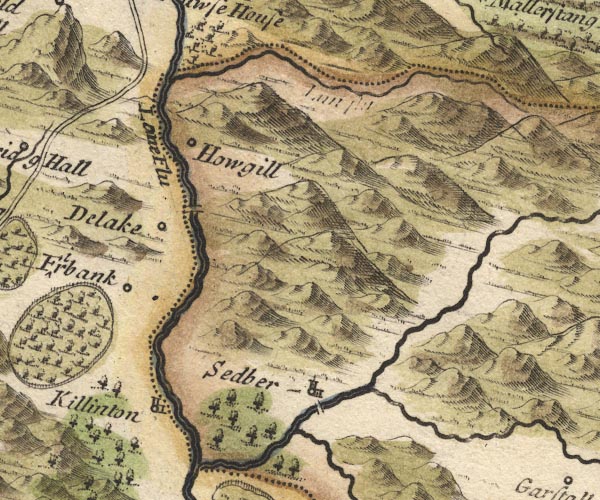 MD10SD69.jpg "Delake" Circle. item:- JandMN : 24 Image © see bottom of page |
|
|
|
||
| evidence:- | old map:- Bowen and Kitchin 1760 placename:- Dillaker |
|
| source data:- | Map, hand coloured engraving, A New Map of the Counties of
Cumberland and Westmoreland Divided into their Respective Wards,
scale about 4 miles to 1 inch, by Emanuel Bowen and Thomas
Kitchin et al, published by T Bowles, Robert Sayer, and John
Bowles, London, 1760.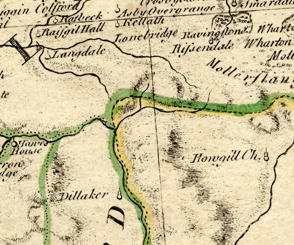 BO18NY60.jpg "Dillaker" circle, tower item:- Armitt Library : 2008.14.10 Image © see bottom of page |
|
|
|
||
| evidence:- | old map:- Jefferys 1770 (Wmd) placename:- Dilliker |
|
| source data:- | Map, 4 sheets, The County of Westmoreland, scale 1 inch to 1
mile, surveyed 1768, and engraved and published by Thomas
Jefferys, London, 1770.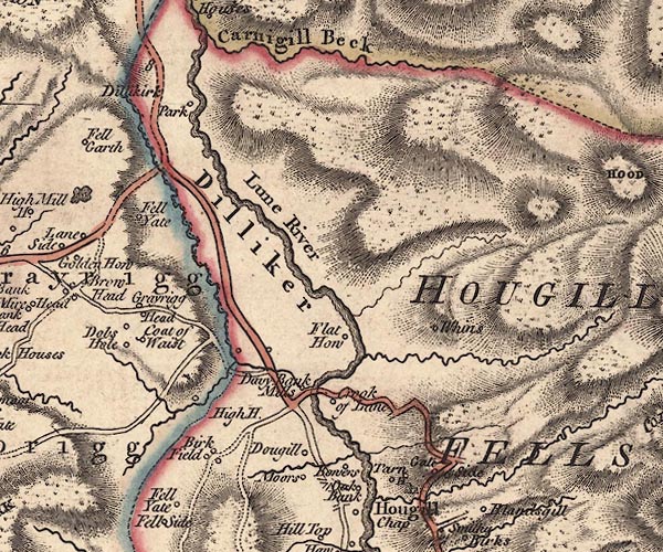 J5SD69NW.jpg "Dilliker" area item:- National Library of Scotland : EME.s.47 Image © National Library of Scotland |
|
|
|
||
 Lakes Guides menu.