 Old Cumbria Gazetteer
 |
 |
|
| Derwent Fells, Above Derwent | ||
| Derwent Fells | ||
| civil parish:- | Above Derwent (formerly Cumberland) | |
| county:- | Cumbria | |
| locality type:- | hill | |
| locality type:- | fell | |
| coordinates:- | NY21372695 (etc etc) | |
| 1Km square:- | NY2119 | |
| 10Km square:- | NY21 | |
|
|
||
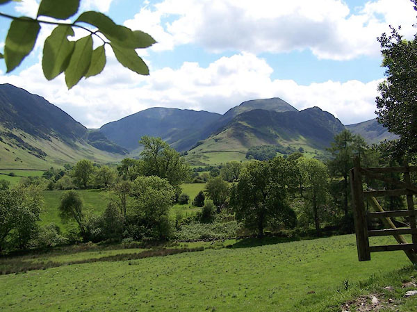 BJQ02.jpg (taken 10.6.2005) |
||
|
|
||
| evidence:- | old map:- OS County Series (Cmd 55 16) placename:- Derwent Fells |
|
| source data:- | Maps, County Series maps of Great Britain, scales 6 and 25
inches to 1 mile, published by the Ordnance Survey, Southampton,
Hampshire, from about 1863 to 1948. OS County Series (Cmd 69 4) |
|
|
|
||
| evidence:- | probably old map:- Ogilby 1675 (plate 96) |
|
| source data:- | Road strip map, hand coloured engraving, the Road from Kendal to
Cockermouth, and the Road from Egremond to Carlisle, scale about
1 inch to 1 mile, by John Ogilby, London, 1675.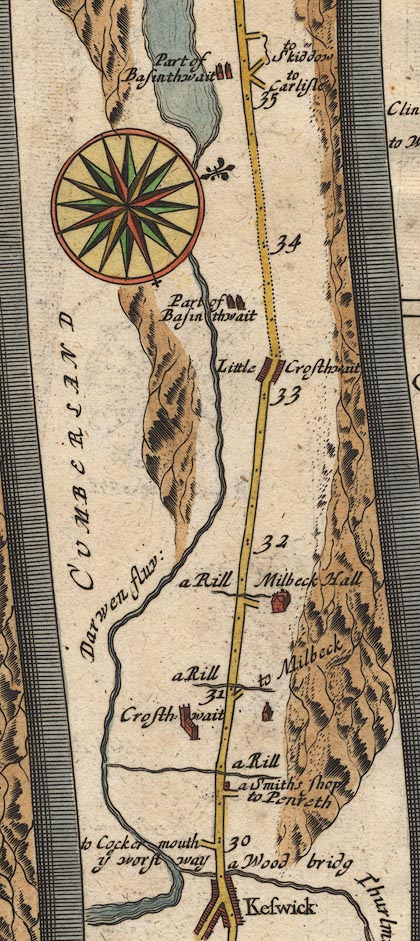 OG96m030.jpg In miles 32 to 33, Cumberland. Mountains to the left of the road. item:- JandMN : 22 Image © see bottom of page |
|
|
|
||
| evidence:- | descriptive text:- Defoe 1724-26 placename:- |
|
| source data:- | Tour through England and Wales, by Daniel Defoe, published in
parts, London, 1724-26. "... hills, call'd Derwent Fells, where the ancient copper mines were found in Queen Elizabeth's time, ..." |
|
|
|
||
| evidence:- | probably old map:- Gents Mag 1751 |
|
| source data:- | Map, uncoloured engraving, Map of the Black Lead Mines in
Cumberland, and area, scale about 2 miles to 1 inch, by George
Smith, published in the Gentleman's Magazine, 1751.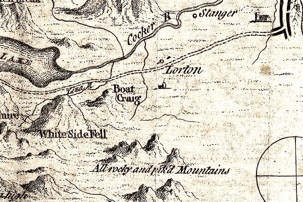 GM1307.jpg "All rocky and pik'd Mountains" knobbly hillocks; mountains item:- JandMN : 114 Image © see bottom of page |
|
|
|
||
| evidence:- | old map:- Bowen and Kitchin 1760 placename:- Darwent Fells Mountains |
|
| source data:- | Map, hand coloured engraving, A New Map of the Counties of
Cumberland and Westmoreland Divided into their Respective Wards,
scale about 4 miles to 1 inch, by Emanuel Bowen and Thomas
Kitchin et al, published by T Bowles, Robert Sayer, and John
Bowles, London, 1760. BO18NY10.jpg "Darwent Fells Mountains" hill hachuring item:- Armitt Library : 2008.14.10 Image © see bottom of page |
|
|
|
||
| evidence:- | old print:- Clarke 1787 placename:- Newlands Fells |
|
| source data:- | circles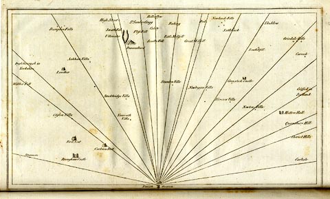 click to enlarge click to enlargeCL18.jpg "Newlands Fells" item:- Armitt Library : A6615.12 Image © see bottom of page |
|
|
|
||
| evidence:- | old text:- Camden 1789 placename:- Derwentfels |
|
| source data:- | Book, Britannia, or A Chorographical Description of the Flourishing Kingdoms of England,
Scotland, and Ireland, by William Camden, 1586, translated from the 1607 Latin edition
by Richard Gough, published London, 1789. goto source goto sourcePage 170:- "..." "... [The Derwent] winds among the hills called Derwentfels, ..." |
|
|
|
||
| evidence:- | old photograph:- Bell 1880s-1940s |
|
| source data:- | Photograph, black and white, Derwent Water and Derwent Fells, Above Derwent, Cumberland,
by Herbert Bell, photographer, Ambleside, Westmorland, 1890s.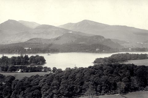 click to enlarge click to enlargeHB0931.jpg internegative at lower left:- "H. Bell" item:- Armitt Library : ALPS608 Image © see bottom of page |
|
|
|
||
| evidence:- | old photograph:- Bell 1880s-1940s |
|
| source data:- | Photograph, black and white, Derwent Water and Derwent Fells, Above Derwent, Cumberland,
by Herbert Bell, photographer, Ambleside, Westmorland, 1890s.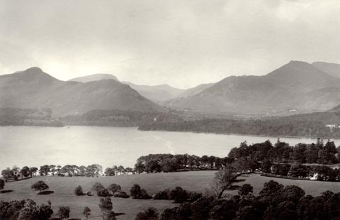 click to enlarge click to enlargeHB0932.jpg item:- Armitt Library : ALPS609 Image © see bottom of page |
|
|
|
||
Lakes Guides menu.