 |
 |
   |
|
|
|
|
| locality:- |
Dentdale |
| civil parish:- |
Dent (formerly Yorkshire) |
| county:- |
Cumbria |
| locality type:- |
buildings |
| coordinates:- |
SD705871 |
| 1Km square:- |
SD7087 |
| 10Km square:- |
SD78 |
|
|
|
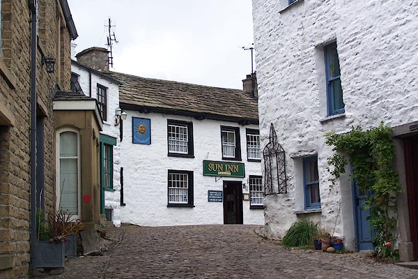
BJW22.jpg And the Sun Inn.
(taken 23.9.2005)
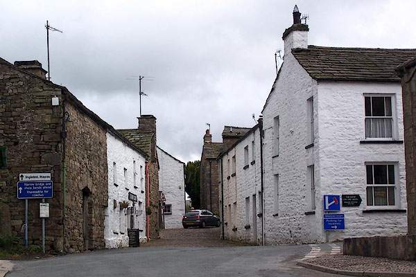
BJW23.jpg (taken 23.9.2005)
|
|
|
| evidence:- |
old map:- Saxton 1579
placename:- Dent
|
| source data:- |
Map, hand coloured engraving, Westmorlandiae et Cumberlandiae Comitatus ie Westmorland
and Cumberland, scale about 5 miles to 1 inch, by Christopher Saxton, London, engraved
by Augustinus Ryther, 1576, published 1579-1645.
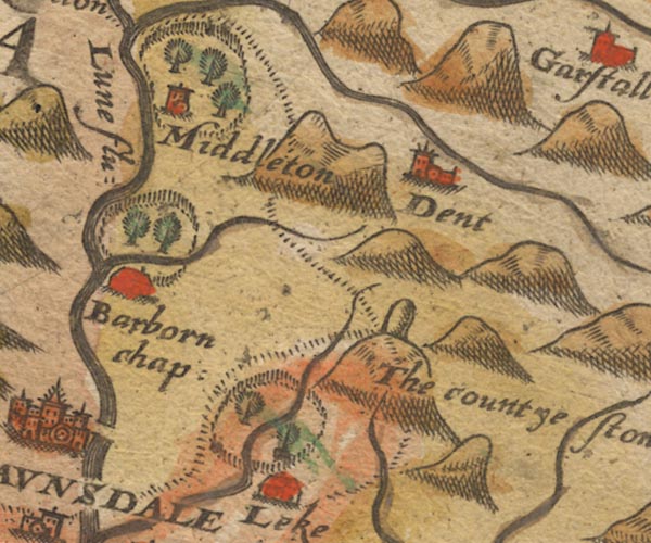
Sax9SD68.jpg
Church, symbol for a parish or village, with a parish church. "dent"
item:- private collection : 2
Image © see bottom of page
|
|
|
| evidence:- |
old map:- Mercator 1595 (edn?)
placename:- Dent
|
| source data:- |
Map, hand coloured engraving, Westmorlandia, Lancastria, Cestria
etc, ie Westmorland, Lancashire, Cheshire etc, scale about 10.5
miles to 1 inch, by Gerard Mercator, Duisberg, Germany, 1595,
edition 1613-16.

MER5WmdA.jpg
"Dent"
circle
item:- Armitt Library : 2008.14.3
Image © see bottom of page
|
|
|
| evidence:- |
old map:- Keer 1605
placename:- Dent
|
| source data:- |
Map, hand coloured engraving, Westmorland and Cumberland, scale
about 16 miles to 1 inch, probably by Pieter van den Keere, or
Peter Keer, about 1605 edition perhaps 1676.
 click to enlarge click to enlarge
KER8.jpg
"Dent"
dot, circle and tower; village
item:- Dove Cottage : 2007.38.110
Image © see bottom of page
|
|
|
| evidence:- |
old map:- Speed 1611 (Wmd)
placename:- Dent
|
| source data:- |
Map, hand coloured engraving, The Countie Westmorland and
Kendale the Cheif Towne, scale about 2.5 miles to 1 inch, by
John Speed, 1610, published by George Humble, Popes Head Alley,
London, 1611-12.
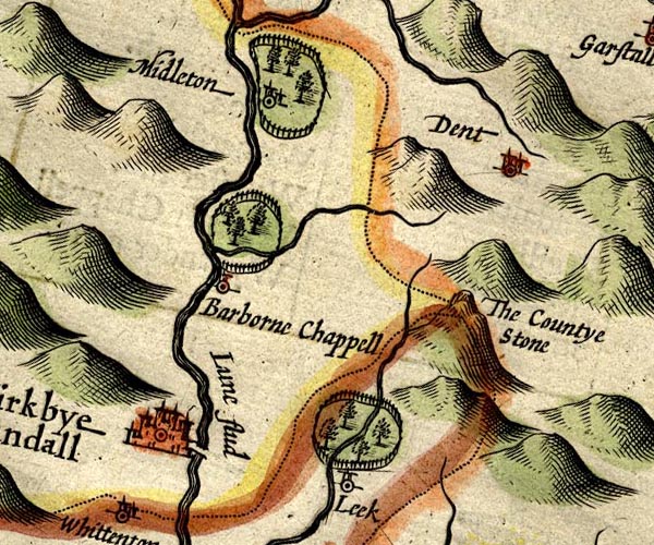
SP14SD68.jpg
"Dent"
circle, towers
item:- Armitt Library : 2008.14.5
Image © see bottom of page
|
|
|
| evidence:- |
old map:- Jansson 1646
placename:- Dent
|
| source data:- |
Map, hand coloured engraving, Cumbria and Westmoria, ie
Cumberland and Westmorland, scale about 3.5 miles to 1 inch, by
John Jansson, Amsterdam, Netherlands, 1646.
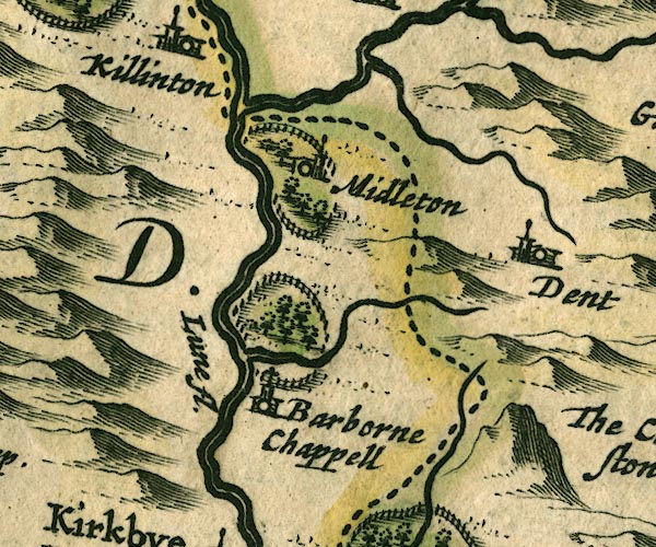
JAN3SD68.jpg
"Dent"
Buildings and tower.
item:- JandMN : 88
Image © see bottom of page
|
|
|
| evidence:- |
old map:- Morden 1695 (Wmd)
placename:- Dent
|
| source data:- |
Map, hand coloured engraving, Westmorland, scale about 2.5 miles to 1 inch, by Robert
Morden, published by Abel Swale, the Unicorn, St Paul's Churchyard, Awnsham, and John
Churchill, the Black Swan, Paternoster Row, London, 1695.
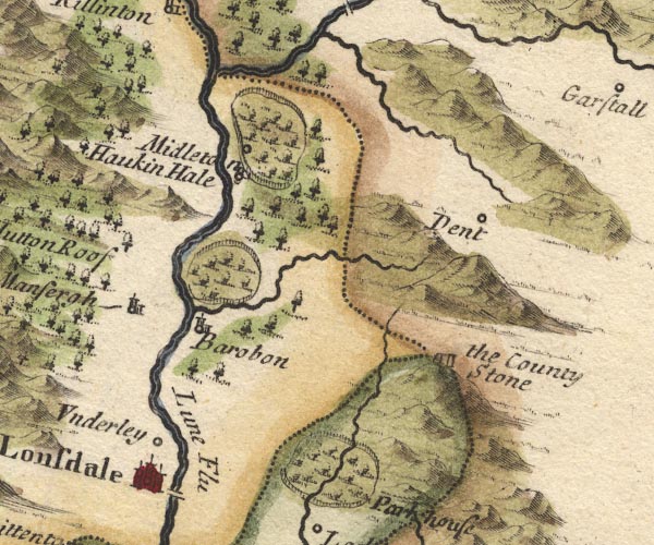
MD10SD68.jpg
"Dent"
Circle.
item:- JandMN : 24
Image © see bottom of page
|
|
|
| evidence:- |
old map:- Badeslade 1742
placename:- Dent
|
| source data:- |
Map, hand coloured engraving, A Map of Yorkshire North from
London, scale about 24 miles to 1 inch, with descriptive text,
by Thomas Badeslade, London, engraved and published by William
Henry Toms, Union Court, Holborn, London, 1742.
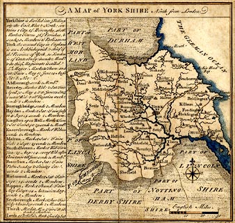 click to enlarge click to enlarge
BD16.jpg
"Dent"
circle, tower/s, upright lowercase text; town
item:- private collection : 162
Image © see bottom of page
|
|
|
| evidence:- |
old map:- Simpson 1746 map (Wmd)
placename:- Dent
|
| source data:- |
Map, uncoloured engraving, Westmorland, scale about 8 miles to 1
inch, printed by R Walker, Fleet Lane, London, 1746.
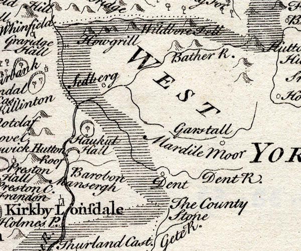
SMP2SDU.jpg
"Dent"
Circle.
item:- Dove Cottage : 2007.38.59
Image © see bottom of page
|
|
|
| evidence:- |
old map:- Pennant 1777
placename:- Dent
|
| source data:- |
Map, hand coloured engraving, A Map of Scotland, Hebrides and
Part of England, drawn for Thomas Pennant, engraved by J Bayly,
published by Benjamin White, London, 1777.
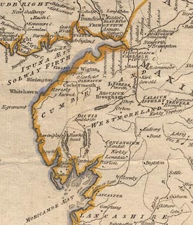 click to enlarge click to enlarge
PEN1Cm.jpg
"Dent"
circle; buildings, village, etc
item:- private collection : 66
Image © see bottom of page
|
|
|
| evidence:- |
old map:- Cooke 1802
placename:- Dent
|
| source data:- |
Map, West Riding of Yorkshire, ie West Yorkshire, scale about 21
miles to 1 inch, by George Cooke, 1802, bound in Gray's New Book
of Roads, 1824, published by Sherwood, Jones and Co, Paternoster
Road, London, 1824.
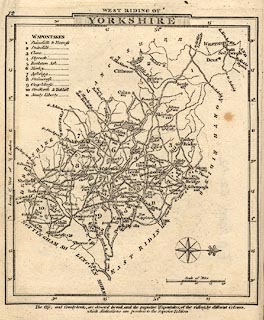 click to enlarge click to enlarge
GRA1Wy.jpg
"Dent"
blocks, italic lowercase text, village, hamlet, locality
item:- Hampshire Museums : FA2000.62.12
Image © see bottom of page
|
|
|
| evidence:- |
old map:- Ford 1839 map
placename:- Dent
|
| source data:- |
Map, uncoloured engraving, Map of the Lake District of
Cumberland, Westmoreland and Lancashire, scale about 3.5 miles
to 1 inch, published by Charles Thurnam, Carlisle, and by R
Groombridge, 5 Paternoster Row, London, 3rd edn 1843.
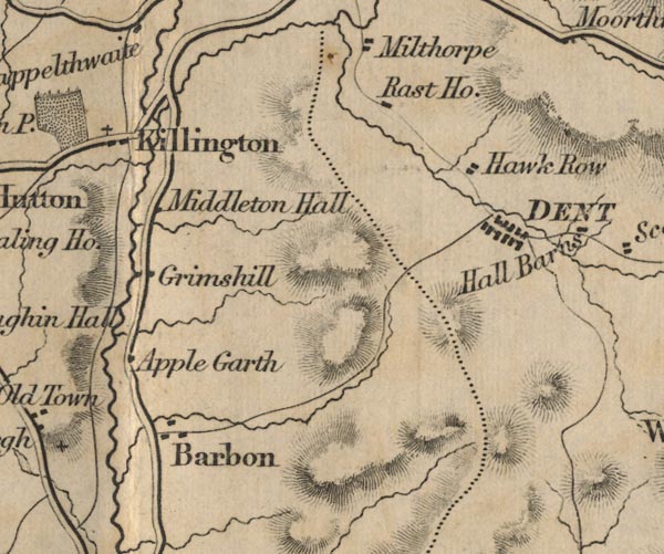
FD02SD68.jpg
"DENT"
item:- JandMN : 100.1
Image © see bottom of page
|
|
|
| evidence:- |
old map:- Post Office 1850s-1900s
placename:- Dent
|
| source data:- |
Post road maps, General Post Office Circulation Map for England
and Wales, for the General Post Office, London, 1850s-1900s.
 click to enlarge click to enlarge
PF10Cm.jpg
"Dent"
map date 1892
|
|
|
| evidence:- |
old map:- Post Office 1850s-1900s
placename:- Dent
|
| source data:- |
Post road maps, General Post Office Circulation Map for England
and Wales, for the General Post Office, London, 1850s-1900s.
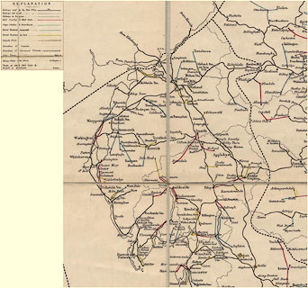 click to enlarge click to enlarge
POF2Cm.jpg
"Dent"
map date 1890
|
|
|
| evidence:- |
old map:- Post Office 1850s-1900s
placename:- Dent
|
| source data:- |
Post road maps, General Post Office Circulation Map for England
and Wales, for the General Post Office, London, 1850s-1900s.
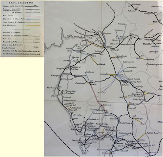 click to enlarge click to enlarge
POF8Cm.jpg
"Dent"
map date 1873
|
|
|
:-
|
images courtesy of the British Postal Museum and Hampshire CC Museums
|
|
|
| evidence:- |
old print:- Clark and Hughes 1890
placename:- Dent
|
| source data:- |
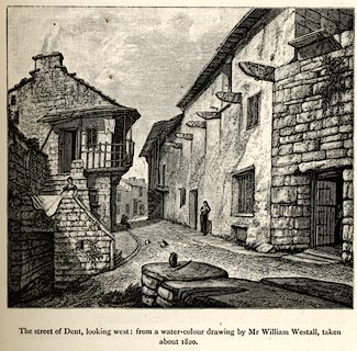
Print, Dent, engraving, the street looking west, from a watercolour painting by William
Westall, about 1820, published by Cambridge University Press, Cambridge, Cambridgeshire,
1890.
 click to enlarge click to enlarge
CH0203.jpg
On vol.1 p.15 of The Life and Letters of the Reverend Adam Sedgwick.
item:- private collection : 195.4
Image © see bottom of page
|
|
|
| evidence:- |
old print:- Clark and Hughes 1890
placename:- Dent
|
| source data:- |
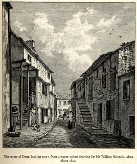
Print, engraving, Dent, the street looking east, from a watercolour painting by William
Westall, about 1820, published by Cambridge University Press, Cambridge, Cambridgeshire,
1890.
 click to enlarge click to enlarge
CH0202.jpg
On vol.1 p.13 of The Life and Letters of the Reverend Adam Sedgwick.
item:- private collection : 195.3
Image © see bottom of page
|
|
|
| evidence:- |
old print:-
placename:- Dent
|
| source data:- |
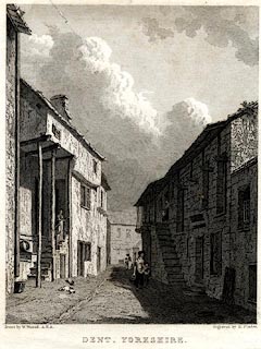
Print, uncoloured engraving, Dent, Yorkshire, now in Cumbria, drawn by W Westall,
engraved by E Finden, published 1800s?
 click to enlarge click to enlarge
PR0557.jpg
Streetscene.
printed at bottom left, right, centre:- "Drawn by W. Westall, A.R.A. / Engraved by E. Finden. / DENT, YORKSHIRE."
item:- Dove Cottage : 2008.107.506
Image © see bottom of page
|
|
|
|
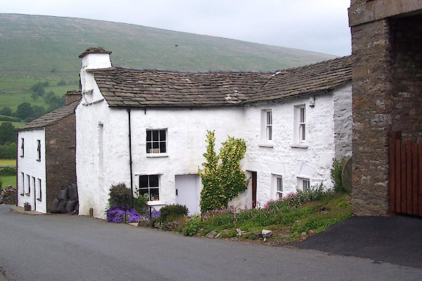
BMG74.jpg Cottage.
(taken 16.6.2006)
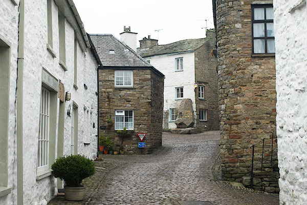
BPX05.jpg (taken 9.1.2009)
|
|
|
|
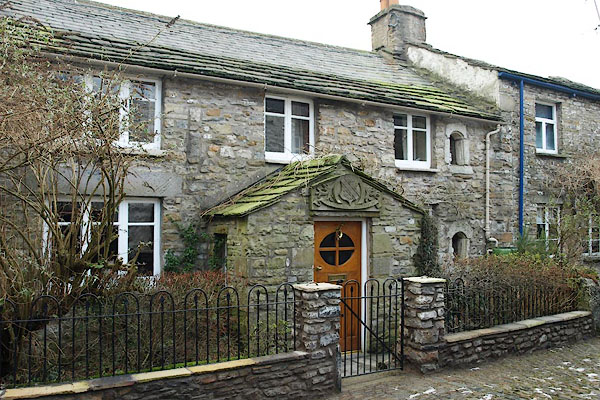
BPX03.jpg Strait End, 2 Queen Square, built 1708.
(taken 9.1.2009)
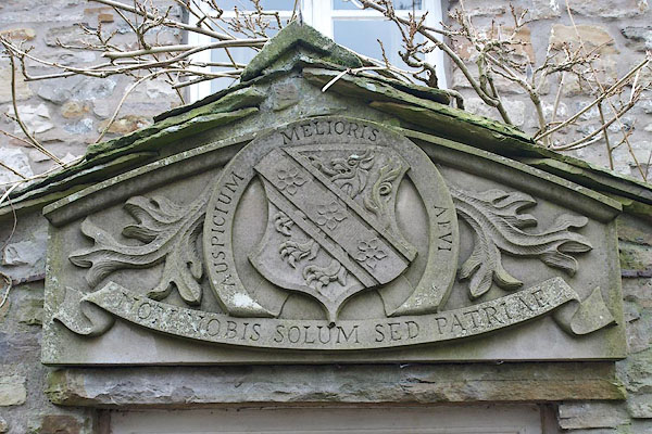
BPX04.jpg Coat of arms mounted on the porch, 2 Queen Square; Fawcett Family from Bradford, not
the local family of Dent.
(taken 9.1.2009)
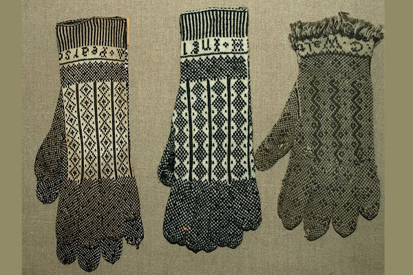
BSF67.jpg Knitted gloves from Dent; the pair on the right knitted by George Walton, Deepdale,
1846.
courtesy of the Wordsworth Trust
|
|
|
notes:-
|
The town and area was famous for its hand knitters, the Terrible Knitters of Dent;
terribly fast knitting. Men and women knitted, sometimes while walking in the fields,
sometimes sitting and chatting. They used a knitting sheath tucked in the belt to
hold one of the needles, these are sometime decoratively carved.
|
|
|
notes:-
|
An advertisement:-
|
|
"RUN AWAY, / From Dent in Yorkshire, on Monday the 28th of Aug last. / THOMAS ANSON,
a Negro Man, about five Feet six Iinches High, aged 20 Years or upwards, and broad
set. Whoever will bring the said Man back to dent, or give any Information that he
may be had again, shall receive a handsome Reward from mr. Edmund Sill of Dent, or
Mr. David Kenyon Merchant in Liverpool."
|
|
|


 click to enlarge


 click to enlarge
 click to enlarge
 click to enlarge
 click to enlarge
 click to enlarge
 click to enlarge
 click to enlarge
 click to enlarge
 click to enlarge


 Lakes Guides menu.