 Old Cumbria Gazetteer
 |
 |
|
| Dearham Bridge Station, Crosscanonby | ||
| Dearham Bridge Station | ||
| Dearham Station | ||
| site name:- | Maryport and Carlisle Railway | |
| civil parish:- | Crosscanonby (formerly Cumberland) | |
| county:- | Cumbria | |
| locality type:- | railway station | |
| coordinates:- | NY07043727 | |
| 1Km square:- | NY0737 | |
| 10Km square:- | NY03 | |
| SummaryText:- | Opened as Dearham Station 1842; renamed Dearham Bridge 1867; closed 1950. | |
|
|
||
| evidence:- | old map:- OS County Series (Cmd 45 2) placename:- Dearham Station |
|
| source data:- | Maps, County Series maps of Great Britain, scales 6 and 25
inches to 1 mile, published by the Ordnance Survey, Southampton,
Hampshire, from about 1863 to 1948.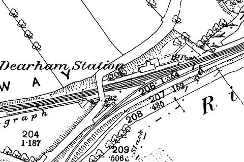 click to enlarge click to enlargeCSRY0056.jpg "Dearham Station" and the junction of a long industrial line |
|
|
|
||
| evidence:- | probably old map:- Garnett 1850s-60s H |
|
| source data:- | Map of the English Lakes, in Cumberland, Westmorland and
Lancashire, scale about 3.5 miles to 1 inch, published by John
Garnett, Windermere, Westmorland, 1850s-60s.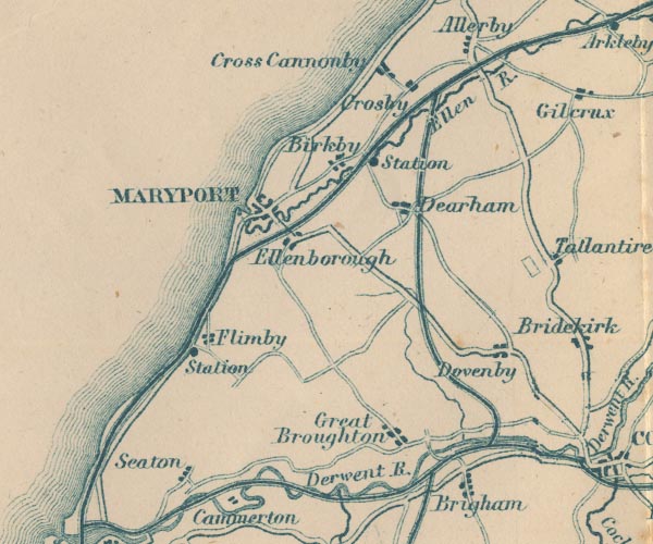 GAR2NY03.jpg "Station" dot by railway item:- JandMN : 82.1 Image © see bottom of page |
|
|
|
||
| hearsay:- |
Branch lines here served Lowther Pit, Lonsdale Pit, Nelson Pit on Broughton Moor,
Bertha Pit, etc. |
|
|
|
||
 Lakes Guides menu.