 |
 |
   |
|
|
|
Cumrew Fell |
| civil parish:- |
Cumrew (formerly Cumberland) |
| county:- |
Cumbria |
| locality type:- |
hill |
| locality type:- |
fell |
| coordinates:- |
NY56585173 (etc etc) |
| 1Km square:- |
NY5651 |
| 10Km square:- |
NY55 |
|
|
| evidence:- |
old map:- OS County Series (Cmd 25 14)
placename:- Cumrew Fell
|
| source data:- |
Maps, County Series maps of Great Britain, scales 6 and 25
inches to 1 mile, published by the Ordnance Survey, Southampton,
Hampshire, from about 1863 to 1948.
|
|
|
| evidence:- |
old text:- Pennant 1773
item:- cairn
|
| source data:- |
Book, A Tour from Downing to Alston Moor, 1773, by Thomas
Pennant, published by Edward Harding, 98 Pall Mall, London, 1801.
 goto source goto source
Pennant's Tour 1773, page 186 "... I went next through Cumrew, at the foot of its fells, on the top of which appeared two cairns."
|
|
|
| evidence:- |
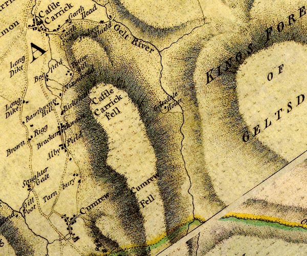
old map:- Donald 1774 (Cmd)
placename:- Cumrew Fell
|
| source data:- |
Map, hand coloured engraving, 3x2 sheets, The County of Cumberland, scale about 1
inch to 1 mile, by Thomas Donald, engraved and published by Joseph Hodskinson, 29
Arundel Street, Strand, London, 1774.

D4NY55SE.jpg
"Cumrew Fell"
hill hachuring; a hill or mountain
item:- Carlisle Library : Map 2
Image © Carlisle Library |
|
|
| evidence:- |
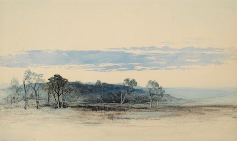
perhaps old painting:-
|
| source data:- |
Painting, watercolour, Cumrew, East Fellside, Cumberland, by William James Blacklock,
1850-58?
 click to enlarge click to enlarge
PR0948.jpg
This watercolour is a view facing west of Cumrew, East Fellside on the edge of the
Pennines in northern Cumbria; not far from his family home at Cumwhitton. Foreground
consists of moorland scattered with birch trees in front of a drystone wall. Beyond
this can be seen to left of composition a low stone cottage. Beyond are shadowy distant
fells of the Eden Valley and the northern fells of the Lake District in the far distance.
A fine example of a Blacklock watercolour painted on the spot.
item:- Tullie House Museum : 1946.67.16
Image © Tullie House Museum |
|
|


 goto source
 click to enlarge