 Old Cumbria Gazetteer
 |
 |
|
| Cumcrook, Stapleton | ||
| Cumcrook | ||
| civil parish:- | Stapleton (formerly Cumberland) | |
| county:- | Cumbria | |
| locality type:- | buildings | |
| coordinates:- | NY50317499 | |
| 1Km square:- | NY5074 | |
| 10Km square:- | NY57 | |
|
|
||
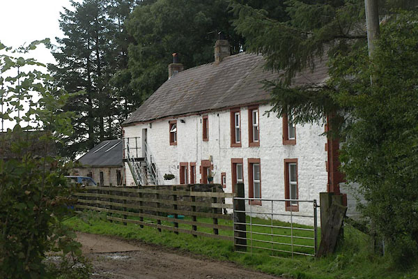 BZJ93.jpg (taken 27.9.2013) |
||
|
|
||
| evidence:- | perhaps old map:- OS County Series (Cmd 7 4) placename:- Cumcrook |
|
| source data:- | Maps, County Series maps of Great Britain, scales 6 and 25
inches to 1 mile, published by the Ordnance Survey, Southampton,
Hampshire, from about 1863 to 1948. |
|
|
|
||
| evidence:- | old map:- Burghley 1590 (facsimile) placename:- Comcrook |
|
| source data:- | Facsimile map, A Platt of the Opposete Border of Scotland to ye West Marches of England,
parts of Cumberland and Scotland including the Debateable Land, from a manuscript
drawn for William Cecil, Lord Burghley, about 1590, published by R B Armstrong, 1897. courtesy of the National Library of Scotland 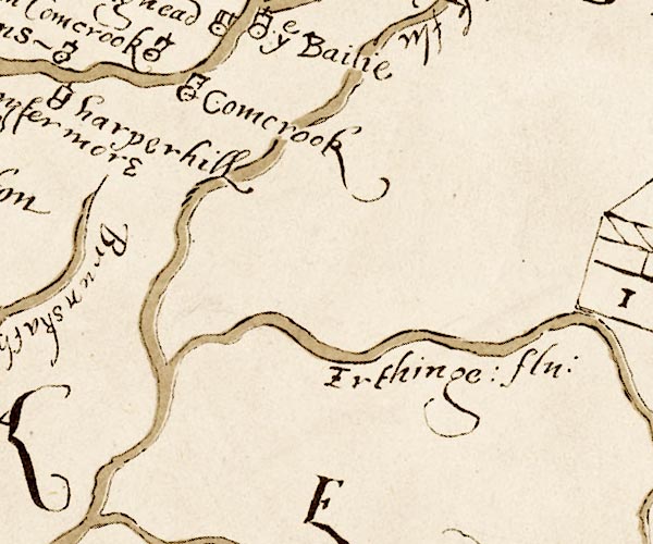 M048NY56.jpg "Comcrook" circle, tower item:- National Library of Scotland : MS6113 f.267 Image © National Library of Scotland |
|
|
|
||
| evidence:- | old map:- Donald 1774 (Cmd) placename:- Cumcrook |
|
| source data:- | Map, hand coloured engraving, 3x2 sheets, The County of Cumberland, scale about 1
inch to 1 mile, by Thomas Donald, engraved and published by Joseph Hodskinson, 29
Arundel Street, Strand, London, 1774.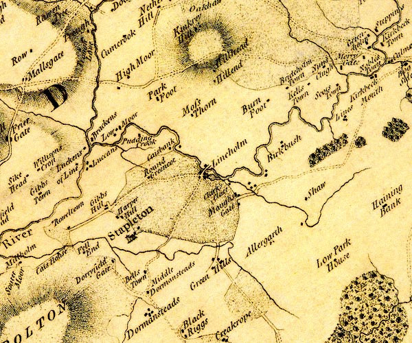 D4NY57SW.jpg "Cumcrook" block or blocks, labelled in lowercase; a hamlet or just a house item:- Carlisle Library : Map 2 Image © Carlisle Library |
|
|
|
||
| evidence:- | database:- Listed Buildings 2010 placename:- Cumcrook item:- date stone (1685) |
|
| source data:- | courtesy of English Heritage "CUMCROOK AND ADJOING BARN / / / STAPLETON / CARLISLE / CUMBRIA / II / 78168 / NY5031574996" |
|
|
|
||
| notes:- |
Tower or stone house site |
|
| Perriam, D R &Robinson, J: 1998: Medieval Fortified Buildings of Cumbria: CWAAS::
ISBN 1 873124 23 6 |
||
|
|
||
 Lakes Guides menu.