 Old Cumbria Gazetteer
 |
 |
|
| Crooklands, Preston Richard | ||
| Crooklands | ||
| civil parish:- | Preston Richard (formerly Westmorland) | |
| civil parish:- | Preston Patrick (formerly Westmorland) | |
| county:- | Cumbria | |
| locality type:- | buildings | |
| locality type:- | locality | |
| coordinates:- | SD53428367 (etc) | |
| 1Km square:- | SD5383 | |
| 10Km square:- | SD58 | |
|
|
||
| evidence:- | old map:- OS County Series (Wmd 43 9) placename:- Crooklands |
|
| source data:- | Maps, County Series maps of Great Britain, scales 6 and 25
inches to 1 mile, published by the Ordnance Survey, Southampton,
Hampshire, from about 1863 to 1948. |
|
|
|
||
| evidence:- | old map:- Jefferys 1770 (Wmd) placename:- Crooklands |
|
| source data:- | Map, 4 sheets, The County of Westmoreland, scale 1 inch to 1
mile, surveyed 1768, and engraved and published by Thomas
Jefferys, London, 1770.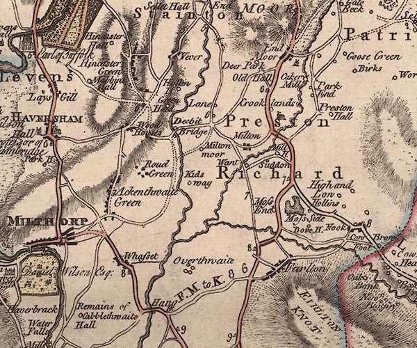 J5SD58SW.jpg "Crooklands" circle, labelled in italic lowercase text; settlement, farm, house, or hamlet? item:- National Library of Scotland : EME.s.47 Image © National Library of Scotland |
|
|
|
||
| evidence:- | old map:- West 1784 map placename:- Crooklands |
|
| source data:- | Map, hand coloured engraving, A Map of the Lakes in Cumberland,
Westmorland and Lancashire, scale about 3.5 miles to 1 inch,
engraved by Paas, 53 Holborn, London, about 1784.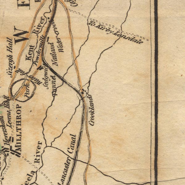 Ws02SD58.jpg item:- Armitt Library : A1221.1 Image © see bottom of page |
|
|
|
||
| evidence:- | old map:- Baker 1802 placename:- Crooklands |
|
| source data:- | Perspective road maps with sections in Lancashire, Westmorland
and Cumberland, by J Baker, London 1802. Bk03Vg17.jpg "Crooklands" item:- private collection : 3 Image © see bottom of page |
|
|
|
||
| evidence:- | old map:- Otley 1818 placename:- Crooklands |
|
| source data:- | Map, uncoloured engraving, The District of the Lakes,
Cumberland, Westmorland, and Lancashire, scale about 4 miles to
1 inch, by Jonathan Otley, 1818, engraved by J and G Menzies,
Edinburgh, Scotland, published by Jonathan Otley, Keswick,
Cumberland, et al, 1833.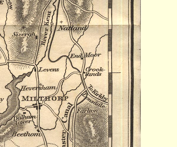 OT02SD58.jpg item:- JandMN : 48.1 Image © see bottom of page |
|
|
|
||
| evidence:- | old map:- Post Office 1807 placename:- Crookland |
|
| source data:- | Post road map, engraving with manuscript details, General Post
Office Circulation Map for England and Wales, The Circulation of
Letters to and from ... 1807, prepared by J Tucker, for the Post
Office, London, 19 May 1807.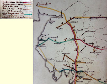 click to enlarge click to enlargePOF3Cm.jpg "Crookland" map date 1807 |
|
|
|
||
| :- |
images courtesy of the British Postal Museum and Hampshire CC Museums |
|
|
|
||
 Lakes Guides menu.