Old Cumbria Gazetteer
 |
 |
|
||
| Crookabeck, Patterdale | ||||
| Crookabeck | ||||
| Crookey Cottage | ||||
| Crookbeck Farm | ||||
| locality:- | Patterdale | |||
| civil parish:- | Patterdale (formerly Westmorland) | |||
| county:- | Cumbria | |||
| locality type:- | locality | |||
| locality type:- | buildings | |||
| coordinates:- | NY40151555 (etc) | |||
| 1Km square:- | NY4015 | |||
| 10Km square:- | NY41 | |||
|
|
||||
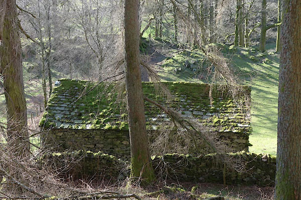
 CAB90.jpg (taken 10.3.2014) |
||||
|
|
||||
| evidence:- | old map:- OS County Series (Wmd 12 15) placename:- Crookedbeck |
|||
| source data:- | Maps, County Series maps of Great Britain, scales 6 and 25
inches to 1 mile, published by the Ordnance Survey, Southampton,
Hampshire, from about 1863 to 1948. |
|||
|
|
||||
| evidence:- | old map:- Jefferys 1770 (Wmd) placename:- Crooksbeck |
|||
| source data:- | Map, 4 sheets, The County of Westmoreland, scale 1 inch to 1
mile, surveyed 1768, and engraved and published by Thomas
Jefferys, London, 1770.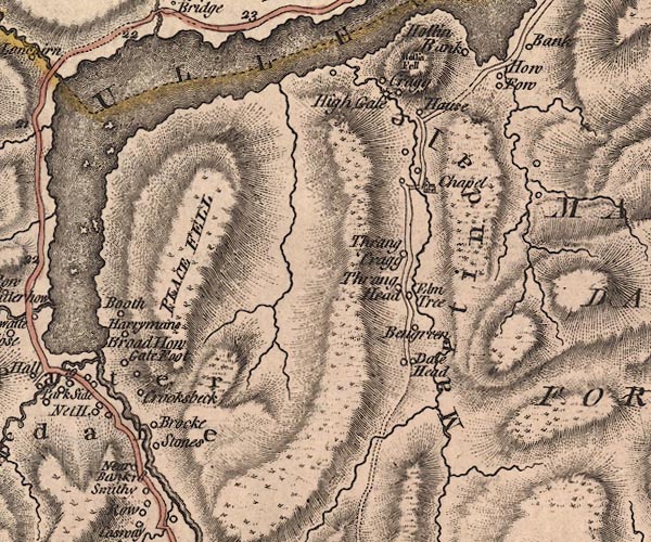 J5NY41NW.jpg "Crooksbeck" circle, labelled in italic lowercase text; settlement, farm, house, or hamlet? item:- National Library of Scotland : EME.s.47 Image © National Library of Scotland |
|||
|
|
||||
| evidence:- | old map:- Cary 1789 (edn 1805) placename:- Gookbed |
|||
| source data:- | Map, uncoloured engraving, Westmoreland, scale about 2.5 miles
to 1 inch, by John Cary, London, 1789; edition 1805.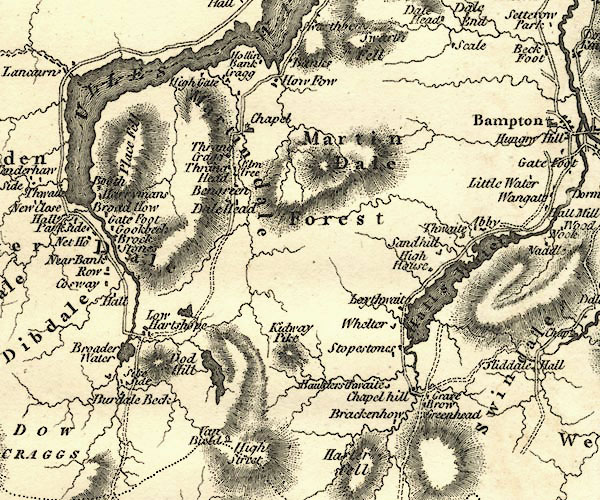 CY24NY41.jpg "Gookbed" block/s, labelled in italic lowercase; house, or hamlet item:- JandMN : 129 Image © see bottom of page |
|||
|
|
||||
| evidence:- | old print:- Green 1809 placename:- Crooka Bridge |
|||
| source data:- | Print, soft ground etching, Crooka Bridge, now Crookbeck Farm, Patterdale, Westmorland,
by William Green, published by William Green, Ambleside, Westmorland, and Longman,
Hurst, Rees and Orme, Paternoster Row, London, 1809. click to enlarge click to enlargeGN0330.jpg Plate 30 in Seventy Eight Studies from Nature. printed in introductory pages to set of prints:- "Number 30. Crooka Bridge is scarcely a mile from the Inn at Patterdale; it lies under Place Fell, on the opposite side of the river to the road from Patterdale to Ambleside." printed at bottom:- "CROOKA BRIDGE. / Published Ambleside, Augst. 1st. 1809, by W. Green." item:- Armitt Library : A6637.30 Image © see bottom of page |
|||
|
|
||||
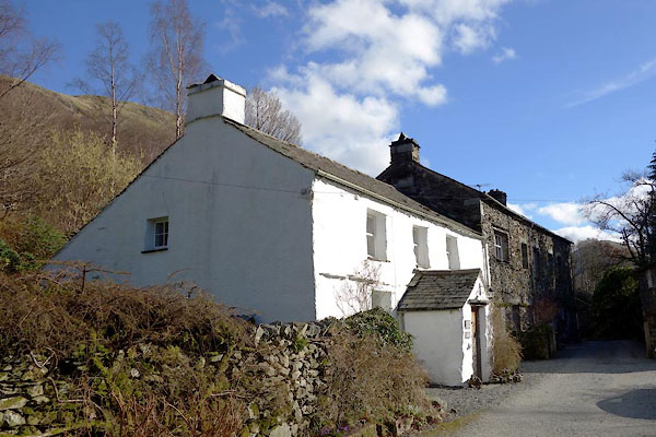
| evidence:- | database:- Listed Buildings 2010 placename:- Crookbeck Farm |
|||
| source data:- | courtesy of English Heritage "CROOKBECK FARMHOUSE / / / PATTERDALE / EDEN / CUMBRIA / II / 452408 / NY4014915571" |
|||
|
|
||||
| places:- |
|
|||
|
||||
 Lakes Guides menu.