 Old Cumbria Gazetteer
 |
 |
|
| Cracoe, Barton | ||
| Cracoe | ||
| Cracoe Close | ||
| civil parish:- | Barton (formerly Westmorland) | |
| county:- | Cumbria | |
| locality type:- | buildings | |
| coordinates:- | NY47742486 | |
| 1Km square:- | NY4724 | |
| 10Km square:- | NY42 | |
|
|
||
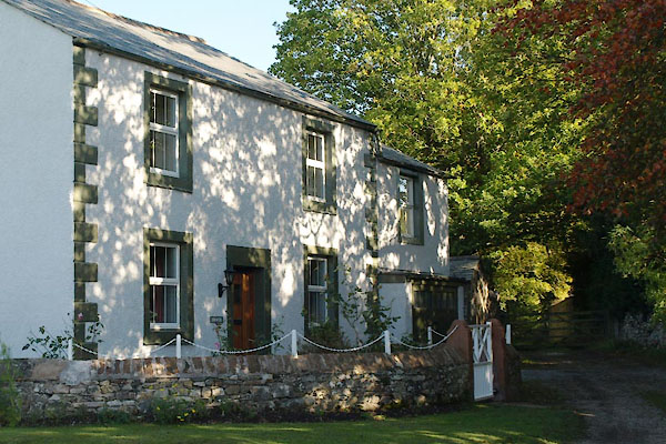 BTR88.jpg (taken 20.10.2010) 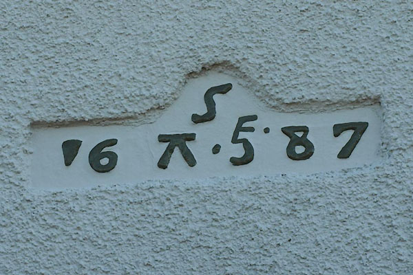 BTR89.jpg Date stone, in lowercase Greek:- "ς / 16 π ξ87" (taken 20.10.2010) |
||
|
|
||
| evidence:- | old map:- OS County Series (Wmd 7 6) placename:- Cracoe |
|
| source data:- | Maps, County Series maps of Great Britain, scales 6 and 25
inches to 1 mile, published by the Ordnance Survey, Southampton,
Hampshire, from about 1863 to 1948. |
|
|
|
||
| hearsay:- |
The two houses were school houses to Barton school. |
|
|
|
||
 Lakes Guides menu.