 |
 |
   |
|
|
|
Cow Pot |
| locality:- |
Casterton Fell |
| civil parish:- |
Casterton (formerly Westmorland) |
| county:- |
Cumbria |
| locality type:- |
cave |
| coordinates:- |
SD66438085 |
| 1Km square:- |
SD6680 |
| 10Km square:- |
SD68 |
| altitude:- |
1000 feet |
| altitude:- |
305m |
| SummaryText:- |
Explored by Yorkshire Ramblers Club, 1899; further by Northern Pennine Club, 1948;
and British Speleological Association, 1969. |
| SummaryText:- |
Grade IV; permission from Council of Northern Caving Clubs. |
| references:- |
Brook, D & Davies, G & Long, M H &Sutcliffe, J R: 1975: Northern Caves, vol.4 Whernside
and Gragareth: Dalesman Books:: ISBN 0 85206 259 1
|
|
|
| evidence:- |
old map:- OS County Series (Wmd 48 2)
placename:- Cow Hole
|
| source data:- |
Maps, County Series maps of Great Britain, scales 6 and 25
inches to 1 mile, published by the Ordnance Survey, Southampton,
Hampshire, from about 1863 to 1948.
|
|
|
| evidence:- |
descriptive text:- Balderston c1890
placename:- Cow Pot
|
| source data:- |
Book, Ingleton, Bygone and Present, by Robert R and Margaret
Balderston, published by Simpkin, Marshall and Co, London, and
by Edmndson and Co, 24 High Street, Skipton, Yorkshire, about
1890.
 goto source goto source
page 74:- "..."
"Cow Pot."
"Only about a couple of fields' breadths to the east of Bull Pot in the course of a
diminutive stream is a peculiar zig-zag sided rift called Cow Pot, into which the
brook descends as a fall for thirty feet, with a second leap of"
 goto source goto source
page 75:- "twenty more, and a third not easily descried beyond; the full depth at the lower end
being seventy-seven feet. The character of the rock work is beautiful, and exquisite
ferns deck the crevices."
|
|
|
| evidence:- |
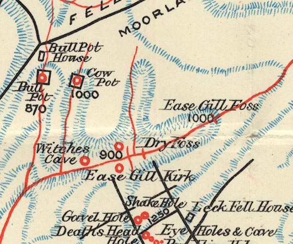
old map:- Balderston c1890 map
placename:- Cow Pot
|
| source data:- |
Map, the hills in the Ingleton area, probably by Robert R
Balderston, engraved by Goodall and Suddick, Leeds, West
Yorkshire, about 1890.

BS1SD68Q.jpg
"Cow Pot"
item:- private collection : 27.1
Image © see bottom of page
|
|
|


 goto source
 goto source
