 Old Cumbria Gazetteer
 |
 |
|
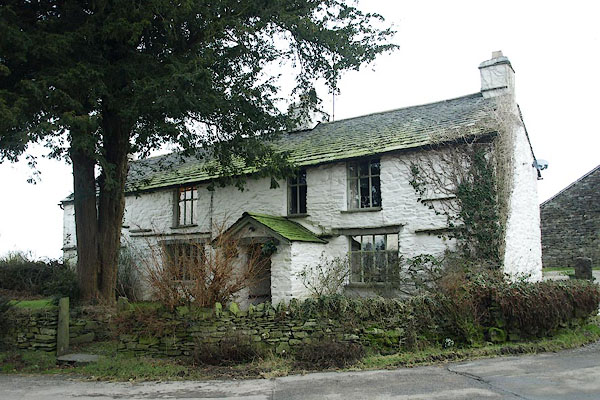
| Common Farm, Windermere | ||
| Common Farm | ||
| locality:- | Common, The | |
| civil parish:- | Windermere (formerly Westmorland) | |
| county:- | Cumbria | |
| locality type:- | buildings | |
| coordinates:- | SD42209957 | |
| 1Km square:- | SD4299 | |
| 10Km square:- | SD49 | |
| SummaryText:- | High and Low Common are now one? | |
|
|
||
 BQB41.jpg (taken 12.2.2009) 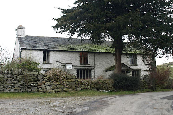 BQB42.jpg (taken 12.2.2009) |
||
|
|
||
| evidence:- | old map:- OS County Series (Wmd 32 8) placename:- High Common placename:- Common, High |
|
| source data:- | Maps, County Series maps of Great Britain, scales 6 and 25
inches to 1 mile, published by the Ordnance Survey, Southampton,
Hampshire, from about 1863 to 1948. |
|
|
|
||
| evidence:- | database:- Listed Buildings 2010 placename:- Common Farm |
|
| source data:- | courtesy of English Heritage "COMMON FARMHOUSE / / CHURCH STREET / WINDERMERE TOWN / SOUTH LAKELAND / CUMBRIA / II / 351666 / SD4219999582" |
|
|
|
||
| hearsay:- |
Low Common is part of the outbuildings to the north. |
|
| William Williamson, died here 1702, was a strict Quaker. He made provision for a school
at the meeting house in Mislet. |
||
| Margaret Williamson, widow of William, died 1721. Her will wanted no dispute:- |
||
| "... It is further my will and mind that if any of ye above-named legatees shall give
or attempt to give any trouble to my Executor, or be discontented with her or his
or their legacy or legacyes, That such person or persons shall have no benefit by
this my last Will; but that his, her or their Legacy or Legacyes shall be and remain
to the use of my Executor." |
||
| Palmer, J H & McIntire, W T (ed): 1945: Historic Farmhouses in and around Westmorland:
Westmorland Gazette (Kendal, Westmorland) |
||
|
|
||
 Lakes Guides menu.