 |
 |
   |
|
|
|
Cold Fell |
| civil parish:- |
St Bridget Beckermet (formerly Cumberland) |
| county:- |
Cumbria |
| locality type:- |
hill |
| locality type:- |
fell |
| coordinates:- |
NY05800923 |
| 1Km square:- |
NY0509 |
| 10Km square:- |
NY00 |
| altitude:- |
961 feet |
| altitude:- |
293m |
|
|
| evidence:- |
old map:- OS County Series (Cmd 73 9)
placename:- Cold Fell
|
| source data:- |
Maps, County Series maps of Great Britain, scales 6 and 25
inches to 1 mile, published by the Ordnance Survey, Southampton,
Hampshire, from about 1863 to 1948.
|
|
|
| evidence:- |
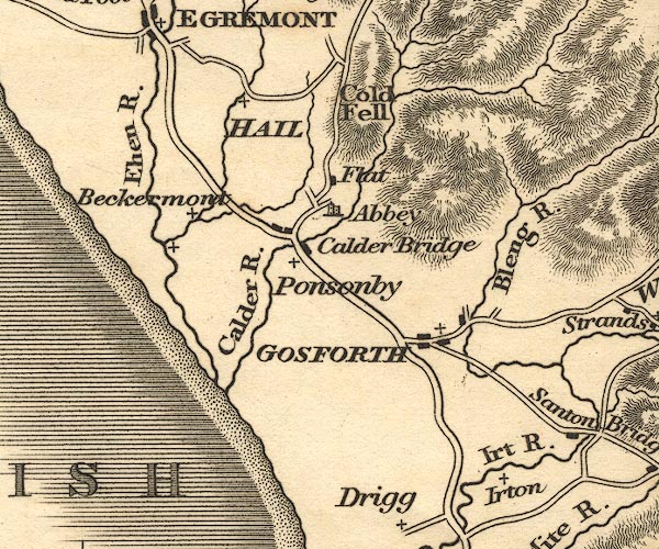
old map:- Otley 1818
placename:- Cold Fell
|
| source data:- |
Map, uncoloured engraving, The District of the Lakes,
Cumberland, Westmorland, and Lancashire, scale about 4 miles to
1 inch, by Jonathan Otley, 1818, engraved by J and G Menzies,
Edinburgh, Scotland, published by Jonathan Otley, Keswick,
Cumberland, et al, 1833.

OT02NY00.jpg
item:- JandMN : 48.1
Image © see bottom of page
|
|
|
| evidence:- |
old text:- Martineau 1855
item:- sheep
|
| source data:- |
Guide book, A Complete Guide to the English Lakes, by Harriet
Martineau, published by John Garnett, Windermere, Westmorland,
and by Whittaker and Co, London, 1855; published 1855-76.
 goto source goto source
Page 124:- "... up to Cold Fell. The drive over that fell is commonly called dreary; and it is
so in bad weather: but it has its charms. The sea-view is fine,- all flecked with
cloud shadows as with islands: and the wide down sprinkled with sheep, that look as
ragged as terriers, after tearing their fleeces with the furze and brambles with which
the swelling slopes are embossed. In a hollow, at rare intervals, stands a farm-house,
under the ordinary sycamore canopy; and far away, between the slopes of the down below,
the soil is cut up into fields, with woods hanging above; ..."
|
|
|


 goto source