 Old Cumbria Gazetteer
 |
 |
|
| Clints, Egremont | ||
| Clints | ||
| civil parish:- | Cleator Moor (formerly Cumberland) | |
| county:- | Cumbria | |
| locality type:- | hill | |
| coordinates:- | NY008123 (etc) | |
| 1Km square:- | NY0012 | |
| 10Km square:- | NY01 | |
| SummaryText:- | cf road called Clints Brow, and Clints Quarry, now a nature reserve. | |
|
|
||
| evidence:- | old map:- Ogilby 1675 (plate 96) placename:- Clint Hill |
|
| source data:- | Road strip map, hand coloured engraving, the Road from Kendal to
Cockermouth, and the Road from Egremond to Carlisle, scale about
1 inch to 1 mile, by John Ogilby, London, 1675.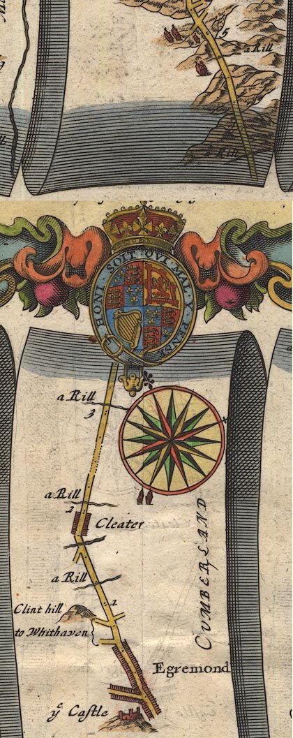 OG96Bm00.jpg In mile 0, Cumberland. "Clint hill" hillock on left of road. item:- JandMN : 22 Image © see bottom of page |
|
|
|
||
| evidence:- | old map:- Bowen 1720 (plate 261) placename:- Clint Hill |
|
| source data:- | Road strip map, uncoloured engraving, pl.261, the end of the
road from Kendal to Cockermouth and the road from Egremont to
Carlisle, scale about 2 miles to 1 inch, published by Emanuel
Bowen, St Katherines, London, 1720.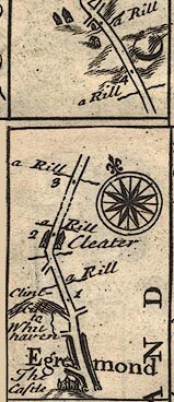 B261m00.jpg At mile 1 from Egremont. item:- Dove Cottage : Lowther.36 Image © see bottom of page |
|
|
|
||
| evidence:- | probably old map:- Bowen and Kitchin 1760 placename:- Clint Hill |
|
| source data:- | Map, hand coloured engraving, A New Map of the Counties of
Cumberland and Westmoreland Divided into their Respective Wards,
scale about 4 miles to 1 inch, by Emanuel Bowen and Thomas
Kitchin et al, published by T Bowles, Robert Sayer, and John
Bowles, London, 1760.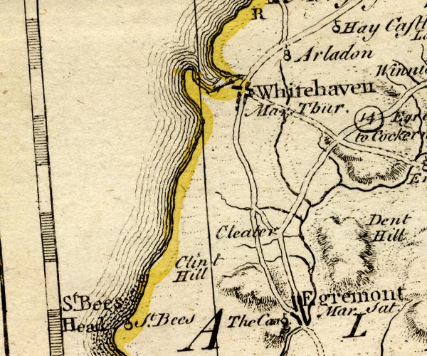 BO18NX91.jpg "Clint Hill" hill hachuring item:- Armitt Library : 2008.14.10 Image © see bottom of page |
|
|
|
||
 Lakes Guides menu.