 Old Cumbria Gazetteer
 |
 |
|
| Cliburn Mill, Cliburn | ||
| Cliburn Mill | ||
| civil parish:- | Cliburn (formerly Westmorland) | |
| county:- | Cumbria | |
| locality type:- | water mill (ex) | |
| locality type:- | mill (ex) | |
| coordinates:- | NY59992460 | |
| 1Km square:- | NY5924 | |
| 10Km square:- | NY52 | |
|
|
||
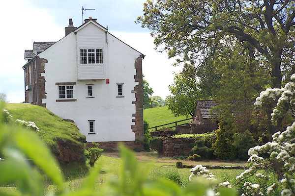 BMD97.jpg (taken 30.5.2006) |
||
|
|
||
| evidence:- | old map:- OS County Series (Wmd 8 7) placename:- Cliburn Mill |
|
| source data:- | Maps, County Series maps of Great Britain, scales 6 and 25
inches to 1 mile, published by the Ordnance Survey, Southampton,
Hampshire, from about 1863 to 1948. "Cliburn Mill (Corn)" |
|
|
|
||
| evidence:- | old map:- Jefferys 1770 (Wmd) |
|
| source data:- | Map, 4 sheets, The County of Westmoreland, scale 1 inch to 1
mile, surveyed 1768, and engraved and published by Thomas
Jefferys, London, 1770.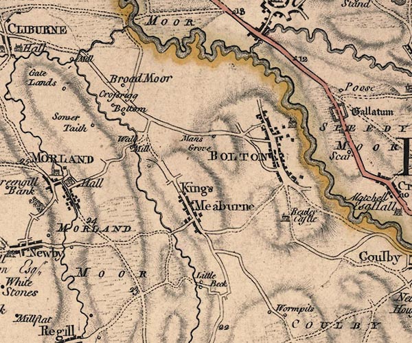 J5NY62SW.jpg "Mill" circle; mill item:- National Library of Scotland : EME.s.47 Image © National Library of Scotland |
|
|
|
||
 Lakes Guides menu.