 Old Cumbria Gazetteer
 |
 |
|
| Cliburn Mill Bridge, Cliburn | ||
| Cliburn Mill Bridge | ||
| site name:- | Lyvennet, River | |
| civil parish:- | Cliburn (formerly Westmorland) | |
| civil parish:- | Bolton (formerly Westmorland) | |
| county:- | Cumbria | |
| locality type:- | bridge | |
| coordinates:- | NY60022466 | |
| 1Km square:- | NY6024 | |
| 10Km square:- | NY62 | |
|
|
||
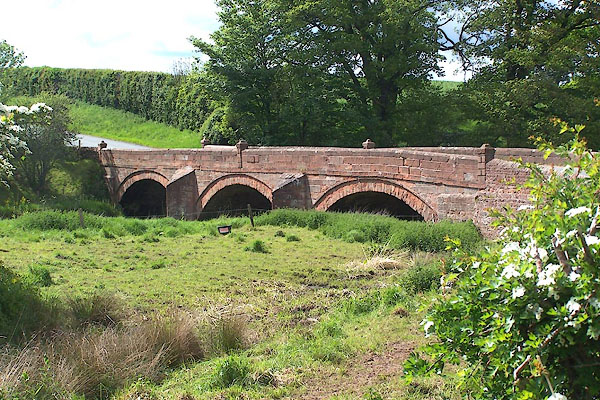 BMD95.jpg (taken 30.5.2006) |
||
|
|
||
| evidence:- | old map:- OS County Series (Wmd 8 7) placename:- Cliburn Mill Bridge |
|
| source data:- | Maps, County Series maps of Great Britain, scales 6 and 25
inches to 1 mile, published by the Ordnance Survey, Southampton,
Hampshire, from about 1863 to 1948. |
|
|
|
||
| evidence:- | database:- Listed Buildings 2010 placename:- Cliburn Mill Bridge item:- date stone (1827) |
|
| source data:- | courtesy of English Heritage "CLIBURN MILL BRIDGE / / / CLIBURN / EDEN / CUMBRIA / II / 422667 / NY6002724660" |
|
| source data:- | courtesy of English Heritage "Bridge, dated 1827. Constructed of large, dressed, sandstone blocks with chamfered coping stones. Each parapet has 3 rusticated pillars whose square capstones have grooved sides and domical tops. 3 segmental arches have concentric string-courses; 2 cutwaters with angled tops. Datestone is on outside of south parapet to right of centre: "R.G. 1827" in circular panel." |
|
|
|
||
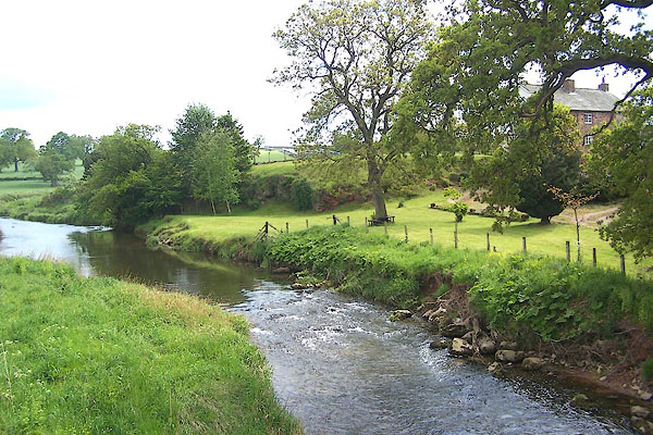 BMD96.jpg View of river. (taken 30.5.2006) |
||
|
|
||
 Lakes Guides menu.