 Old Cumbria Gazetteer
 |
 |
|
| chapel, Firbank | ||
| Firbank Church | ||
| site name:- | Firbank Fell | |
| civil parish:- | Firbank (formerly Westmorland) | |
| county:- | Cumbria | |
| locality type:- | chapel | |
| locality type:- | church | |
| coordinates:- | SD61909373 | |
| 1Km square:- | SD6193 | |
| 10Km square:- | SD69 | |
|
|
||
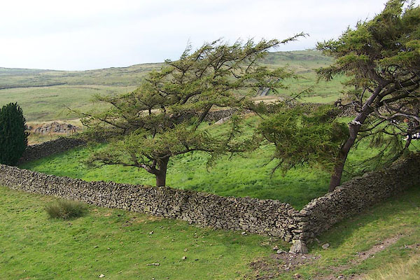 BJQ90.jpg (taken 24.7.2005) |
||
|
|
||
| evidence:- | old map:- OS County Series (Wmd 39 4) |
|
| source data:- | Maps, County Series maps of Great Britain, scales 6 and 25
inches to 1 mile, published by the Ordnance Survey, Southampton,
Hampshire, from about 1863 to 1948. "Church (Site of) / Grave Yard" |
|
|
|
||
| evidence:- | old map:- Jefferys 1770 (Wmd) |
|
| source data:- | Map, 4 sheets, The County of Westmoreland, scale 1 inch to 1
mile, surveyed 1768, and engraved and published by Thomas
Jefferys, London, 1770.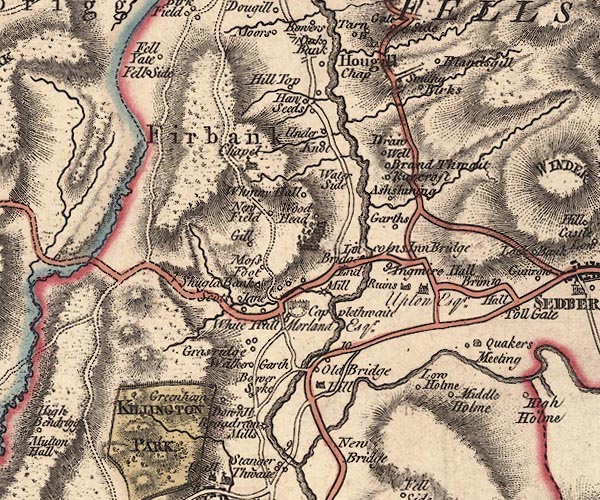 J5SD69SW.jpg "Chapel" church item:- National Library of Scotland : EME.s.47 Image © National Library of Scotland |
|
|
|
||
| evidence:- | database:- Listed Buildings 2010 |
|
| source data:- | courtesy of English Heritage "GRAVEYARD BOUNDARY WALLS TO ORIGINAL PARISH CHURCH / / / FIRBANK / SOUTH LAKELAND / CUMBRIA / II / 75652 / SD6189293744" |
|
| source data:- | courtesy of English Heritage "Graveyard walls. Date uncertain, possibly pre-Reformation, recorded in mid C17, church demolished in 1830s. Dry stone walls enclosing area approx. 31m square. Entrance to west side. Some gravestones with early C19 dates. To south-east is Fox's pulpit, which George Fox preached for 3 hours to approx. 1,000 Seekers (forerunners of the Society of Friends) on 13 June 1652. The meeting led to the formation of the Society of Friends (Quakers)." |
|
|
|
||
| :- |
Site of a chapel on Firbank Fell. This was destroyed in a storm, winter 1839-40. A
few grave stones remain in the enclosure. |
|
| Rooksby, Donald A: 1998: And Sometime Upon the Hills::: ISBN 0 9523548 2 9 |
||
|
|
||
 Lakes Guides menu.