 Old Cumbria Gazetteer
 |
 |
|
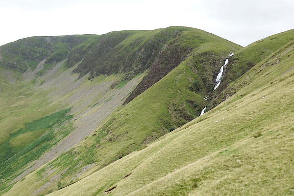
| Cautley Spout, Sedbergh | ||
| Cautley Spout | ||
| locality:- | Cautley | |
| locality:- | Howgill Fells | |
| civil parish:- | Sedbergh (formerly Yorkshire) | |
| county:- | Cumbria | |
| locality type:- | waterfall | |
| coordinates:- | SD68129754 (etc) | |
| 1Km square:- | SD6897 | |
| 10Km square:- | SD69 | |
|
|
||
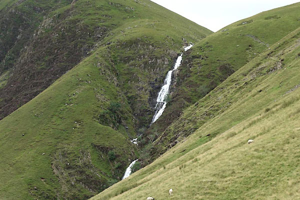 BYZ95.jpg (taken 6.8.2013) 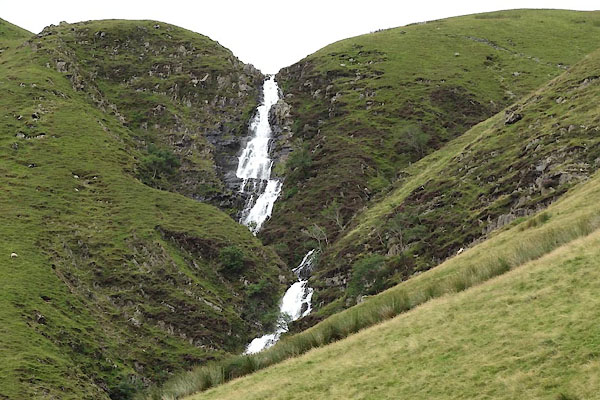 BYZ96.jpg (taken 6.8.2013) 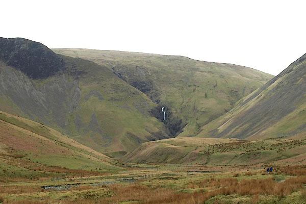 BOX98.jpg From down in the valley. (taken 31.3.2008) 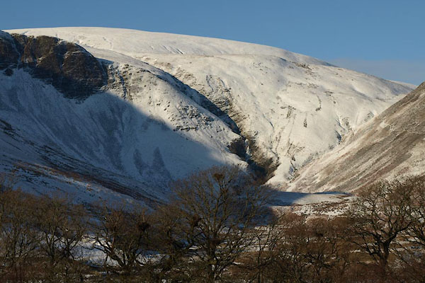 BTV56.jpg In snow. (taken 24.12.2010) 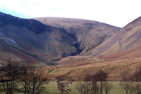 BLQ80.jpg (taken 4.3.2006) |
||
|
|
||
| evidence:- | old map:- Jefferys 1770 (Wmd) placename:- Codley Spout |
|
| source data:- | Map, 4 sheets, The County of Westmoreland, scale 1 inch to 1
mile, surveyed 1768, and engraved and published by Thomas
Jefferys, London, 1770.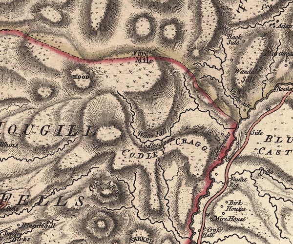 J5SD69NE.jpg "Water Fall / Codley Spout" waterfall item:- National Library of Scotland : EME.s.47 Image © National Library of Scotland |
|
|
|
||
| evidence:- | descriptive text:- Otley 1823 (8th edn 1849) placename:- Cautley Spout |
|
| source data:- | Guide book, A Concise Description of the English Lakes, the
mountains in their vicinity, and the roads by which they may be
visited, with remarks on the mineralogy and geology of the
district, by Jonathan Otley, published by the author, Keswick,
Cumberland now Cumbria, by J Richardson, London, and by Arthur
Foster, Kirkby Lonsdale, Cumbria, 1823; published 1823-49,
latterly as the Descriptive Guide to the English Lakes. goto source goto sourcePage 189:- "..." "CAUTLEY SPOUT.- This place, though not properly belonging to Lonsdale, is too important a feature of the Howgill Fells to be omitted. It consists of three cascades; the highest of which takes a clear leap of 400 feet and upwards. The whole height of the cascade, from the spout to the foot of the lower fall, has been measured as 860 feet. The south side of the fall is crowned by tremendous precipices and shelves of loose stone, called 'Cautley Screes.' The north side is particularly abrupt, and requires a firm foot, and a good head, to get either up or down." |
|
|
|
||
| evidence:- | old print:- Braithwaite 1922 placename:- Cautley Waterfall |
|
| source data:- | Print, halftone photograph, Cautley Fells and Waterfall, Sedbergh, Yorkshire, published
by J W Braithwaite and Sons, Kirkby Stephen, Westmorland, 1922.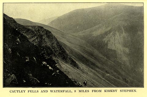 click to enlarge click to enlargeBT0104.jpg Included in a guide book, Kirkby Stephen, 4th edn 1922. printed at bottom:- "CAUTLEY FELLS AND WATERFALL, 8 MILES FROM KIRKBY STEPHEN." item:- private collection : 220.4 Image © see bottom of page |
|
|
|
||
| evidence:- | old print:- Thompson 1894 placename:- Cautley Spout |
|
| source data:- | Print, engraving, Cautley Spout, Sedbergh, Yorkshire, published by Richard Jackson,
Commercial Street, Leeds, Yorkshire, 1894.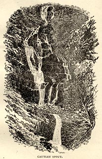 click to enlarge click to enlargeTHP117.jpg On p.78 of An Illustrated Guide to Sedbergh, Garsdale, and Dent, by W Thompson. item:- Armitt Library : A1612.B17 Image © see bottom of page |
|
|
|
||
 BYZ94.jpg (taken 6.8.2013) 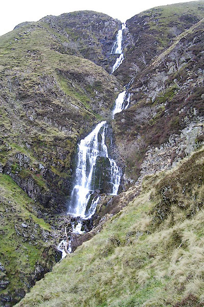 BOY26.jpg At the top. (taken 31.3.2008) 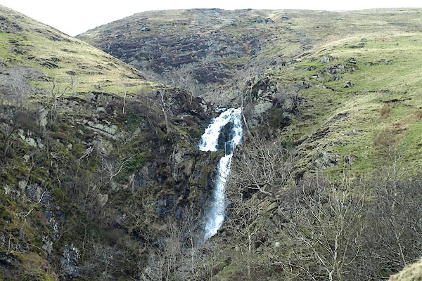 BOY02.jpg (taken 31.3.2008) 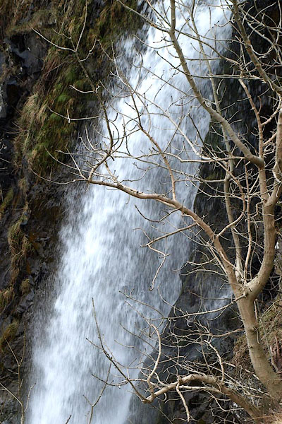 BOY04.jpg (taken 31.3.2008) 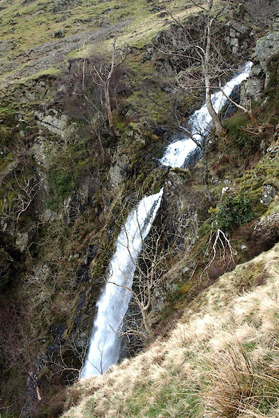 BOY03.jpg (taken 31.3.2008) 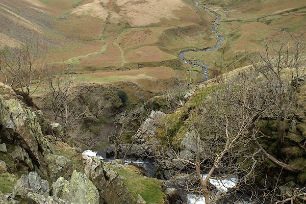 BOY05.jpg Looking over the spout. (taken 31.3.2008) |
||
|
|
||
Lakes Guides menu.