 Old Cumbria Gazetteer
 |
 |
|
| Carlatton Demesne, Carlatton | ||
| Carlatton Demesne | ||
| locality:- | Carlatton | |
| civil parish:- | Carlatton (formerly Cumberland) | |
| county:- | Cumbria | |
| locality type:- | buildings | |
| coordinates:- | NY52315254 | |
| 1Km square:- | NY5252 | |
| 10Km square:- | NY55 | |
|
|
||
| evidence:- | old map:- OS County Series (Cmd 24 12) placename:- Carlatton Demesne |
|
| source data:- | Maps, County Series maps of Great Britain, scales 6 and 25
inches to 1 mile, published by the Ordnance Survey, Southampton,
Hampshire, from about 1863 to 1948. |
|
|
|
||
| evidence:- | old map:- Donald 1774 (Cmd) placename:- Carlatton |
|
| source data:- | Map, hand coloured engraving, 3x2 sheets, The County of Cumberland, scale about 1
inch to 1 mile, by Thomas Donald, engraved and published by Joseph Hodskinson, 29
Arundel Street, Strand, London, 1774.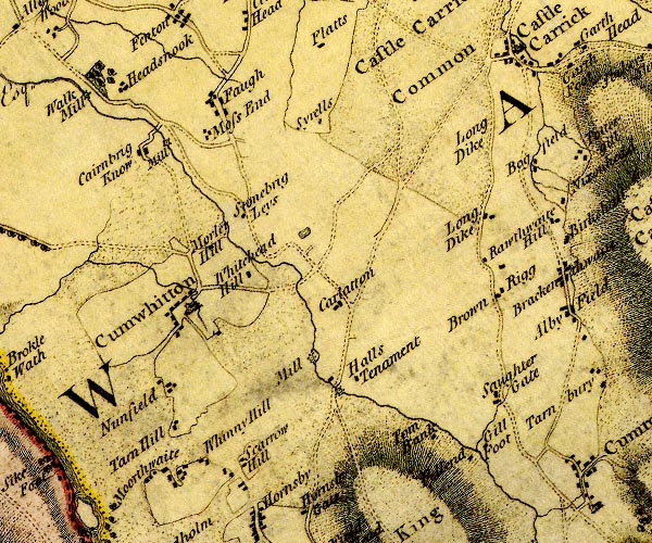 D4NY55SW.jpg "Carlatton" block or blocks, labelled in lowercase; a hamlet or just a house item:- Carlisle Library : Map 2 Image © Carlisle Library |
|
|
|
||
| evidence:- | old map:- Ford 1839 map placename:- Carlatton |
|
| source data:- | Map, uncoloured engraving, Map of the Lake District of
Cumberland, Westmoreland and Lancashire, scale about 3.5 miles
to 1 inch, published by Charles Thurnam, Carlisle, and by R
Groombridge, 5 Paternoster Row, London, 3rd edn 1843.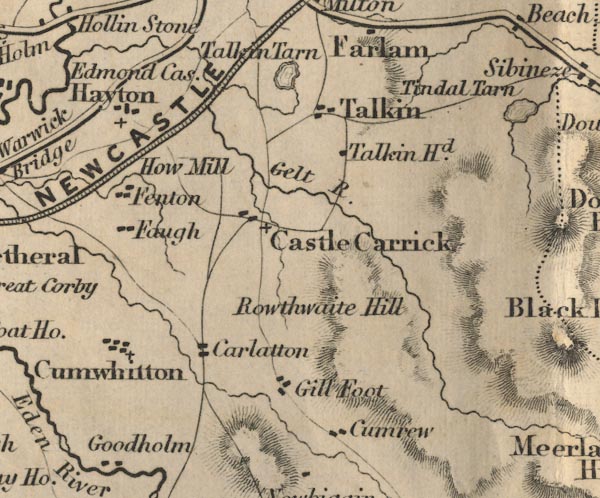 FD02NY55.jpg "Carlatton" item:- JandMN : 100.1 Image © see bottom of page |
|
|
|
||
| evidence:- | database:- Listed Buildings 2010 placename:- Carlatton Demesne item:- date stone (1754) |
|
| source data:- | courtesy of English Heritage "CARLATTON DEMESNE / / / CARLATTON / CARLISLE / CUMBRIA / II / 77992 / NY5233952536" |
|
|
|
||
 Lakes Guides menu.