 Old Cumbria Gazetteer
 |
 |
|
| Carby Hill, Scotland | ||
| Carby Hill | ||
| country:- | Scotland | |
| locality type:- | earthwork | |
| coordinates:- | NY49068436 | |
| 1Km square:- | NY4984 | |
| 10Km square:- | NY48 | |
|
|
||
| evidence:- | old map:- Ogilby 1675 (plate 62) placename:- Kirkby Hill |
|
| source data:- | Raod strip map, uncoloured engraving, the Road from Carlisle to
Barwick, scale about 1 inch to 1 mile, by John Ogilby, London,
1675.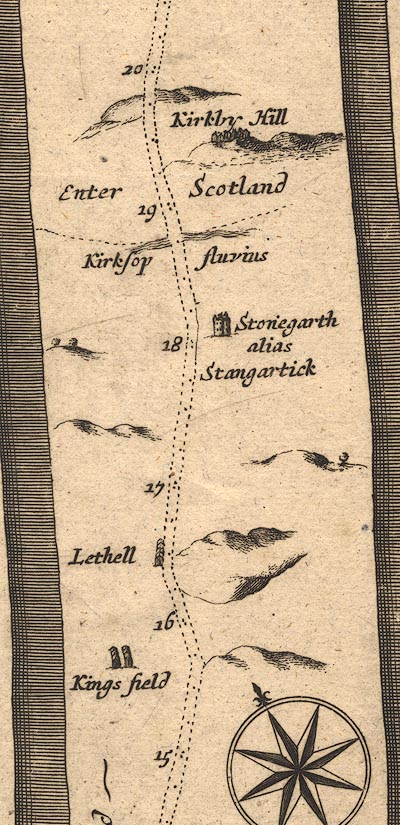 OG62m015.jpg In mile 19, Scotland. "Kirkby Hill" cluster of houses on a hill to the right of the road. item:- JandMN : 83 Image © see bottom of page |
|
|
|
||
| evidence:- | probably old map:- Bowen 1720 (plate 161) placename:- Kirkby Hill |
|
| source data:- | Road strip map, uncoloured engraving, pl.161, part of The Road
from Carlisle to Barwick, scale about 2 miles to 1 inch, with
sections in Cumberland, and Scotland, published by Emanuel
Bowen, St Katherines, London, 1720.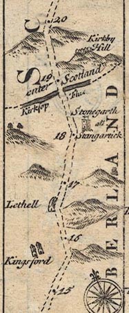 B161m15.jpg "Kirkby Hill" group of buildings on hillocks in Scotland; mile 19. item:- JandMN : 65.161 Image © see bottom of page |
|
|
|
||
| evidence:- | old map:- Bowen and Kitchin 1760 placename:- Kirkby Hill |
|
| source data:- | Map, hand coloured engraving, A New Map of the Counties of
Cumberland and Westmoreland Divided into their Respective Wards,
scale about 4 miles to 1 inch, by Emanuel Bowen and Thomas
Kitchin et al, published by T Bowles, Robert Sayer, and John
Bowles, London, 1760.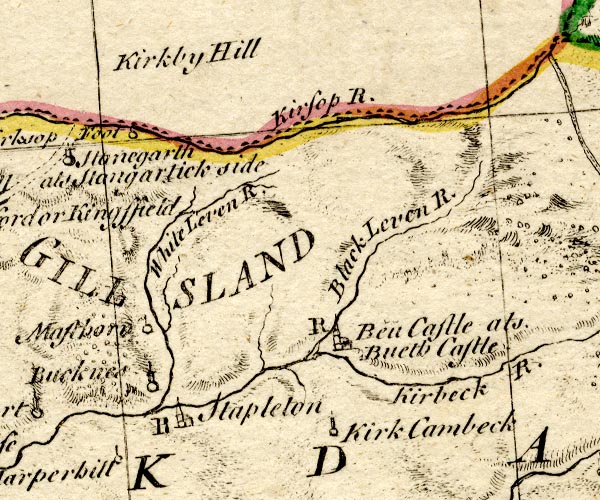 BO18NY57.jpg "Kirkby Hill" hill hachuring item:- Armitt Library : 2008.14.10 Image © see bottom of page |
|
|
|
||
| evidence:- | old map:- Donald 1774 (Cmd) placename:- Kirkbyhill |
|
| source data:- | Map, hand coloured engraving, 3x2 sheets, The County of Cumberland, scale about 1
inch to 1 mile, by Thomas Donald, engraved and published by Joseph Hodskinson, 29
Arundel Street, Strand, London, 1774.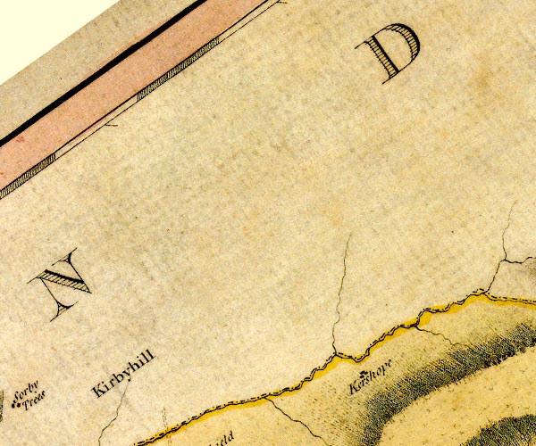 D4NY58NW.jpg "Kirkbyhill" area item:- Carlisle Library : Map 2 Image © Carlisle Library |
|
|
|
||
 Lakes Guides menu.