 Old Cumbria Gazetteer
 |
 |
|
| Camerton Hall, Camerton | ||
| Camerton Hall | ||
| civil parish:- | Camerton (formerly Cumberland) | |
| county:- | Cumbria | |
| locality type:- | buildings | |
| coordinates:- | NY03303062 | |
| 1Km square:- | NY0330 | |
| 10Km square:- | NY03 | |
|
|
||
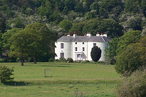 BNR05.jpg (taken 14.5.2007) |
||
|
|
||
| evidence:- | old map:- OS County Series (Cmd 53 4) placename:- Camerton Hall |
|
| source data:- | Maps, County Series maps of Great Britain, scales 6 and 25
inches to 1 mile, published by the Ordnance Survey, Southampton,
Hampshire, from about 1863 to 1948. |
|
|
|
||
| evidence:- | old map:- Donald 1774 (Cmd) placename:- Cammerton Hall |
|
| source data:- | Map, hand coloured engraving, 3x2 sheets, The County of Cumberland, scale about 1
inch to 1 mile, by Thomas Donald, engraved and published by Joseph Hodskinson, 29
Arundel Street, Strand, London, 1774.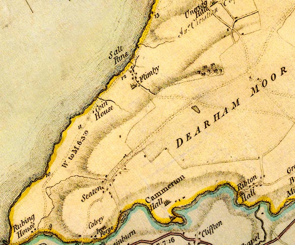 D4NY03SW.jpg "Cammerton Hall" house item:- Carlisle Library : Map 2 Image © Carlisle Library |
|
|
|
||
| evidence:- | database:- Listed Buildings 2010 placename:- Camerton Hall |
|
| source data:- | courtesy of English Heritage "CAMERTON HALL / / / CAMERTON / ALLERDALE / CUMBRIA / II / 72227 / NY0331630580" |
|
|
|
||
| notes:- |
Possible traces of a tower 'close to where the dining room now is'. |
|
| Perriam, D R &Robinson, J: 1998: Medieval Fortified Buildings of Cumbria: CWAAS::
ISBN 1 873124 23 6; plan |
||
|
|
||
| hearsay:- |
Perhaps designed by Inigo Jones? Built on the site of a pele tower, 14th century. |
|
|
|
||
 Lakes Guides menu.