 Old Cumbria Gazetteer
 |
 |
|
| Kaker Mill, Preston Patrick | ||
| Kaker Mill | ||
| site name:- | Peasey Beck | |
| civil parish:- | Preston Patrick (formerly Westmorland) | |
| county:- | Cumbria | |
| locality type:- | buildings | |
| locality type:- | water mill (ex) | |
| locality type:- | mill (ex) | |
| locality type:- | corn mill (ex) | |
| locality type:- | maltings (ex malt kiln) | |
| coordinates:- | SD54258430 | |
| 1Km square:- | SD5484 | |
| 10Km square:- | SD58 | |
| SummaryText:- | Some modern maps have this as Kaker Mill Cottage and Kaker Mill the other side of the road, away from the river. | |
|
|
||
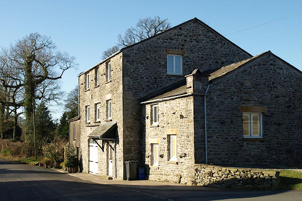 BQA64.jpg (taken 6.2.2009) 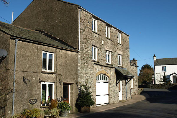 BQA63.jpg (taken 6.2.2009) |
||
|
|
||
| evidence:- | old map:- OS County Series (Wmd 43) placename:- Kaker Mill |
|
| source data:- | Maps, County Series maps of Great Britain, scales 6 and 25
inches to 1 mile, published by the Ordnance Survey, Southampton,
Hampshire, from about 1863 to 1948. "Kaker Mill (Corn)" |
|
|
|
||
| evidence:- | old map:- Jefferys 1770 (Wmd) placename:- Caker Mill |
|
| source data:- | Map, 4 sheets, The County of Westmoreland, scale 1 inch to 1
mile, surveyed 1768, and engraved and published by Thomas
Jefferys, London, 1770.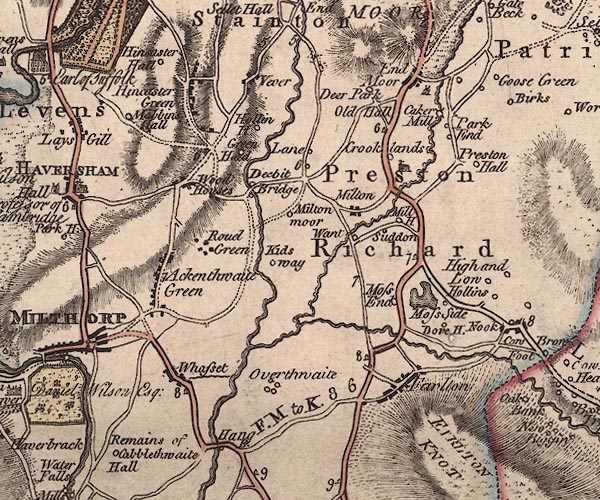 J5SD58SW.jpg "Caker Mill" circle with rays; water mill item:- National Library of Scotland : EME.s.47 Image © National Library of Scotland |
|
|
|
||
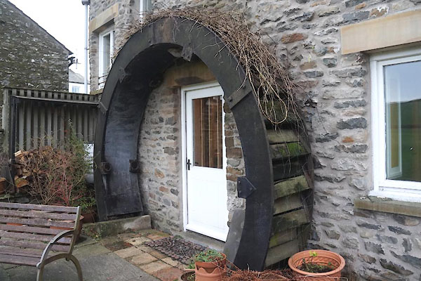 CEM35.jpg Porch at the back, the water wheel. (taken 1.1.2016) courtesy of the owner 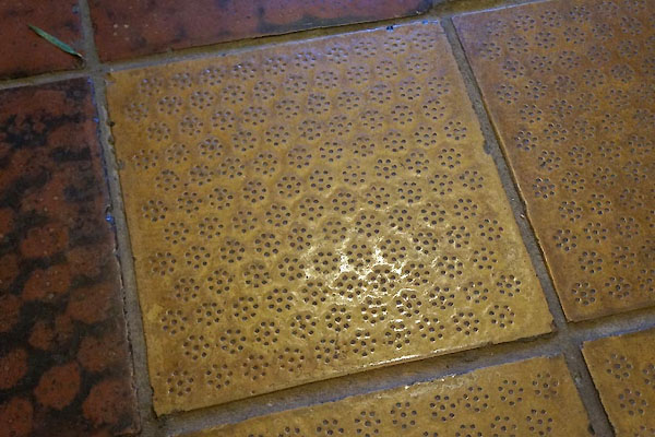 CEM32.jpg Tiles from the drying floor. (taken 1.1.2016) courtesy of the owner 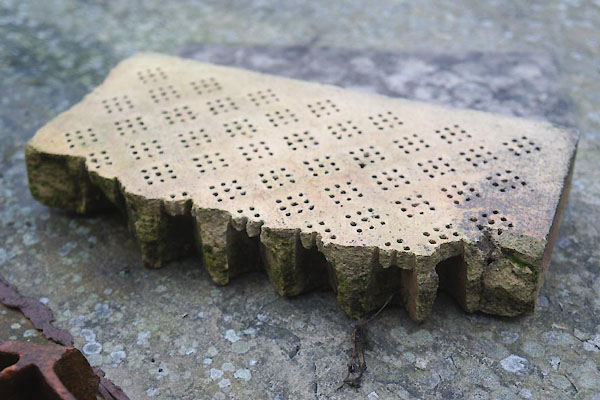 CEM33.jpg Tiles from the drying floor. (taken 1.1.2016) courtesy of the owner 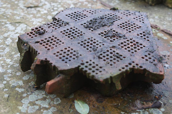 CEM34.jpg Tiles from the drying floor. (taken 1.1.2016) courtesy of the owner |
||
|
|
||
| notes:- |
There was a mill here in the 12th century. Corn mill from the 17th century, and a
malt kiln. |
|
| Somervell, John: 1930: Water Power Mills of South Westmorland |
||
|
|
||
 Lakes Guides menu.